
| Memorials | : | 0 |
| Location | : | Oslo, Oslo kommune, Norway |
| Coordinate | : | 59.8591400, 10.8031780 |
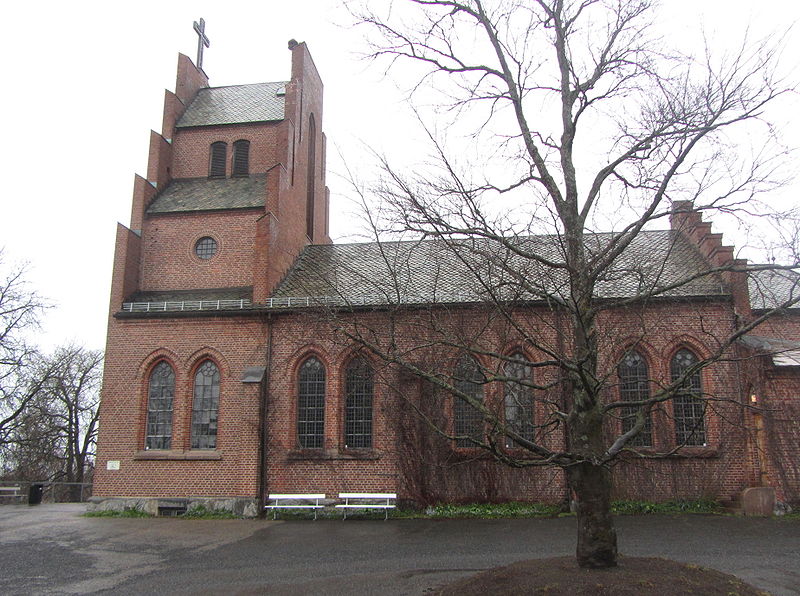
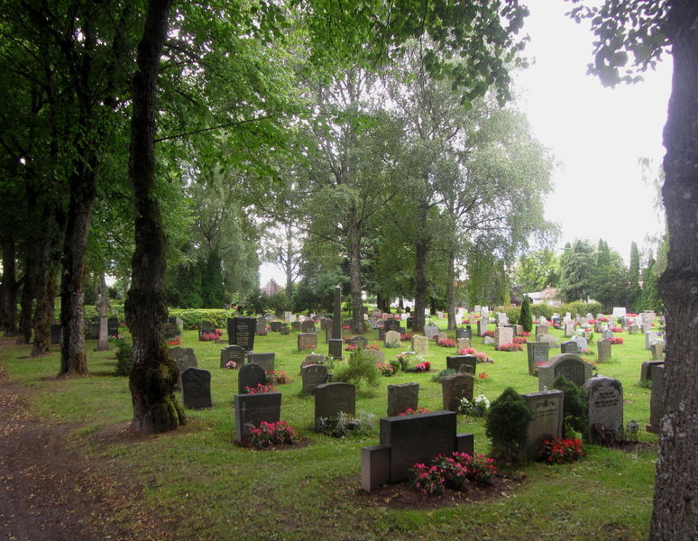
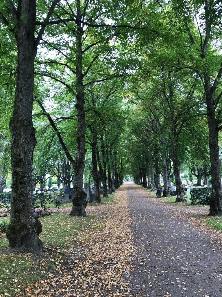
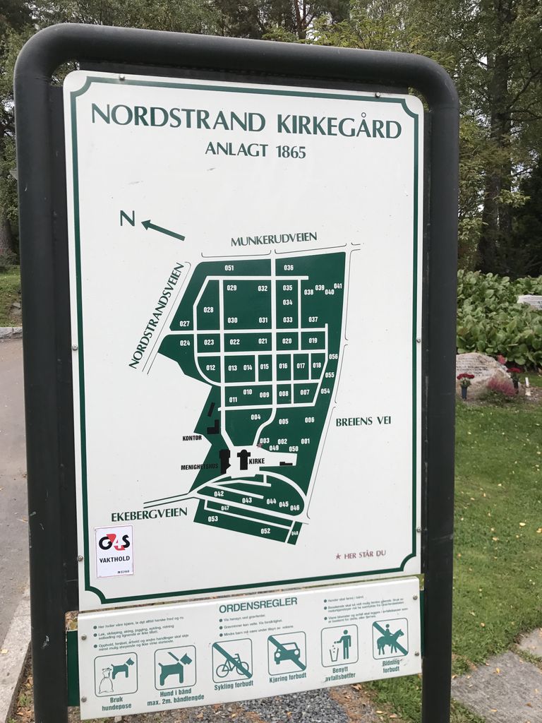
| Description | : | The first graves in the cemetery Nordstrand are believed to originate from the late 1800's. The cemetery was consecrated with the church in 1866. The cemetery was planned around the church, but later changed the extent and form several times, partly because of veireguleringer. In 1954 the area between the cemetery and Nordstrand Ekebergbanen, which was previously zoned for cemetery, omregulert the playground. The burial chamber at the cemetery is privately owned. Nordstrand cemetery has many large protected monuments. In addition, it has a number of family tombs and graves frame that is worthy. A tomb that specifically include children's graves... Read More |
frequently asked questions (FAQ):
-
Where is Nordstrand kirkegård?
Nordstrand kirkegård is located at Ekebergveien 236 Oslo, Oslo kommune ,Oslo fylke , 1166Norway.
-
Nordstrand kirkegård cemetery's updated grave count on graveviews.com?
0 memorials
-
Where are the coordinates of the Nordstrand kirkegård?
Latitude: 59.8591400
Longitude: 10.8031780
Nearby Cemetories:
1. Bekkelaget urnelund
Oslo, Oslo kommune, Norway
Coordinate: 59.8849135, 10.7881908
2. Klemetsrud kirkegård
Oslo, Oslo kommune, Norway
Coordinate: 59.8319960, 10.8513850
3. Kolbotn Cemetery
Kolbotn, Oppegård kommune, Norway
Coordinate: 59.8193160, 10.7900300
4. Gamlebyen Gravlund
Oslo, Oslo kommune, Norway
Coordinate: 59.9046240, 10.7709790
5. Mariekirkens ruin
Oslo, Oslo kommune, Norway
Coordinate: 59.9034515, 10.7621204
6. Hallvardskatedralens ruin
Oslo, Oslo kommune, Norway
Coordinate: 59.9058810, 10.7686740
7. Østre Gravlund
Oslo, Oslo kommune, Norway
Coordinate: 59.9130300, 10.8088490
8. Helsfyr gravlund
Oslo, Oslo kommune, Norway
Coordinate: 59.9132810, 10.8124210
9. Det kongelige mausoleum i Akershus Slott
Oslo, Oslo kommune, Norway
Coordinate: 59.9067600, 10.7361560
10. Østre Aker kirkegård
Okern, Oslo kommune, Norway
Coordinate: 59.9217730, 10.8197180
11. Krist kirkegård
Oslo, Oslo kommune, Norway
Coordinate: 59.9172300, 10.7467380
12. Sofienberg jødiske gravlund
Oslo, Oslo kommune, Norway
Coordinate: 59.9229390, 10.7668660
13. Vår Frelsers gravlund
Oslo, Oslo kommune, Norway
Coordinate: 59.9199500, 10.7435400
14. Gamle Aker kirkegård
Oslo, Oslo kommune, Norway
Coordinate: 59.9237680, 10.7469560
15. Alfaset – tysk krigskirkegård
Oslo, Oslo kommune, Norway
Coordinate: 59.9314700, 10.8559100
16. Nesodden Cemetery
Nesoddtangen, Nesodden kommune, Norway
Coordinate: 59.8052000, 10.6933700
17. Alfaset gravlund
Oslo, Oslo kommune, Norway
Coordinate: 59.9337100, 10.8583210
18. Siggerud Gamle Mnye Nr
Ski, Ski kommune, Norway
Coordinate: 59.7903570, 10.8888240
19. Nordre gravlund
Oslo, Oslo kommune, Norway
Coordinate: 59.9371400, 10.7483990
20. Oppegaard Cemetery
Oppegård kommune, Norway
Coordinate: 59.7788200, 10.7509130
21. Vestre Aker kirkegård
Oslo, Oslo kommune, Norway
Coordinate: 59.9369400, 10.7291200
22. Vestre Gravlund
Oslo, Oslo kommune, Norway
Coordinate: 59.9306100, 10.6998500
23. Polhøgda Cemetery
Lysaker, Bærum kommune, Norway
Coordinate: 59.9052560, 10.6348830
24. Grefsen kirkegård
Oslo, Oslo kommune, Norway
Coordinate: 59.9553656, 10.7710968