
| Memorials | : | 0 |
| Location | : | Oslo, Oslo kommune, Norway |
| Coordinate | : | 59.9132810, 10.8124210 |
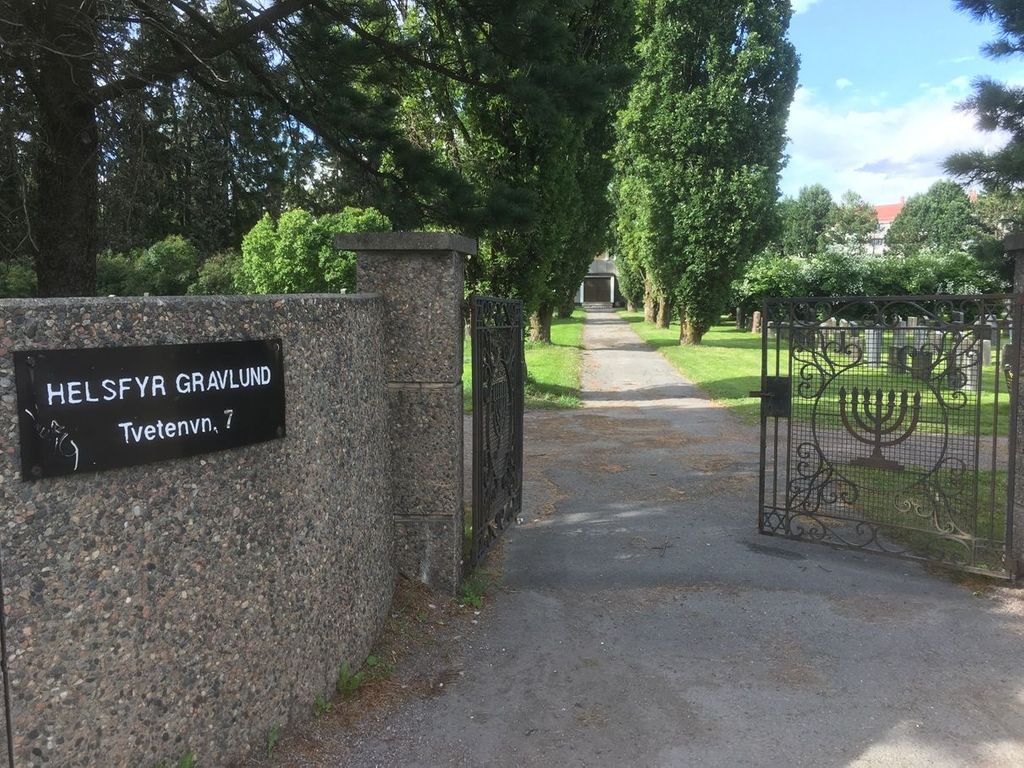
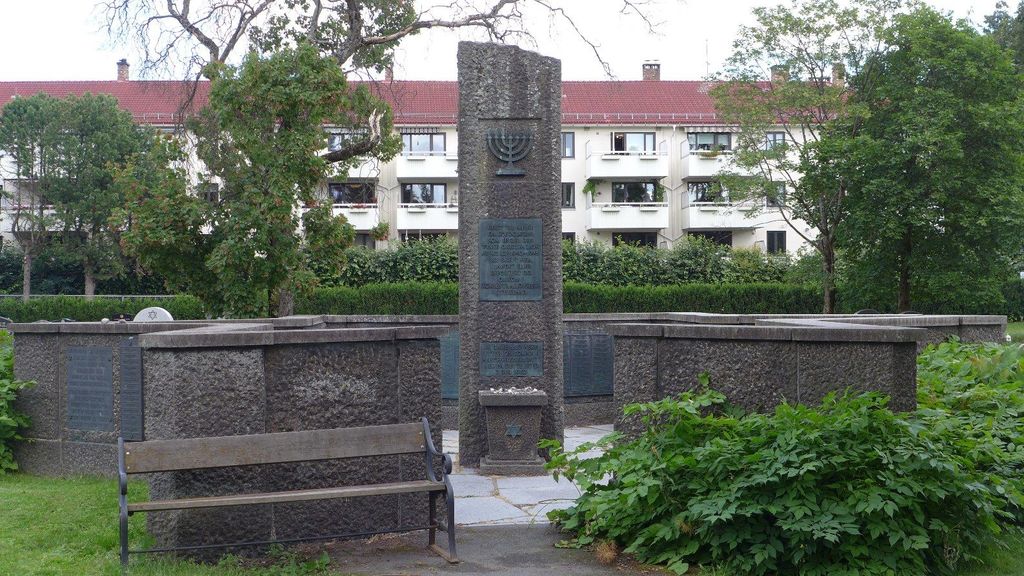
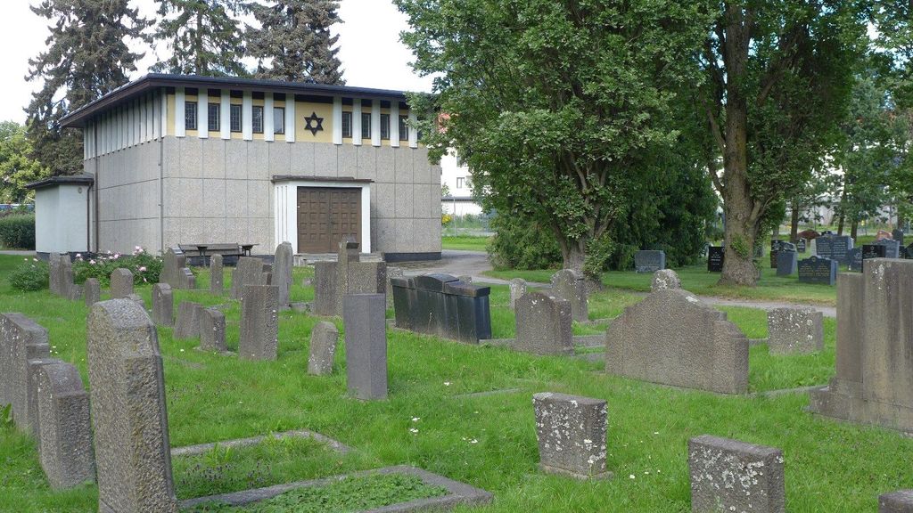
| Description | : | Helsfyr gravlund is in the southeastern part of Østre gravlund - the area of (10,5 dekar) 2,60 acres (US/UK) was purchased by the Jewish community in 1912. Since Jewish graves, according to Jewish traditions, cannot be reused (the graves are everlasting), the Jewish congregation itself must buy their cemetery. Helsfyr gravlund came into use in 1917. In the middle of the cemetery stands a monument over the 620 Norwegian Jews who were killed at home and abroad during World War II. |
frequently asked questions (FAQ):
-
Where is Helsfyr gravlund?
Helsfyr gravlund is located at Tvetenveien 7 Oslo, Oslo kommune ,Oslo fylke , 0661Norway.
-
Helsfyr gravlund cemetery's updated grave count on graveviews.com?
0 memorials
-
Where are the coordinates of the Helsfyr gravlund?
Latitude: 59.9132810
Longitude: 10.8124210
Nearby Cemetories:
1. Østre Gravlund
Oslo, Oslo kommune, Norway
Coordinate: 59.9130300, 10.8088490
2. Østre Aker kirkegård
Okern, Oslo kommune, Norway
Coordinate: 59.9217730, 10.8197180
3. Gamlebyen Gravlund
Oslo, Oslo kommune, Norway
Coordinate: 59.9046240, 10.7709790
4. Hallvardskatedralens ruin
Oslo, Oslo kommune, Norway
Coordinate: 59.9058810, 10.7686740
5. Sofienberg jødiske gravlund
Oslo, Oslo kommune, Norway
Coordinate: 59.9229390, 10.7668660
6. Mariekirkens ruin
Oslo, Oslo kommune, Norway
Coordinate: 59.9034515, 10.7621204
7. Alfaset – tysk krigskirkegård
Oslo, Oslo kommune, Norway
Coordinate: 59.9314700, 10.8559100
8. Alfaset gravlund
Oslo, Oslo kommune, Norway
Coordinate: 59.9337100, 10.8583210
9. Bekkelaget urnelund
Oslo, Oslo kommune, Norway
Coordinate: 59.8849135, 10.7881908
10. Krist kirkegård
Oslo, Oslo kommune, Norway
Coordinate: 59.9172300, 10.7467380
11. Gamle Aker kirkegård
Oslo, Oslo kommune, Norway
Coordinate: 59.9237680, 10.7469560
12. Vår Frelsers gravlund
Oslo, Oslo kommune, Norway
Coordinate: 59.9199500, 10.7435400
13. Det kongelige mausoleum i Akershus Slott
Oslo, Oslo kommune, Norway
Coordinate: 59.9067600, 10.7361560
14. Nordre gravlund
Oslo, Oslo kommune, Norway
Coordinate: 59.9371400, 10.7483990
15. Grefsen kirkegård
Oslo, Oslo kommune, Norway
Coordinate: 59.9553656, 10.7710968
16. Vestre Aker kirkegård
Oslo, Oslo kommune, Norway
Coordinate: 59.9369400, 10.7291200
17. Nordstrand kirkegård
Oslo, Oslo kommune, Norway
Coordinate: 59.8591400, 10.8031780
18. Grorud kirkegård
Oslo, Oslo kommune, Norway
Coordinate: 59.9573990, 10.8841250
19. Høybråten kirkegård
Oslo, Oslo kommune, Norway
Coordinate: 59.9435670, 10.9113910
20. Vestre Gravlund
Oslo, Oslo kommune, Norway
Coordinate: 59.9306100, 10.6998500
21. Ris urnelund
Oslo, Oslo kommune, Norway
Coordinate: 59.9478110, 10.7012330
22. Ullern kirkegård
Oslo, Oslo kommune, Norway
Coordinate: 59.9252790, 10.6542960
23. Klemetsrud kirkegård
Oslo, Oslo kommune, Norway
Coordinate: 59.8319960, 10.8513850
24. Lørenskog Cemetery
Lørenskog kommune, Norway
Coordinate: 59.9249280, 10.9863810