
| Memorials | : | 1 |
| Location | : | Oslo, Oslo kommune, Norway |
| Coordinate | : | 59.9237680, 10.7469560 |
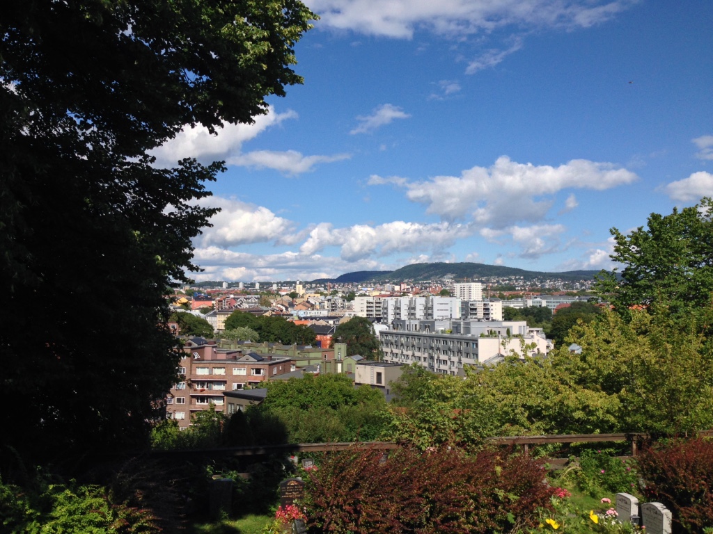
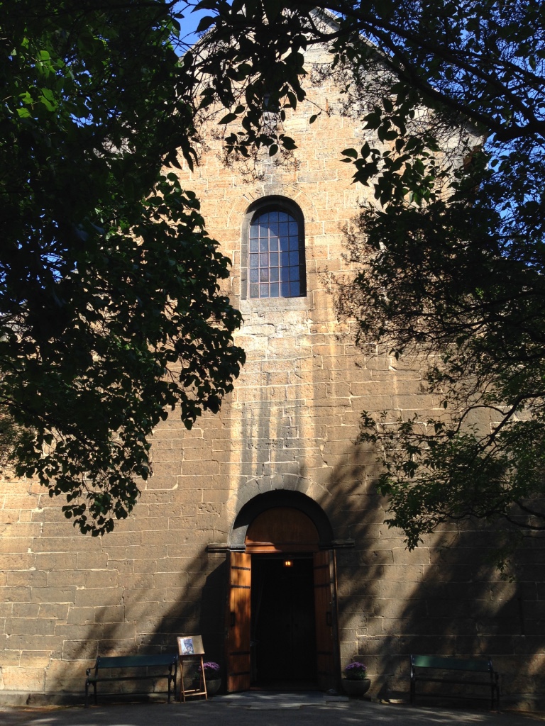
| Description | : | Gamle Aker cemetery surrounds Oslo's oldest building, Old Aker church, from approx. 1180. The cemetery was taken into use as early as the Middle Ages, it lies between Telthusbakken, Akersbakken and Maridalsveien. Just southwest of the cemetery lies the more well-known Vår Frelsers gravlund. The area down Maridalsveien was created by the municipality of Aker in 1837 for the burial of cholera victims. The cemetery was then expanded in 1918 and 1929, the newest burial grounds being from the 1940s. The cemetery has a memorial grove for anonymous urn graves with... Read More |
frequently asked questions (FAQ):
-
Where is Gamle Aker kirkegård?
Gamle Aker kirkegård is located at Akersbakken 26 Oslo, Oslo kommune ,Oslo fylke , 0172Norway.
-
Gamle Aker kirkegård cemetery's updated grave count on graveviews.com?
1 memorials
-
Where are the coordinates of the Gamle Aker kirkegård?
Latitude: 59.9237680
Longitude: 10.7469560
Nearby Cemetories:
1. Vår Frelsers gravlund
Oslo, Oslo kommune, Norway
Coordinate: 59.9199500, 10.7435400
2. Krist kirkegård
Oslo, Oslo kommune, Norway
Coordinate: 59.9172300, 10.7467380
3. Sofienberg jødiske gravlund
Oslo, Oslo kommune, Norway
Coordinate: 59.9229390, 10.7668660
4. Nordre gravlund
Oslo, Oslo kommune, Norway
Coordinate: 59.9371400, 10.7483990
5. Vestre Aker kirkegård
Oslo, Oslo kommune, Norway
Coordinate: 59.9369400, 10.7291200
6. Det kongelige mausoleum i Akershus Slott
Oslo, Oslo kommune, Norway
Coordinate: 59.9067600, 10.7361560
7. Hallvardskatedralens ruin
Oslo, Oslo kommune, Norway
Coordinate: 59.9058810, 10.7686740
8. Mariekirkens ruin
Oslo, Oslo kommune, Norway
Coordinate: 59.9034515, 10.7621204
9. Gamlebyen Gravlund
Oslo, Oslo kommune, Norway
Coordinate: 59.9046240, 10.7709790
10. Vestre Gravlund
Oslo, Oslo kommune, Norway
Coordinate: 59.9306100, 10.6998500
11. Østre Gravlund
Oslo, Oslo kommune, Norway
Coordinate: 59.9130300, 10.8088490
12. Ris urnelund
Oslo, Oslo kommune, Norway
Coordinate: 59.9478110, 10.7012330
13. Grefsen kirkegård
Oslo, Oslo kommune, Norway
Coordinate: 59.9553656, 10.7710968
14. Helsfyr gravlund
Oslo, Oslo kommune, Norway
Coordinate: 59.9132810, 10.8124210
15. Østre Aker kirkegård
Okern, Oslo kommune, Norway
Coordinate: 59.9217730, 10.8197180
16. Bekkelaget urnelund
Oslo, Oslo kommune, Norway
Coordinate: 59.8849135, 10.7881908
17. Ullern kirkegård
Oslo, Oslo kommune, Norway
Coordinate: 59.9252790, 10.6542960
18. Alfaset – tysk krigskirkegård
Oslo, Oslo kommune, Norway
Coordinate: 59.9314700, 10.8559100
19. Alfaset gravlund
Oslo, Oslo kommune, Norway
Coordinate: 59.9337100, 10.8583210
20. Voksen Cemetery
Oslo, Oslo kommune, Norway
Coordinate: 59.9566690, 10.6503380
21. Polhøgda Cemetery
Lysaker, Bærum kommune, Norway
Coordinate: 59.9052560, 10.6348830
22. Nordstrand kirkegård
Oslo, Oslo kommune, Norway
Coordinate: 59.8591400, 10.8031780
23. Grorud kirkegård
Oslo, Oslo kommune, Norway
Coordinate: 59.9573990, 10.8841250
24. Høybråten kirkegård
Oslo, Oslo kommune, Norway
Coordinate: 59.9435670, 10.9113910