
| Memorials | : | 0 |
| Location | : | Burns, Smith County, USA |
| Coordinate | : | 32.1310501, -89.5399399 |
| Description | : | From Raleigh Mississippi proceed North on Highway 35 until reaching the intersection of Highway 481 (a distance of approximately 6.5 miles.) Turn left (West) on Highway 481 and proceed 1.5 miles to the intersection of Smith County Road 527A (SCR 527A) making a left (West) turn. Cemetery will be on the left (South) side of the road, 16S BA 60401 57783, specifically: SW1/4 NW1/4, S1, T3N-R7E, Smith, Homewood Quadrangle map. |
frequently asked questions (FAQ):
-
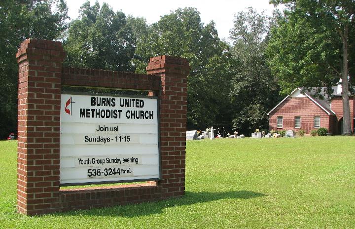
Where is Burns United Methodist Church Cemetery?
Burns United Methodist Church Cemetery is located at Smith County Road 527A Burns, Smith County ,Mississippi , 39153USA.
-
Burns United Methodist Church Cemetery cemetery's updated grave count on graveviews.com?
0 memorials
-
Where are the coordinates of the Burns United Methodist Church Cemetery?
Latitude: 32.1310501
Longitude: -89.5399399
Nearby Cemetories:
1. Barber Cemetery
Raleigh, Smith County, USA
Coordinate: 32.1321810, -89.5385960
2. Burns Baptist Church Cemetery
Raleigh, Smith County, USA
Coordinate: 32.1321880, -89.5384430
3. Providence Cemetery
Burns, Smith County, USA
Coordinate: 32.1357400, -89.5528600
4. Henderson Family Cemetery
Smith County, USA
Coordinate: 32.1207008, -89.5181122
5. Good Hope Cemetery
Smith County, USA
Coordinate: 32.1613100, -89.5345100
6. Goodwater Baptist Church Cemetery
Smith County, USA
Coordinate: 32.1415200, -89.5027900
7. Derrick Cemetery
Smith County, USA
Coordinate: 32.1484800, -89.5742400
8. Page Cemetery
Raleigh, Smith County, USA
Coordinate: 32.0891991, -89.5432968
9. Old Henderson Cemetery
Smith County, USA
Coordinate: 32.1199100, -89.4919700
10. Myers Cemetery
Raleigh, Smith County, USA
Coordinate: 32.0950012, -89.5730972
11. Austin Cemetery
Shongelo, Smith County, USA
Coordinate: 32.0875015, -89.5233002
12. Barnes Cemetery
Raleigh, Smith County, USA
Coordinate: 32.0946999, -89.5068970
13. Gasque Chapel Cemetery
Smith County, USA
Coordinate: 32.1793540, -89.5297340
14. Sharon Baptist Church Cemetery
Raleigh, Smith County, USA
Coordinate: 32.0909100, -89.5740800
15. Moss Cemetery
Smith County, USA
Coordinate: 32.1063995, -89.5919037
16. Moulder Cemetery
Smith County, USA
Coordinate: 32.1239014, -89.6007996
17. Boykin Church Cemetery
Raleigh, Smith County, USA
Coordinate: 32.0985177, -89.5898151
18. Craft Cemetery
Smith County, USA
Coordinate: 32.0774994, -89.5460968
19. Bethel Baptist Church Cemetery
Smith County, USA
Coordinate: 32.1830920, -89.5565660
20. Lemon Christian Cemetery
Raleigh, Smith County, USA
Coordinate: 32.1225570, -89.4748020
21. Gordan Cemetery
Raleigh, Smith County, USA
Coordinate: 32.0950012, -89.5935974
22. Zion Cemetery
Smith County, USA
Coordinate: 32.1689700, -89.5918000
23. New Chapel Cemetery
Smith County, USA
Coordinate: 32.1710100, -89.5944800
24. Lorena Baptist Church Cemetery
Lorena, Smith County, USA
Coordinate: 32.1917890, -89.5061570