
| Memorials | : | 0 |
| Location | : | Smith County, USA |
| Coordinate | : | 32.1207008, -89.5181122 |
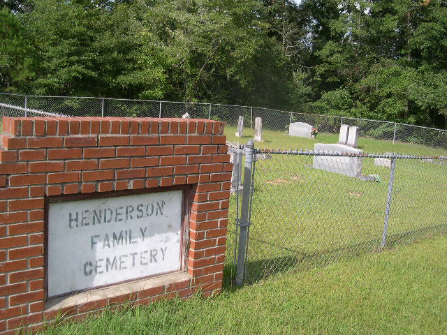
| Description | : | From Raleigh, Mississippi proceed North on Highway 35 (Hwy 35) 6.2 miles, Hedderson Family cemetery will be on the right (East) side of Hwy 35 approximately 100 feet from Hwy 35 and clearly visible, specifically: SE1/4 SW1/4, S6, T3N-R8E, Smith, Raleigh Quadrangle map, USNG: 16S BA 62440 56604 This cemetery is well marked, well maintained and fenced. |
frequently asked questions (FAQ):
-
Where is Henderson Family Cemetery?
Henderson Family Cemetery is located at Mississippi Highway 35 Smith County ,Mississippi , 39152USA.
-
Henderson Family Cemetery cemetery's updated grave count on graveviews.com?
0 memorials
-
Where are the coordinates of the Henderson Family Cemetery?
Latitude: 32.1207008
Longitude: -89.5181122
Nearby Cemetories:
1. Burns Baptist Church Cemetery
Raleigh, Smith County, USA
Coordinate: 32.1321880, -89.5384430
2. Barber Cemetery
Raleigh, Smith County, USA
Coordinate: 32.1321810, -89.5385960
3. Burns United Methodist Church Cemetery
Burns, Smith County, USA
Coordinate: 32.1310501, -89.5399399
4. Old Henderson Cemetery
Smith County, USA
Coordinate: 32.1199100, -89.4919700
5. Goodwater Baptist Church Cemetery
Smith County, USA
Coordinate: 32.1415200, -89.5027900
6. Barnes Cemetery
Raleigh, Smith County, USA
Coordinate: 32.0946999, -89.5068970
7. Providence Cemetery
Burns, Smith County, USA
Coordinate: 32.1357400, -89.5528600
8. Austin Cemetery
Shongelo, Smith County, USA
Coordinate: 32.0875015, -89.5233002
9. Lemon Christian Cemetery
Raleigh, Smith County, USA
Coordinate: 32.1225570, -89.4748020
10. Page Cemetery
Raleigh, Smith County, USA
Coordinate: 32.0891991, -89.5432968
11. Good Hope Cemetery
Smith County, USA
Coordinate: 32.1613100, -89.5345100
12. Trinity Methodist Cemetery
Raleigh, Smith County, USA
Coordinate: 32.0920600, -89.4753300
13. High Hill Baptist Church Cemetery
Raleigh, Smith County, USA
Coordinate: 32.0860100, -89.4780800
14. Craft Cemetery
Smith County, USA
Coordinate: 32.0774994, -89.5460968
15. Mount Nebo Cemetery
Smith County, USA
Coordinate: 32.0951900, -89.4677200
16. Myers Cemetery
Raleigh, Smith County, USA
Coordinate: 32.0950012, -89.5730972
17. Derrick Cemetery
Smith County, USA
Coordinate: 32.1484800, -89.5742400
18. Sylvan Grove Cemetery
Smith County, USA
Coordinate: 32.1137310, -89.4530439
19. Sharon Baptist Church Cemetery
Raleigh, Smith County, USA
Coordinate: 32.0909100, -89.5740800
20. Gasque Chapel Cemetery
Smith County, USA
Coordinate: 32.1793540, -89.5297340
21. Mount Pisgah Cemetery
Raleigh, Smith County, USA
Coordinate: 32.0589300, -89.5261100
22. Moss Cemetery
Smith County, USA
Coordinate: 32.1063995, -89.5919037
23. Boykin Church Cemetery
Raleigh, Smith County, USA
Coordinate: 32.0985177, -89.5898151
24. Gordan Cemetery
Raleigh, Smith County, USA
Coordinate: 32.0950012, -89.5935974