
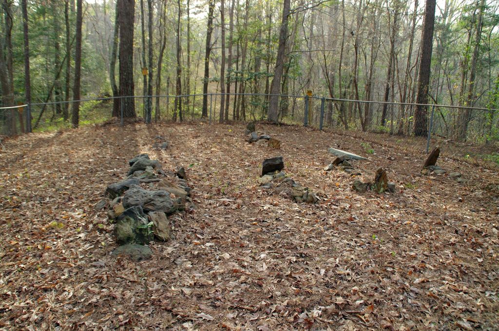
| Memorials | : | 0 |
| Location | : | Smith County, USA |
| Coordinate | : | 32.1199100, -89.4919700 |
| Description | : | From Raleigh, MS proceed North on Mississippi Highway 35 (MS 35 aka Mimosa Drive) 5.8 Miles to the intersection of US National Forest Service Road 533 (USFS 533.) Turn Right (East) on USFS 533 and continue 1.4 miles to the intersection of US National Forest Service Road 533-A (USFS 533-A.) Turn Left (North) on USFS 533-A and proceed slightly more than one tenth mile to the intersection of US Forest Service Trail 533A1 (USFS 533A1.) Turn Right (East) onto USFS 533A1. You will only be able to drive approximately 70 feet before reaching a locked iron gate. From this point... Read More |
frequently asked questions (FAQ):
-
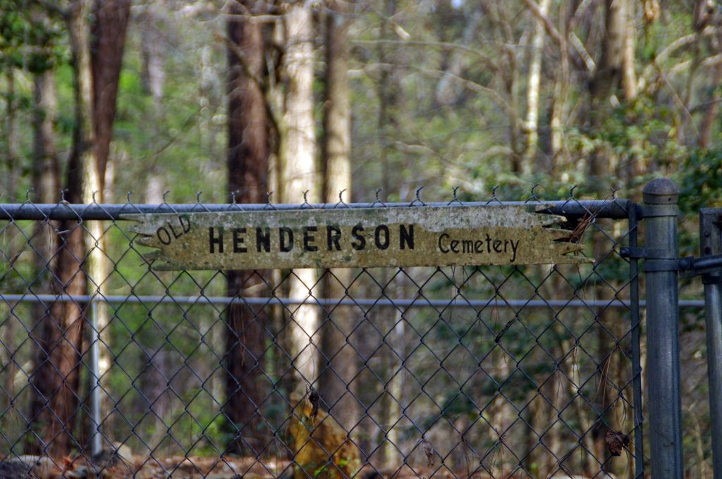
Where is Old Henderson Cemetery?
Old Henderson Cemetery is located at US Forest Service Road 533A1 Smith County ,Mississippi , 39152USA.
-
Old Henderson Cemetery cemetery's updated grave count on graveviews.com?
0 memorials
-
Where are the coordinates of the Old Henderson Cemetery?
Latitude: 32.1199100
Longitude: -89.4919700

Nearby Cemetories:
1. Lemon Christian Cemetery
Raleigh, Smith County, USA
Coordinate: 32.1225570, -89.4748020
2. Henderson Family Cemetery
Smith County, USA
Coordinate: 32.1207008, -89.5181122
3. Goodwater Baptist Church Cemetery
Smith County, USA
Coordinate: 32.1415200, -89.5027900
4. Barnes Cemetery
Raleigh, Smith County, USA
Coordinate: 32.0946999, -89.5068970
5. Trinity Methodist Cemetery
Raleigh, Smith County, USA
Coordinate: 32.0920600, -89.4753300
6. Mount Nebo Cemetery
Smith County, USA
Coordinate: 32.0951900, -89.4677200
7. Sylvan Grove Cemetery
Smith County, USA
Coordinate: 32.1137310, -89.4530439
8. High Hill Baptist Church Cemetery
Raleigh, Smith County, USA
Coordinate: 32.0860100, -89.4780800
9. Burns Baptist Church Cemetery
Raleigh, Smith County, USA
Coordinate: 32.1321880, -89.5384430
10. Barber Cemetery
Raleigh, Smith County, USA
Coordinate: 32.1321810, -89.5385960
11. Austin Cemetery
Shongelo, Smith County, USA
Coordinate: 32.0875015, -89.5233002
12. Burns United Methodist Church Cemetery
Burns, Smith County, USA
Coordinate: 32.1310501, -89.5399399
13. Page Cemetery
Raleigh, Smith County, USA
Coordinate: 32.0891991, -89.5432968
14. Providence Cemetery
Burns, Smith County, USA
Coordinate: 32.1357400, -89.5528600
15. Good Hope Cemetery
Smith County, USA
Coordinate: 32.1613100, -89.5345100
16. Mount Nebo Baptist Cemetery
Raleigh, Smith County, USA
Coordinate: 32.0981000, -89.4317400
17. Mount Carmel Cemetery
Smith County, USA
Coordinate: 32.1748200, -89.4593010
18. Craft Cemetery
Smith County, USA
Coordinate: 32.0774994, -89.5460968
19. Mount Pisgah Cemetery
Raleigh, Smith County, USA
Coordinate: 32.0589300, -89.5261100
20. Gasque Chapel Cemetery
Smith County, USA
Coordinate: 32.1793540, -89.5297340
21. Union Grove Cemetery
Smith County, USA
Coordinate: 32.1888520, -89.4801290
22. Lorena Baptist Church Cemetery
Lorena, Smith County, USA
Coordinate: 32.1917890, -89.5061570
23. Myers Cemetery
Raleigh, Smith County, USA
Coordinate: 32.0950012, -89.5730972
24. Turner Chapel Cemetery
Raleigh, Smith County, USA
Coordinate: 32.0474700, -89.5075300