
| Memorials | : | 0 |
| Location | : | Oslo, Oslo kommune, Norway |
| Coordinate | : | 59.9478110, 10.7012330 |
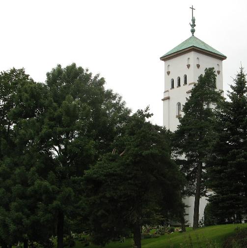
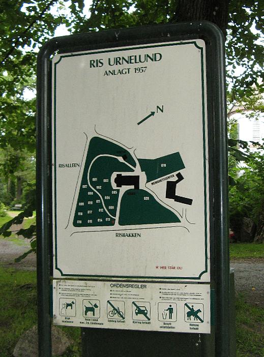
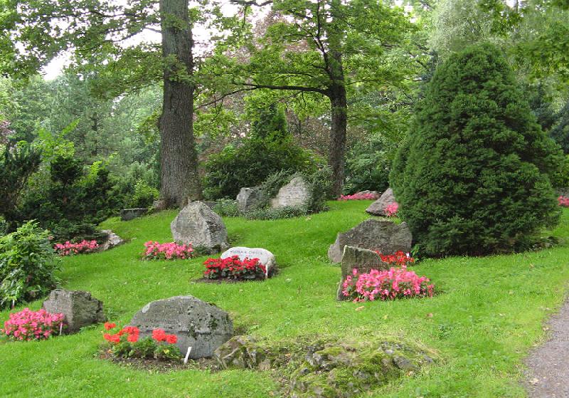
| Description | : | Ris urnelund is in Vestre Aker district in Oslo, it was inaugurated in 1957, has only urn graves and a size of approx. (26 dekar) 6,42 acre (US/UK). In 1926, an area was purchased from Riis Farm, to build a church there - Ris church. It was consecrated 12th June 1932. Inside the church is a memorial plaque to those who died in World War II. The cemetery contains a monument commemorating 46 victims of World War II - it was unveiled in 1952. There is also a common grave site for the... Read More |
frequently asked questions (FAQ):
-
Where is Ris urnelund?
Ris urnelund is located at Risbakken 3 Oslo, Oslo kommune ,Oslo fylke , 0374Norway.
-
Ris urnelund cemetery's updated grave count on graveviews.com?
0 memorials
-
Where are the coordinates of the Ris urnelund?
Latitude: 59.9478110
Longitude: 10.7012330
Nearby Cemetories:
1. Vestre Gravlund
Oslo, Oslo kommune, Norway
Coordinate: 59.9306100, 10.6998500
2. Vestre Aker kirkegård
Oslo, Oslo kommune, Norway
Coordinate: 59.9369400, 10.7291200
3. Nordre gravlund
Oslo, Oslo kommune, Norway
Coordinate: 59.9371400, 10.7483990
4. Voksen Cemetery
Oslo, Oslo kommune, Norway
Coordinate: 59.9566690, 10.6503380
5. Ullern kirkegård
Oslo, Oslo kommune, Norway
Coordinate: 59.9252790, 10.6542960
6. Gamle Aker kirkegård
Oslo, Oslo kommune, Norway
Coordinate: 59.9237680, 10.7469560
7. Vår Frelsers gravlund
Oslo, Oslo kommune, Norway
Coordinate: 59.9199500, 10.7435400
8. Grefsen kirkegård
Oslo, Oslo kommune, Norway
Coordinate: 59.9553656, 10.7710968
9. Krist kirkegård
Oslo, Oslo kommune, Norway
Coordinate: 59.9172300, 10.7467380
10. Sofienberg jødiske gravlund
Oslo, Oslo kommune, Norway
Coordinate: 59.9229390, 10.7668660
11. Det kongelige mausoleum i Akershus Slott
Oslo, Oslo kommune, Norway
Coordinate: 59.9067600, 10.7361560
12. Mariekirkens ruin
Oslo, Oslo kommune, Norway
Coordinate: 59.9034515, 10.7621204
13. Hallvardskatedralens ruin
Oslo, Oslo kommune, Norway
Coordinate: 59.9058810, 10.7686740
14. Polhøgda Cemetery
Lysaker, Bærum kommune, Norway
Coordinate: 59.9052560, 10.6348830
15. Gamlebyen Gravlund
Oslo, Oslo kommune, Norway
Coordinate: 59.9046240, 10.7709790
16. Østre Gravlund
Oslo, Oslo kommune, Norway
Coordinate: 59.9130300, 10.8088490
17. Østre Aker kirkegård
Okern, Oslo kommune, Norway
Coordinate: 59.9217730, 10.8197180
18. Helsfyr gravlund
Oslo, Oslo kommune, Norway
Coordinate: 59.9132810, 10.8124210
19. Haslum Cemetery
Haslum, Bærum kommune, Norway
Coordinate: 59.9247660, 10.5671860
20. Steinsskogen Cemetery
Baerums Verk, Bærum kommune, Norway
Coordinate: 59.9318020, 10.5530360
21. Bekkelaget urnelund
Oslo, Oslo kommune, Norway
Coordinate: 59.8849135, 10.7881908
22. Alfaset – tysk krigskirkegård
Oslo, Oslo kommune, Norway
Coordinate: 59.9314700, 10.8559100
23. Alfaset gravlund
Oslo, Oslo kommune, Norway
Coordinate: 59.9337100, 10.8583210
24. Sørkedalen kirkegård
Oslo, Oslo kommune, Norway
Coordinate: 60.0156200, 10.6165900