
| Memorials | : | 67 |
| Location | : | Iowa Hill, Placer County, USA |
| Coordinate | : | 39.1108880, -120.8568740 |
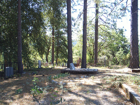
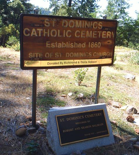
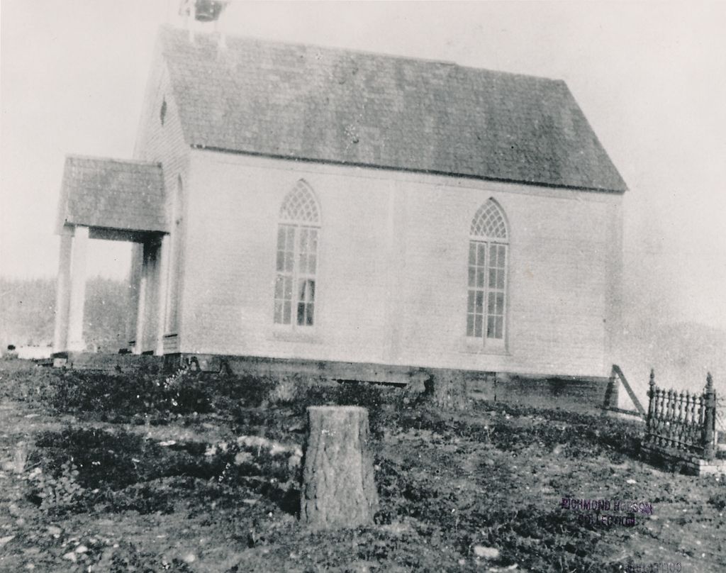
| Description | : | Saint Dominic's Catholic Cemetery St. Dominic's Cemetery in Iowa Hill is no longer affiliated with St. Dominic's Catholic Church in Colfax. People whose funeral services were held at St. Dominic's Catholic Church were probably buried in the Colfax Cemetery. Saint Dominic's Catholic Cemetery is one of two remaining official cemeteries in Iowa Hill, Placer County, California. The other is the Old Iowa Hill (AKA Protestant). Both are located on Banjo Hill, approximately 1/4 mile northeast of Iowa Hill on the road to Sugar Pine Dam and Forest Hill. The Catholic Cemetery is located on the south side of the road, across... Read More |
frequently asked questions (FAQ):
-
Where is Saint Dominics Catholic Cemetery?
Saint Dominics Catholic Cemetery is located at Iowa Hill Road Iowa Hill, Placer County ,California , 95713USA.
-
Saint Dominics Catholic Cemetery cemetery's updated grave count on graveviews.com?
67 memorials
-
Where are the coordinates of the Saint Dominics Catholic Cemetery?
Latitude: 39.1108880
Longitude: -120.8568740
Nearby Cemetories:
1. Iowa Hill Chinese Cemetery
Iowa Hill, Placer County, USA
Coordinate: 39.1113090, -120.8573260
2. Old Iowa Hill Cemetery
Iowa Hill, Placer County, USA
Coordinate: 39.1116667, -120.8575000
3. Gold Run Cemetery
Placer County, USA
Coordinate: 39.1757100, -120.8612900
4. Colfax Cemetery
Colfax, Placer County, USA
Coordinate: 39.0979522, -120.9471644
5. Colfax Indian Cemetery
Colfax, Placer County, USA
Coordinate: 39.0909900, -120.9503000
6. Yankee Jims Cemetery
Foresthill, Placer County, USA
Coordinate: 39.0292511, -120.8614349
7. Saint Paul Lutheran Cemetery
Pinecrest, Nevada County, USA
Coordinate: 39.1475900, -120.9649400
8. Saint Joseph Catholic Cemetery
Foresthill, Placer County, USA
Coordinate: 39.0240200, -120.8068800
9. Dutch Flat Cemetery
Dutch Flat, Placer County, USA
Coordinate: 39.2055000, -120.8340500
10. Belle Haven Farm Family Cemetery
Pinecrest, Nevada County, USA
Coordinate: 39.1570100, -120.9664300
11. Foresthill Community Cemetery
Foresthill, Placer County, USA
Coordinate: 39.0184500, -120.8114700
12. You Bet Cemetery
Nevada County, USA
Coordinate: 39.2036050, -120.9054320
13. Todd Valley Cemetery
Placer County, USA
Coordinate: 38.9970900, -120.8541000
14. Red Dog Cemetery
Grass Valley, Nevada County, USA
Coordinate: 39.2173340, -120.9094920
15. Michigan Bluff Cemetery
Placer County, USA
Coordinate: 39.0409400, -120.7401200
16. Odd Fellows Cemetery
Michigan Bluff, Placer County, USA
Coordinate: 39.0449240, -120.7361840
17. Deadwood Cemetery
Foresthill, Placer County, USA
Coordinate: 39.0447700, -120.7361200
18. Spring Garden Indian Cemetery
Foresthill, Placer County, USA
Coordinate: 38.9998620, -120.9049310
19. Weimar Sanatorium Cemetery
Weimar, Placer County, USA
Coordinate: 39.0350200, -120.9834400
20. Stoney Bar Cemetery
Foresthill, Placer County, USA
Coordinate: 39.0114980, -120.7408060
21. Josephine Mine Cemetery
Volcanoville, El Dorado County, USA
Coordinate: 38.9798000, -120.7892170
22. Esoteric Fraternity Cemetery
Applegate, Placer County, USA
Coordinate: 38.9946190, -120.9687490
23. Cunningham Cemetery
Grass Valley, Nevada County, USA
Coordinate: 39.1105600, -121.0756000
24. Loma Rica Ranch Burial Site
Grass Valley, Nevada County, USA
Coordinate: 39.2261450, -121.0238470