
| Memorials | : | 56 |
| Location | : | Foresthill, Placer County, USA |
| Coordinate | : | 38.9998620, -120.9049310 |
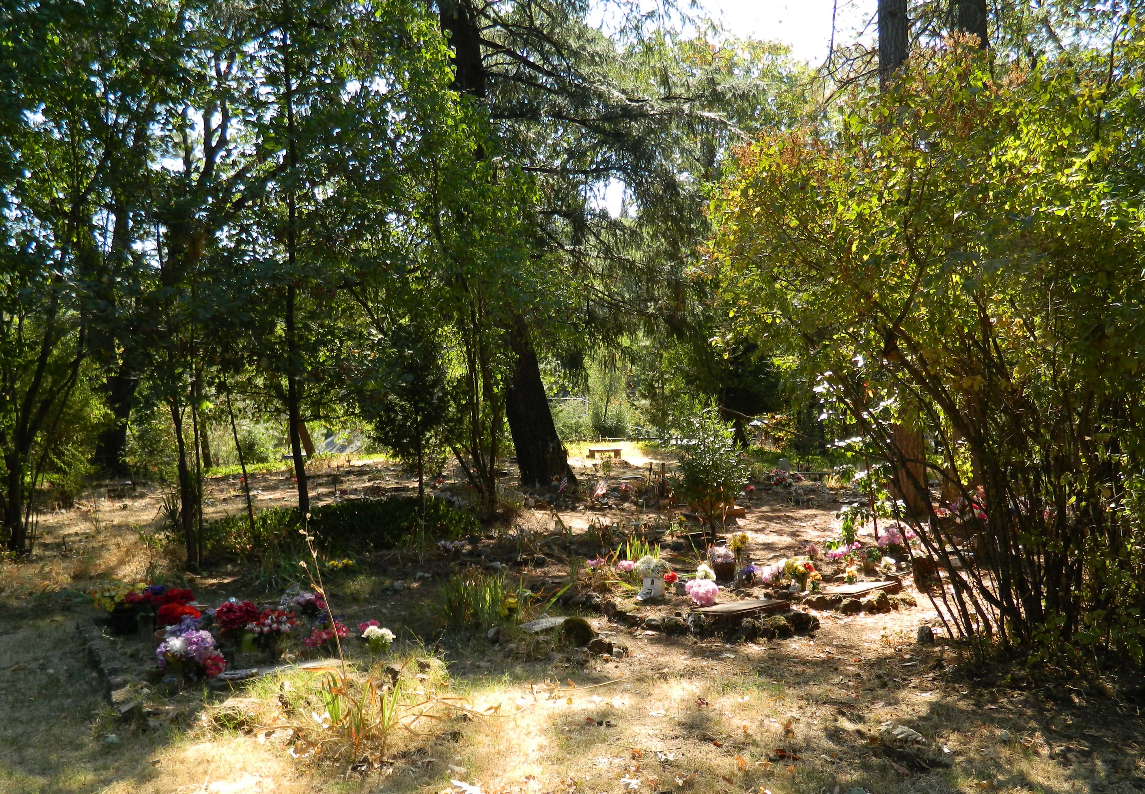
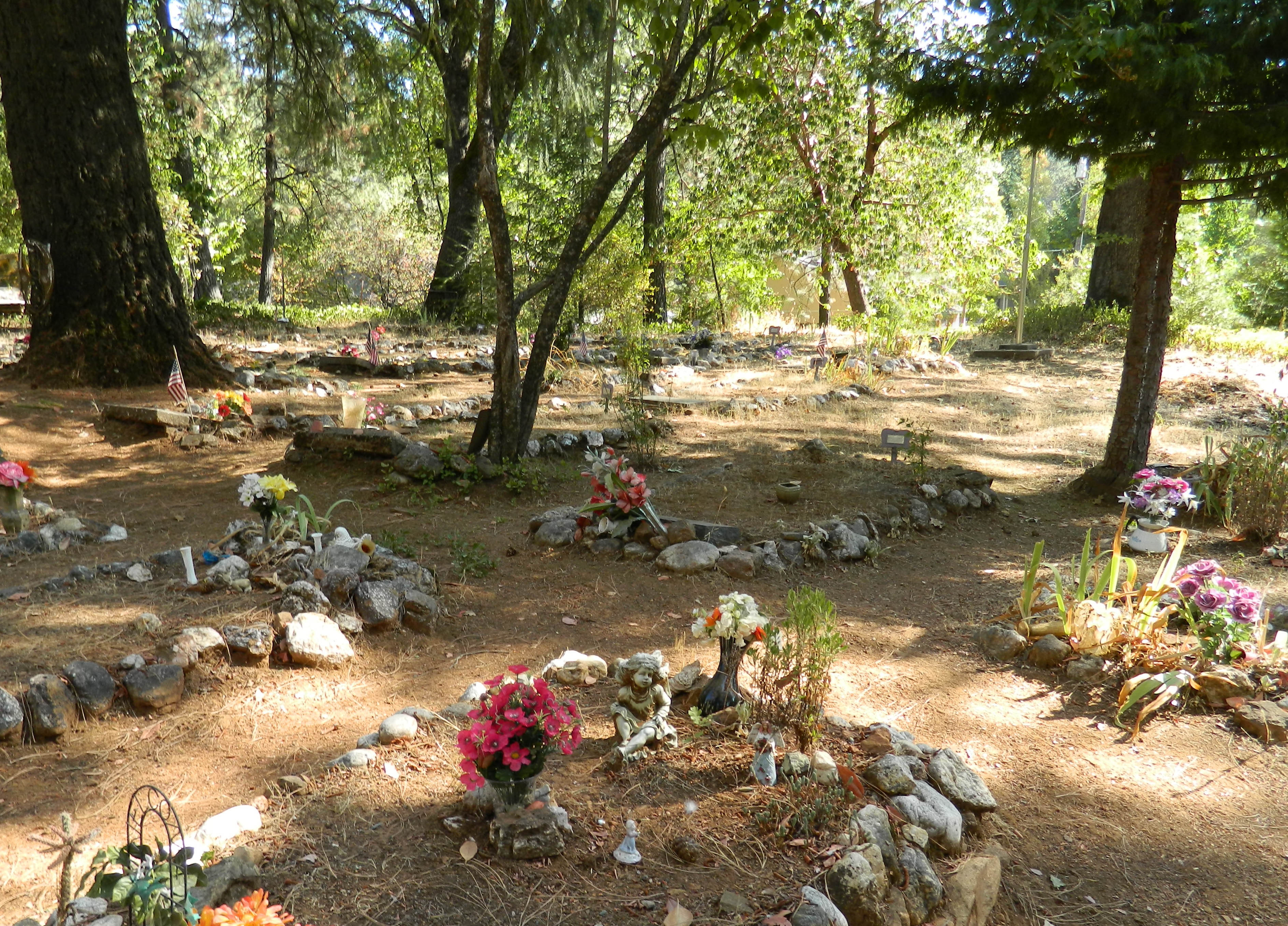
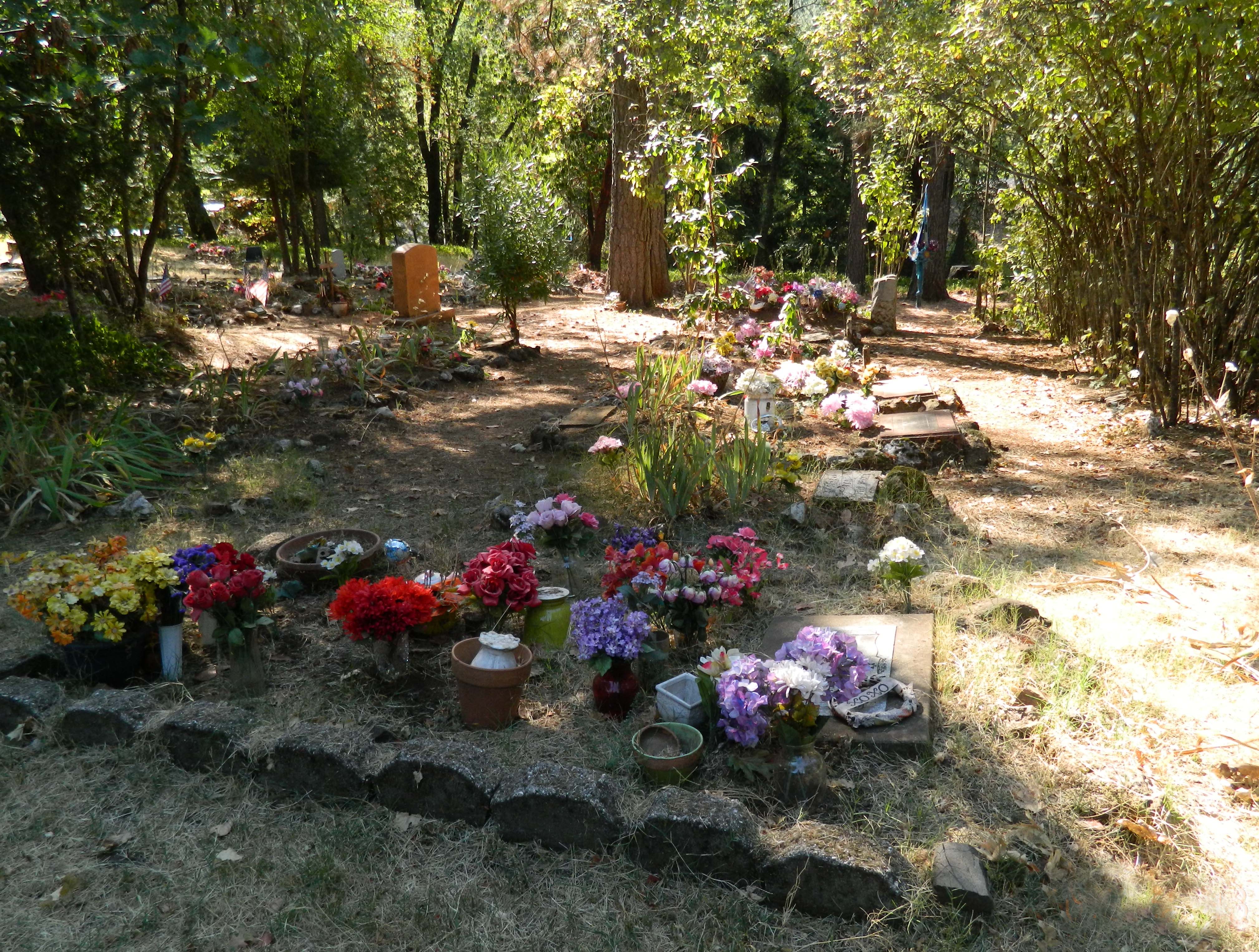
| Description | : | Spring Garden Indian Cemetery is located at the intersection of Ponderosa McKeon & Red Rock Road. Cemetery may be on private property. I got permission to visit from the house on the corner of where this cemetery is located behind. This cemetery is not marked in anyway, no signs, very private Indian family cemetery. Several graves were unmarked. As far as I know all headstone pictures have been taken and posted as of Oct 2012. One of the unknown gravesites that had a wooden marker has been posted, several had a cement marker with the word unknown on them. |
frequently asked questions (FAQ):
-
Where is Spring Garden Indian Cemetery?
Spring Garden Indian Cemetery is located at Foresthill, Placer County ,California ,USA.
-
Spring Garden Indian Cemetery cemetery's updated grave count on graveviews.com?
56 memorials
-
Where are the coordinates of the Spring Garden Indian Cemetery?
Latitude: 38.9998620
Longitude: -120.9049310
Nearby Cemetories:
1. Todd Valley Cemetery
Placer County, USA
Coordinate: 38.9970900, -120.8541000
2. Yankee Jims Cemetery
Foresthill, Placer County, USA
Coordinate: 39.0292511, -120.8614349
3. Esoteric Fraternity Cemetery
Applegate, Placer County, USA
Coordinate: 38.9946190, -120.9687490
4. Spanish Dry Diggings Cemetery
Greenwood, El Dorado County, USA
Coordinate: 38.9431600, -120.9158000
5. Weimar Sanatorium Cemetery
Weimar, Placer County, USA
Coordinate: 39.0350200, -120.9834400
6. Foresthill Community Cemetery
Foresthill, Placer County, USA
Coordinate: 39.0184500, -120.8114700
7. Saint Joseph Catholic Cemetery
Foresthill, Placer County, USA
Coordinate: 39.0240200, -120.8068800
8. Josephine Mine Cemetery
Volcanoville, El Dorado County, USA
Coordinate: 38.9798000, -120.7892170
9. Georgia Slide Cemetery
Georgetown, El Dorado County, USA
Coordinate: 38.9218063, -120.8377838
10. Clipper Gap Cemetery
Clipper Gap, Placer County, USA
Coordinate: 38.9784880, -121.0256590
11. Colfax Indian Cemetery
Colfax, Placer County, USA
Coordinate: 39.0909900, -120.9503000
12. Carmelite Monastery Cemetery
Georgetown, El Dorado County, USA
Coordinate: 38.9273300, -120.8173840
13. Greenwood Pioneer Cemetery
Greenwood, El Dorado County, USA
Coordinate: 38.8985786, -120.9099274
14. Colfax Cemetery
Colfax, Placer County, USA
Coordinate: 39.0979522, -120.9471644
15. Georgetown-Renke Cemetery Annex
Georgetown, El Dorado County, USA
Coordinate: 38.8964610, -120.9116240
16. Georgetown Pioneer Cemetery
Georgetown, El Dorado County, USA
Coordinate: 38.9068108, -120.8430862
17. Saint Dominics Catholic Cemetery
Iowa Hill, Placer County, USA
Coordinate: 39.1108880, -120.8568740
18. Iowa Hill Chinese Cemetery
Iowa Hill, Placer County, USA
Coordinate: 39.1113090, -120.8573260
19. Old Iowa Hill Cemetery
Iowa Hill, Placer County, USA
Coordinate: 39.1116667, -120.8575000
20. Stoney Bar Cemetery
Foresthill, Placer County, USA
Coordinate: 39.0114980, -120.7408060
21. Michigan Bluff Cemetery
Placer County, USA
Coordinate: 39.0409400, -120.7401200
22. Deadwood Cemetery
Foresthill, Placer County, USA
Coordinate: 39.0447700, -120.7361200
23. Odd Fellows Cemetery
Michigan Bluff, Placer County, USA
Coordinate: 39.0449240, -120.7361840
24. Saint Paul Lutheran Cemetery
Pinecrest, Nevada County, USA
Coordinate: 39.1475900, -120.9649400