
| Memorials | : | 0 |
| Location | : | Armstrong County, USA |
| Coordinate | : | 40.8323850, -79.4236530 |
| Description | : | Driving directions: From Kittanning, PA, at the intersection of Pennsylvania Route 28/66 and Pennsylvania Route 85, drive north on PA 28/66 for a total of 1.89 miles, to the top of the hill, in the village of Spaces Corners and, in Spaces Corners, look for the intersection of Anderson Creek Road. This top of the hill intersection is an easy road to miss and is on a blind curve...If you start down the hill, out of Spaces Corners, you missed this turn. At this intersection, turn right onto Anderson Creek Road and drive a total of 2.41 miles to... Read More |
frequently asked questions (FAQ):
-
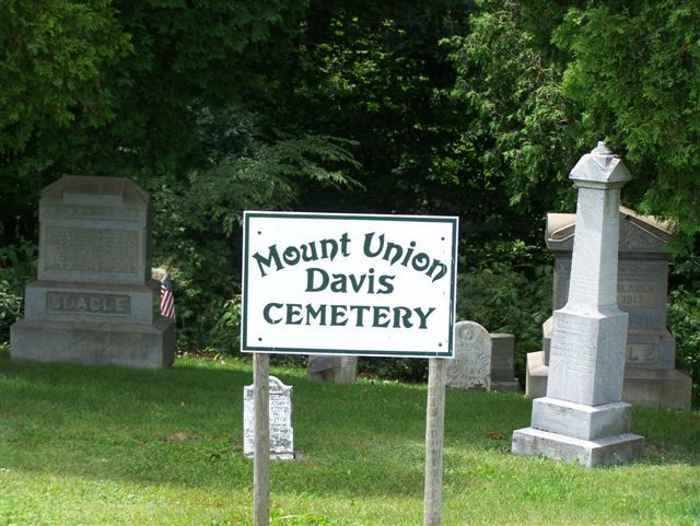
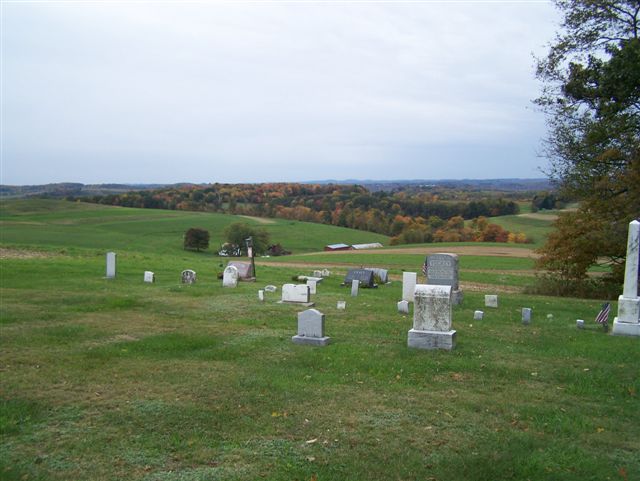
Where is Mount Union Davis Cemetery?
Mount Union Davis Cemetery is located at Armstrong County ,Pennsylvania ,USA.
-
Mount Union Davis Cemetery cemetery's updated grave count on graveviews.com?
0 memorials
-
Where are the coordinates of the Mount Union Davis Cemetery?
Latitude: 40.8323850
Longitude: -79.4236530
Nearby Cemetories:
1. Pine Creek Methodist Cemetery
Pine Furnace, Armstrong County, USA
Coordinate: 40.8497870, -79.4309590
2. Scott Fox Memorial Site
Kittanning, Armstrong County, USA
Coordinate: 40.8457580, -79.3972170
3. Pine Creek Baptist Church Cemetery
Kittanning, Armstrong County, USA
Coordinate: 40.8514748, -79.4601440
4. Calhoun Cemetery
Armstrong County, USA
Coordinate: 40.8502426, -79.3848648
5. Lower Piney Cemetery
Armstrong County, USA
Coordinate: 40.8655920, -79.4395400
6. Mount Zion Presbyterian Cemetery
Boggs Township, Armstrong County, USA
Coordinate: 40.8717100, -79.4171980
7. Good Shepherd Cemetery
Fenelton, Butler County, USA
Coordinate: 40.8434590, -79.4741510
8. Mateer Cemetery
Armstrong County, USA
Coordinate: 40.8721000, -79.4175000
9. Ritchison Farm Cemetery
Armstrong County, USA
Coordinate: 40.8475000, -79.4747000
10. Simpson Church Cemetery
Kittanning, Armstrong County, USA
Coordinate: 40.7899000, -79.4083640
11. County Home Cemetery
Armstrong County, USA
Coordinate: 40.8114710, -79.4842390
12. Elgin-Old Presbyterian Cemetery
Rural Valley, Armstrong County, USA
Coordinate: 40.8046646, -79.3662949
13. Salem United Church of Christ Cemetery
Kittanning, Armstrong County, USA
Coordinate: 40.8244130, -79.3559970
14. Rupp Lutheran Church Cemetery
Kittanning, Armstrong County, USA
Coordinate: 40.7866516, -79.4561920
15. Myers-Patton Cemetery
Adrian, Armstrong County, USA
Coordinate: 40.8619270, -79.4972458
16. Saint Joseph Cemetery
Kittanning, Armstrong County, USA
Coordinate: 40.8266983, -79.5074997
17. Pleasant Union Cemetery
Cowanshannock Township, Armstrong County, USA
Coordinate: 40.8314018, -79.3350449
18. Cochran Cemetery
Templeton, Armstrong County, USA
Coordinate: 40.8941994, -79.4582977
19. Sowers Cemetery
Rural Valley, Armstrong County, USA
Coordinate: 40.7775993, -79.3703003
20. Kittanning Cemetery
Kittanning, Armstrong County, USA
Coordinate: 40.8231140, -79.5174340
21. Rehobeth Reformed Presbyterian Church Cemetery
Kittanning, Armstrong County, USA
Coordinate: 40.8922670, -79.3695690
22. Black Cemetery
Kittanning, Armstrong County, USA
Coordinate: 40.7764060, -79.4860300
23. Saint Marys Cemetery
Kittanning, Armstrong County, USA
Coordinate: 40.8347015, -79.5239029
24. Echo Methodist Episcopal Church Cemetery
Armstrong County, USA
Coordinate: 40.8570420, -79.3275330