
| Memorials | : | 0 |
| Location | : | Smallfield, Tandridge District, England |
| Coordinate | : | 51.1770230, -0.1151960 |
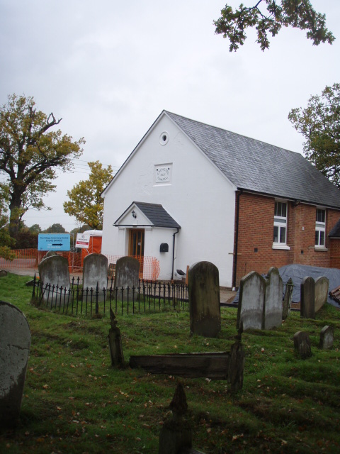
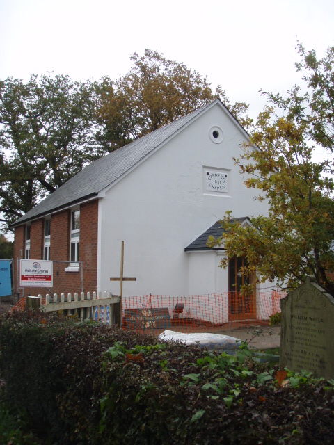
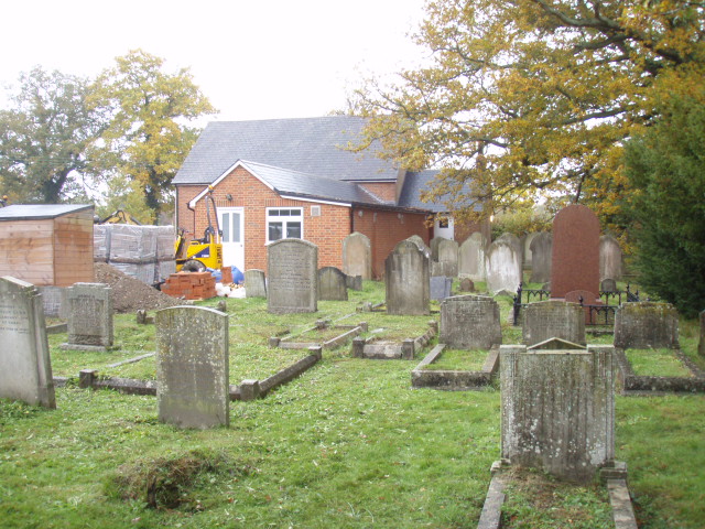
| Description | : | Ebenezer Chapel 1851 Proceed southwards from Redhill and Reigate down the A23 Brighton Road through Earlswood and Salfords. Shortly after Vines BMW showroom, turn left at the premises of Titan Travel into Cross Oak Lane which merges with Hathersham Lane alongside the M23. Turn left into Weatherhill Road, over the motorway bridge into Smallfield village. Turn left into Chapel Road and Ebenezer Chapel is about 500 yards along on the right hand side. Ebenezer Chapel is a brick rendered building with pitched slate roof understood to date from the early Victorian era. A single storey... Read More |
frequently asked questions (FAQ):
-
Where is Smallfield Ebenezer Chapel Cemetery?
Smallfield Ebenezer Chapel Cemetery is located at Chapel Road Smallfield, Tandridge District ,Surrey ,England.
-
Smallfield Ebenezer Chapel Cemetery cemetery's updated grave count on graveviews.com?
0 memorials
-
Where are the coordinates of the Smallfield Ebenezer Chapel Cemetery?
Latitude: 51.1770230
Longitude: -0.1151960
Nearby Cemetories:
1. St. Mary the Virgin Churchyard
Horne, Tandridge District, England
Coordinate: 51.1827330, -0.0886630
2. St John the Baptist Churchyard
Outwood, Tandridge District, England
Coordinate: 51.1981770, -0.1127510
3. St Bartholomew Churchyard
Burstow, Tandridge District, England
Coordinate: 51.1558610, -0.1247750
4. St John the Evangelist Churchyard
Copthorne, Crawley Borough, England
Coordinate: 51.1394100, -0.1175700
5. Parish of Horley's New Churchyard
Horley, Reigate and Banstead Borough, England
Coordinate: 51.1711120, -0.1747610
6. St. Bartholomew's Churchyard
Horley, Reigate and Banstead Borough, England
Coordinate: 51.1698000, -0.1758000
7. St. John the Evangelist Churchyard
Blindley Heath, Tandridge District, England
Coordinate: 51.1961510, -0.0536070
8. Surrey and Sussex Crematorium
Crawley, Crawley Borough, England
Coordinate: 51.1357000, -0.1469230
9. All Saints Churchyard
Crawley Down, Mid Sussex District, England
Coordinate: 51.1211200, -0.0830650
10. St John The Divine
Felbridge, Tandridge District, England
Coordinate: 51.1414480, -0.0392460
11. Sidlow Bridge Emmanuel Churchyard
Sidlow, Reigate and Banstead Borough, England
Coordinate: 51.2077270, -0.1989510
12. Redstone Cemetery
Redhill, Reigate and Banstead Borough, England
Coordinate: 51.2310910, -0.1601330
13. St Peter and St Paul Churchyard
Lingfield, Tandridge District, England
Coordinate: 51.1763840, -0.0142480
14. St Mary Churchyard
Bletchingley, Tandridge District, England
Coordinate: 51.2413460, -0.0994430
15. St Peter and St Paul Churchyard
Nutfield, Tandridge District, England
Coordinate: 51.2419780, -0.1258540
16. Bletchingley Cemetery
Bletchingley, Tandridge District, England
Coordinate: 51.2411080, -0.0911120
17. St Nicholas Churchyard
Worth, Mid Sussex District, England
Coordinate: 51.1102870, -0.1415280
18. Charlwood Friends Burial Ground
Charlwood, Mole Valley District, England
Coordinate: 51.1553700, -0.2305800
19. St Leonard's Church
Turners Hill, Mid Sussex District, England
Coordinate: 51.1023030, -0.0911310
20. St John the Evangelist Churchyard
Dormansland, Tandridge District, England
Coordinate: 51.1597320, 0.0054300
21. Quakers Burial Ground
Reigate, Reigate and Banstead Borough, England
Coordinate: 51.2372600, -0.1936700
22. Reigate Cemetery
Reigate, Reigate and Banstead Borough, England
Coordinate: 51.2353550, -0.1977820
23. Dormansland Baptist Chapelyard
Dormansland, Tandridge District, England
Coordinate: 51.1634300, 0.0073300
24. Friary Churchyard of St. Francis and St. Anthony
Crawley, Crawley Borough, England
Coordinate: 51.1133670, -0.1875970