
| Memorials | : | 0 |
| Location | : | Boarstall, Aylesbury Vale District, England |
| Coordinate | : | 51.8218170, -1.0926460 |
| Description | : | Boarstall is a village and civil parish in the Aylesbury Vale district of Buckinghamshire, about 12 miles (19 km) west of Aylesbury. The parish is on the county boundary with Oxfordshire and the village is about 5.5 miles (9 km) southeast of the Oxfordshire market town of Bicester. (Text By Wertypop) |
frequently asked questions (FAQ):
-
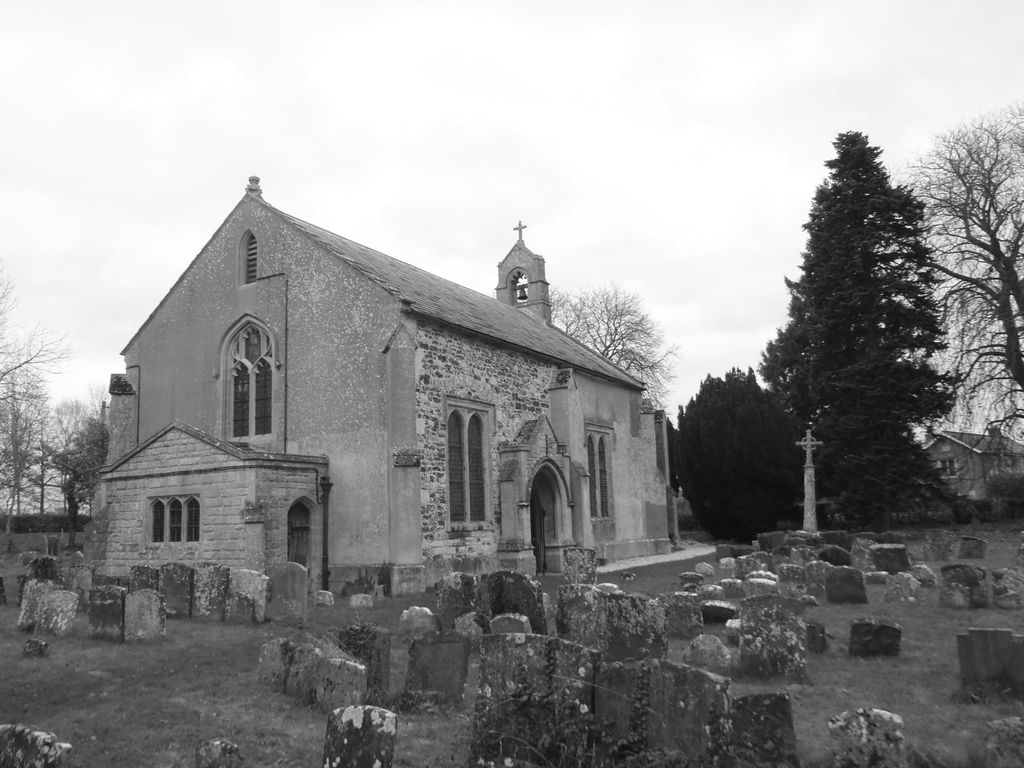
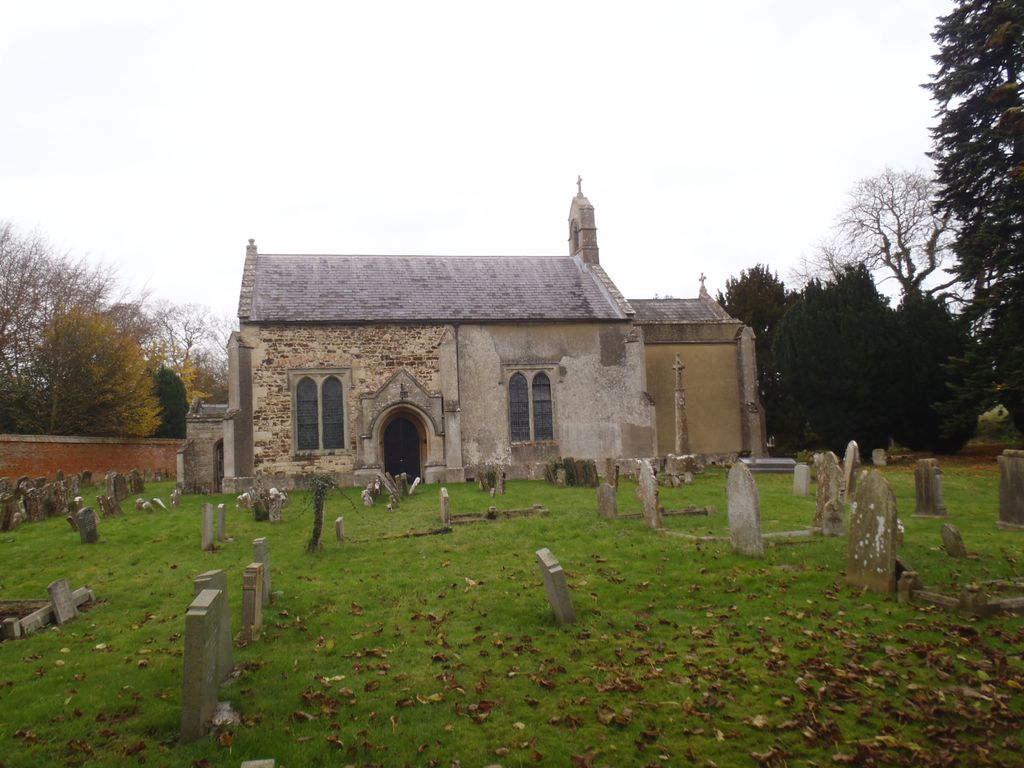
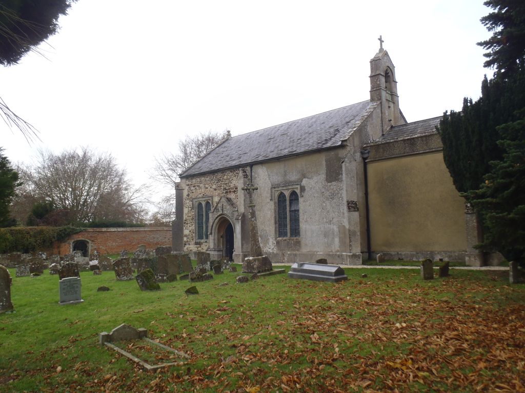
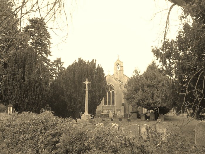
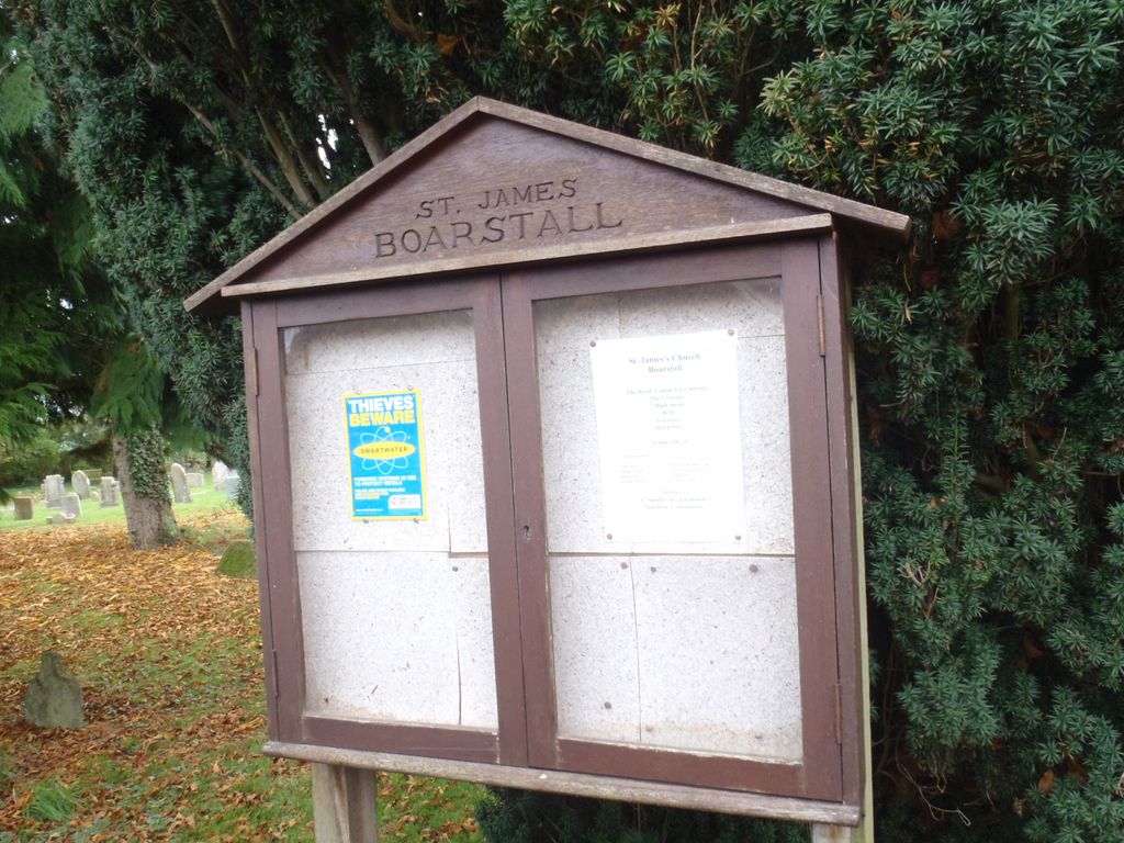
Where is St. James' Churchyard?
St. James' Churchyard is located at Off B4011 Boarstall, Aylesbury Vale District ,Buckinghamshire , HP18 9UXEngland.
-
St. James' Churchyard cemetery's updated grave count on graveviews.com?
0 memorials
-
Where are the coordinates of the St. James' Churchyard?
Latitude: 51.8218170
Longitude: -1.0926460
Nearby Cemetories:
1. St Mary Churchyard
Oakley, Aylesbury Vale District, England
Coordinate: 51.8054770, -1.0704700
2. All Saints Churchyard
Brill, Aylesbury Vale District, England
Coordinate: 51.8196440, -1.0490570
3. St Nicholas Churchyard
Piddington, Cherwell District, England
Coordinate: 51.8477520, -1.0723950
4. St John the Baptist Churchyard
Piddington, Cherwell District, England
Coordinate: 51.8477859, -1.0723360
5. Studley Priory
Horton-cum-Studley, Cherwell District, England
Coordinate: 51.8054560, -1.1346920
6. St Barnabas Churchyard
Horton-cum-Studley, Cherwell District, England
Coordinate: 51.8077260, -1.1409690
7. St. Mary the Virgin Churchyard
Ludgershall, Aylesbury Vale District, England
Coordinate: 51.8495250, -1.0434220
8. St John the Baptist
Dorton, Aylesbury Vale District, England
Coordinate: 51.8198434, -1.0162377
9. St Marys Churchyard
Ambrosden, Cherwell District, England
Coordinate: 51.8699990, -1.1255190
10. St Swithuns Churchyard
Merton, Cherwell District, England
Coordinate: 51.8559670, -1.1633060
11. St. Mary's Churchyard
Chilton, Aylesbury Vale District, England
Coordinate: 51.7988760, -1.0055490
12. St Mary Church Cemetery
Charlton-on-Otmoor, Cherwell District, England
Coordinate: 51.8394100, -1.1838090
13. St. Mary the Virgin Churchyard
Charlton-on-Otmoor, Cherwell District, England
Coordinate: 51.8381510, -1.1859010
14. Saint John the Baptist
Stanton St John, South Oxfordshire District, England
Coordinate: 51.7800350, -1.1642830
15. St. Nicholas' Churchyard
Ickford, Aylesbury Vale District, England
Coordinate: 51.7614648, -1.0656459
16. Assumption of the Blessed Virgin Mary Churchyard
Beckley, South Oxfordshire District, England
Coordinate: 51.7972530, -1.1858920
17. St. Andrew Churchyard
Oddington, Cherwell District, England
Coordinate: 51.8291010, -1.1996230
18. St Mary's Churchyard
Waterperry, South Oxfordshire District, England
Coordinate: 51.7521000, -1.0894000
19. Forest Hill Church Cemetery
Forest Hill, South Oxfordshire District, England
Coordinate: 51.7641700, -1.1567100
20. St. Nicholas' Church
Forest Hill, South Oxfordshire District, England
Coordinate: 51.7641400, -1.1567200
21. St Marys Churchyard
Ashendon, Aylesbury Vale District, England
Coordinate: 51.8221320, -0.9784380
22. St Bartholomew Churchyard
Holton, South Oxfordshire District, England
Coordinate: 51.7529490, -1.1246510
23. St Giles Churchyard
Noke, Cherwell District, England
Coordinate: 51.8145050, -1.2114790
24. St. Mary Magdalene Churchyard
Shabbington, Aylesbury Vale District, England
Coordinate: 51.7554420, -1.0357510