
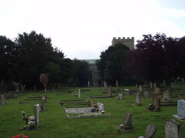
| Memorials | : | 39 |
| Location | : | Ambrosden, Cherwell District, England |
| Coordinate | : | 51.8699990, -1.1255190 |
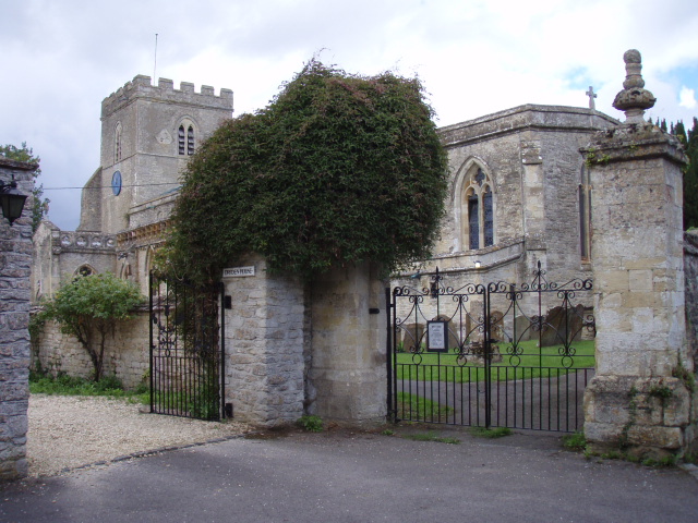
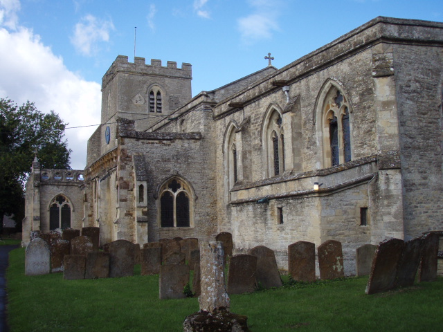
| Description | : | The earliest history of the parish church is traced to the reign of Edward I, built on the ground of an old Saxon structure. This earliest part of the Church of England parish church was consecrated to St. Mary the Virgin in the 12th-century Norman north doorway. Over the centuries, the church has been refurbished many times. The northern gate of this ancient church has been preserved for the reason that it has witnessed many marriage celebrations, exchange of dowries, execution of contracts and normal village business transactions. The Early English Gothic west tower was built slightly later.The remainder of... Read More |
frequently asked questions (FAQ):
-
Where is St Marys Churchyard?
St Marys Churchyard is located at Church Walk Ambrosden, Cherwell District ,Oxfordshire , OX25 2LYEngland.
-
St Marys Churchyard cemetery's updated grave count on graveviews.com?
33 memorials
-
Where are the coordinates of the St Marys Churchyard?
Latitude: 51.8699990
Longitude: -1.1255190
Nearby Cemetories:
1. St Swithuns Churchyard
Merton, Cherwell District, England
Coordinate: 51.8559670, -1.1633060
2. Bethel Congregational Church
Launton, Cherwell District, England
Coordinate: 51.8979200, -1.1151020
3. Independent Chapel Cemetery
Bicester, Cherwell District, England
Coordinate: 51.8960550, -1.1514940
4. St Marys Churchyard
Launton, Cherwell District, England
Coordinate: 51.9006740, -1.1230300
5. Bicester Town Cemetery
Bicester, Cherwell District, England
Coordinate: 51.8945880, -1.1553730
6. St Edburg Churchyard
Bicester, Cherwell District, England
Coordinate: 51.8960060, -1.1541930
7. Bicester Priory
Bicester, Cherwell District, England
Coordinate: 51.9000000, -1.1500000
8. St Nicholas Churchyard
Piddington, Cherwell District, England
Coordinate: 51.8477520, -1.0723950
9. St John the Baptist Churchyard
Piddington, Cherwell District, England
Coordinate: 51.8477859, -1.0723360
10. St Giles Churchyard
Wendlebury, Cherwell District, England
Coordinate: 51.8730580, -1.1901000
11. St Mary Churchyard
Chesterton, Cherwell District, England
Coordinate: 51.8879880, -1.1851540
12. St Mary Church Cemetery
Charlton-on-Otmoor, Cherwell District, England
Coordinate: 51.8394100, -1.1838090
13. St. Mary the Virgin Churchyard
Charlton-on-Otmoor, Cherwell District, England
Coordinate: 51.8381510, -1.1859010
14. Marsh Gibbon Cemetery
Bicester, Cherwell District, England
Coordinate: 51.9000250, -1.0607810
15. St. James' Churchyard
Boarstall, Aylesbury Vale District, England
Coordinate: 51.8218170, -1.0926460
16. St Mary the Virgin Churchyard
Marsh Gibbon, Aylesbury Vale District, England
Coordinate: 51.9038310, -1.0601060
17. St. Mary the Virgin Churchyard
Ludgershall, Aylesbury Vale District, England
Coordinate: 51.8495250, -1.0434220
18. St Laurence Churchyard
Caversfield, Cherwell District, England
Coordinate: 51.9223030, -1.1571690
19. SS Mary & Edburga Churchyard
Stratton Audley, Cherwell District, England
Coordinate: 51.9294810, -1.1164160
20. St. Andrew Churchyard
Oddington, Cherwell District, England
Coordinate: 51.8291010, -1.1996230
21. St Barnabas Churchyard
Horton-cum-Studley, Cherwell District, England
Coordinate: 51.8077260, -1.1409690
22. Studley Priory
Horton-cum-Studley, Cherwell District, England
Coordinate: 51.8054560, -1.1346920
23. St Marys Churchyard
Weston-on-the-Green, Cherwell District, England
Coordinate: 51.8632420, -1.2302540
24. St Peter's Churchyard
Bucknell, Cherwell District, England
Coordinate: 51.9263400, -1.1861700