
| Memorials | : | 60 |
| Location | : | Piddington, Cherwell District, England |
| Coordinate | : | 51.8477520, -1.0723950 |
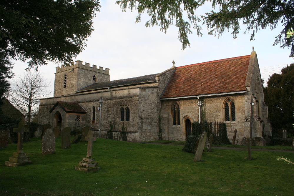
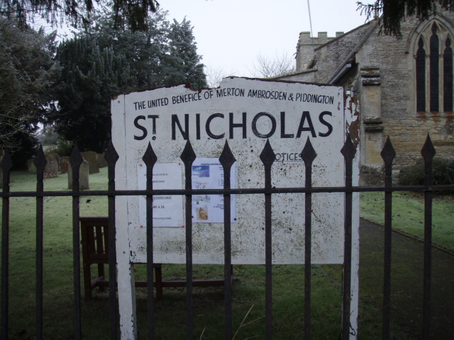
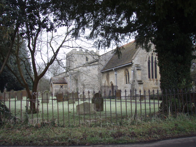
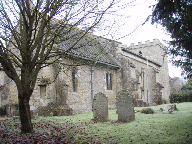
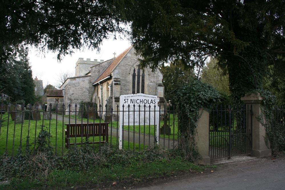
| Description | : | Piddington was originally part of the ecclesiastical parish of Ambrosden. By 1152 "Ralph the hermit" had established Holy Cross chapel on Muswell Hill about 1 mile (2 km) south of the village. Until the English Reformation, Piddington villagers used to process to the chapel on Christian feast days. The last ruins of the chapel are reported to have disappeared in 1800. The chapel of Saint Nicholas in Piddington is known to have existed by 1309. It is now Piddington's Church of England parish church. Its chancel was built in about 1300, but contains features added in the Decorated style... Read More |
frequently asked questions (FAQ):
-
Where is St Nicholas Churchyard?
St Nicholas Churchyard is located at Thame Road Piddington, Cherwell District ,Oxfordshire , OX6 0PYEngland.
-
St Nicholas Churchyard cemetery's updated grave count on graveviews.com?
59 memorials
-
Where are the coordinates of the St Nicholas Churchyard?
Latitude: 51.8477520
Longitude: -1.0723950
Nearby Cemetories:
1. St John the Baptist Churchyard
Piddington, Cherwell District, England
Coordinate: 51.8477859, -1.0723360
2. St. Mary the Virgin Churchyard
Ludgershall, Aylesbury Vale District, England
Coordinate: 51.8495250, -1.0434220
3. St. James' Churchyard
Boarstall, Aylesbury Vale District, England
Coordinate: 51.8218170, -1.0926460
4. All Saints Churchyard
Brill, Aylesbury Vale District, England
Coordinate: 51.8196440, -1.0490570
5. St Marys Churchyard
Ambrosden, Cherwell District, England
Coordinate: 51.8699990, -1.1255190
6. St Mary Churchyard
Oakley, Aylesbury Vale District, England
Coordinate: 51.8054770, -1.0704700
7. St John the Baptist
Dorton, Aylesbury Vale District, England
Coordinate: 51.8198434, -1.0162377
8. St Leonard Churchyard
Grendon Underwood, Aylesbury Vale District, England
Coordinate: 51.8832800, -1.0174800
9. Marsh Gibbon Cemetery
Bicester, Cherwell District, England
Coordinate: 51.9000250, -1.0607810
10. St Mary the Virgin Churchyard
Marsh Gibbon, Aylesbury Vale District, England
Coordinate: 51.9038310, -1.0601060
11. Bethel Congregational Church
Launton, Cherwell District, England
Coordinate: 51.8979200, -1.1151020
12. St Swithuns Churchyard
Merton, Cherwell District, England
Coordinate: 51.8559670, -1.1633060
13. Studley Priory
Horton-cum-Studley, Cherwell District, England
Coordinate: 51.8054560, -1.1346920
14. St Barnabas Churchyard
Horton-cum-Studley, Cherwell District, England
Coordinate: 51.8077260, -1.1409690
15. St Marys Churchyard
Launton, Cherwell District, England
Coordinate: 51.9006740, -1.1230300
16. St Michael and All Angels Churchyard
Edgcott, Aylesbury Vale District, England
Coordinate: 51.8995450, -1.0132210
17. St Marys Churchyard
Ashendon, Aylesbury Vale District, England
Coordinate: 51.8221320, -0.9784380
18. St. Mary's Churchyard
Chilton, Aylesbury Vale District, England
Coordinate: 51.7988760, -1.0055490
19. Independent Chapel Cemetery
Bicester, Cherwell District, England
Coordinate: 51.8960550, -1.1514940
20. St Marys Churchyard
Westcott, Aylesbury Vale District, England
Coordinate: 51.8482790, -0.9609600
21. St Mary Church Cemetery
Charlton-on-Otmoor, Cherwell District, England
Coordinate: 51.8394100, -1.1838090
22. Bicester Town Cemetery
Bicester, Cherwell District, England
Coordinate: 51.8945880, -1.1553730
23. St Edburg Churchyard
Bicester, Cherwell District, England
Coordinate: 51.8960060, -1.1541930
24. St. Mary the Virgin Churchyard
Charlton-on-Otmoor, Cherwell District, England
Coordinate: 51.8381510, -1.1859010