
| Memorials | : | 0 |
| Location | : | Ludgershall, Aylesbury Vale District, England |
| Coordinate | : | 51.8495250, -1.0434220 |
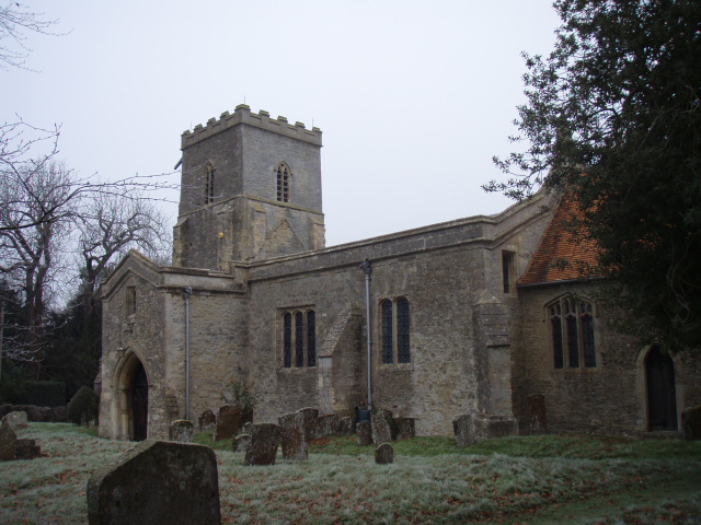
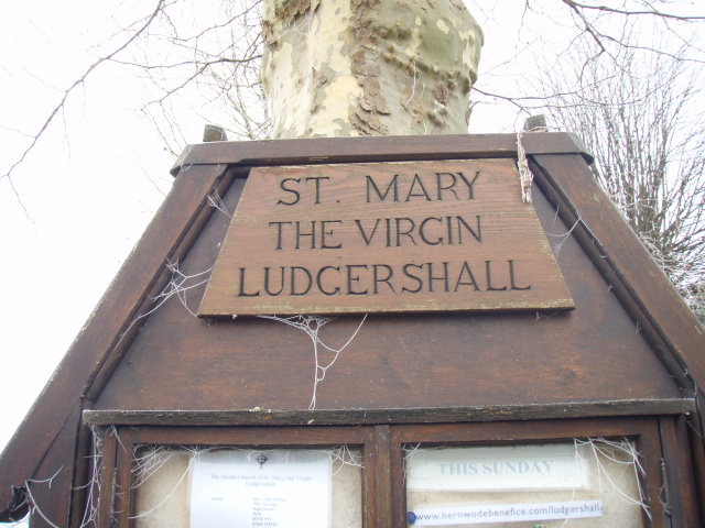
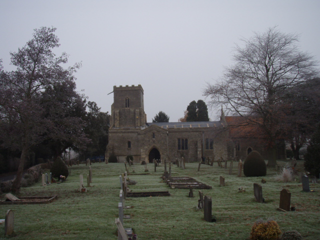
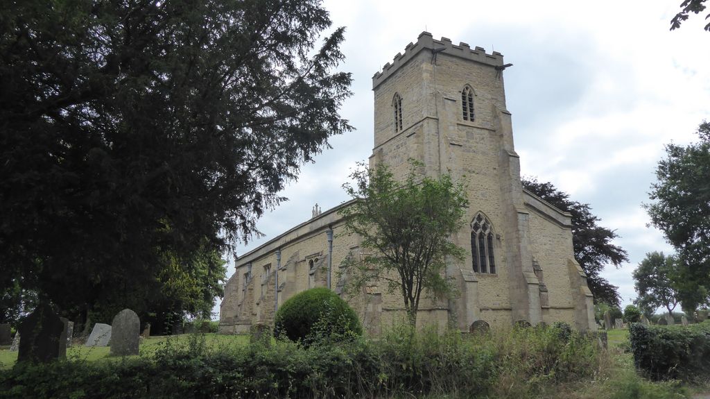
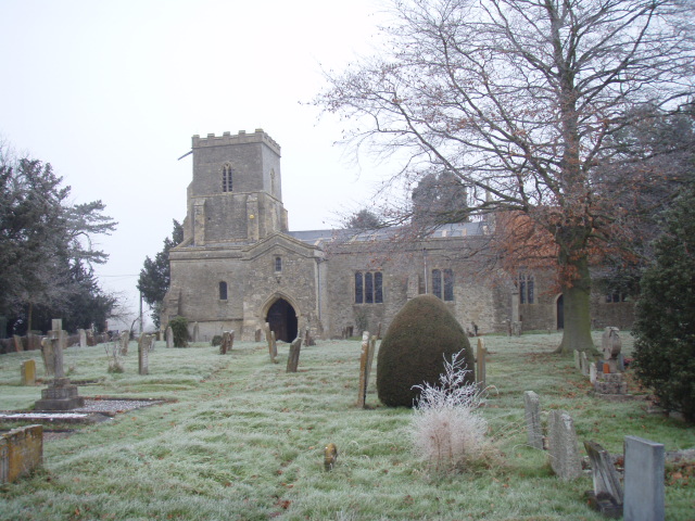
| Description | : | Ludgershall is a village and civil parish in the Aylesbury Vale district of Buckinghamshire, England. It is near the boundary with Oxfordshire, about 5.5 miles (8.9 km) south-east of Bicester and 5 miles (8.0 km) west of Waddesdon. The toponym is Old English in origin, and is said to mean "nook with a trapping spear" but this is disputed. It occurs in more than one place in England . The Domesday Book of 1086 records the village as Litlegarsele. St Mary the Virgin Church, Ludgershall Henry II granted land in the parish to the priory of Santingfeld in Picardy,... Read More |
frequently asked questions (FAQ):
-
Where is St. Mary the Virgin Churchyard?
St. Mary the Virgin Churchyard is located at Piddington Lane Ludgershall, Aylesbury Vale District ,Buckinghamshire ,England.
-
St. Mary the Virgin Churchyard cemetery's updated grave count on graveviews.com?
0 memorials
-
Where are the coordinates of the St. Mary the Virgin Churchyard?
Latitude: 51.8495250
Longitude: -1.0434220
Nearby Cemetories:
1. St John the Baptist Churchyard
Piddington, Cherwell District, England
Coordinate: 51.8477859, -1.0723360
2. St Nicholas Churchyard
Piddington, Cherwell District, England
Coordinate: 51.8477520, -1.0723950
3. All Saints Churchyard
Brill, Aylesbury Vale District, England
Coordinate: 51.8196440, -1.0490570
4. St John the Baptist
Dorton, Aylesbury Vale District, England
Coordinate: 51.8198434, -1.0162377
5. St Leonard Churchyard
Grendon Underwood, Aylesbury Vale District, England
Coordinate: 51.8832800, -1.0174800
6. St. James' Churchyard
Boarstall, Aylesbury Vale District, England
Coordinate: 51.8218170, -1.0926460
7. St Mary Churchyard
Oakley, Aylesbury Vale District, England
Coordinate: 51.8054770, -1.0704700
8. St Marys Churchyard
Ashendon, Aylesbury Vale District, England
Coordinate: 51.8221320, -0.9784380
9. St Marys Churchyard
Westcott, Aylesbury Vale District, England
Coordinate: 51.8482790, -0.9609600
10. Marsh Gibbon Cemetery
Bicester, Cherwell District, England
Coordinate: 51.9000250, -1.0607810
11. St Michael and All Angels Churchyard
Edgcott, Aylesbury Vale District, England
Coordinate: 51.8995450, -1.0132210
12. St Marys Churchyard
Ambrosden, Cherwell District, England
Coordinate: 51.8699990, -1.1255190
13. St Mary the Virgin Churchyard
Marsh Gibbon, Aylesbury Vale District, England
Coordinate: 51.9038310, -1.0601060
14. St. Mary's Churchyard
Chilton, Aylesbury Vale District, England
Coordinate: 51.7988760, -1.0055490
15. Bethel Congregational Church
Launton, Cherwell District, England
Coordinate: 51.8979200, -1.1151020
16. St Marys Churchyard
Launton, Cherwell District, England
Coordinate: 51.9006740, -1.1230300
17. Studley Priory
Horton-cum-Studley, Cherwell District, England
Coordinate: 51.8054560, -1.1346920
18. St. Michael and All Angels Churchyard
Waddesdon, Aylesbury Vale District, England
Coordinate: 51.8464760, -0.9269500
19. St Barnabas Churchyard
Horton-cum-Studley, Cherwell District, England
Coordinate: 51.8077260, -1.1409690
20. St Swithuns Churchyard
Merton, Cherwell District, England
Coordinate: 51.8559670, -1.1633060
21. St. Nicholas' Churchyard
Nether Winchendon, Aylesbury Vale District, England
Coordinate: 51.8041000, -0.9388000
22. St Mary Magdalene Churchyard
Upper Winchendon, Aylesbury Vale District, England
Coordinate: 51.8240620, -0.9192140
23. St Mary the Virgin Churchyard
Long Crendon, Aylesbury Vale District, England
Coordinate: 51.7758380, -0.9890670
24. Independent Chapel Cemetery
Bicester, Cherwell District, England
Coordinate: 51.8960550, -1.1514940