
| Memorials | : | 83 |
| Location | : | Pauntley, Forest of Dean District, England |
| Coordinate | : | 51.9588610, -2.3670030 |
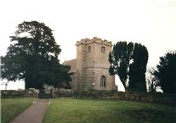
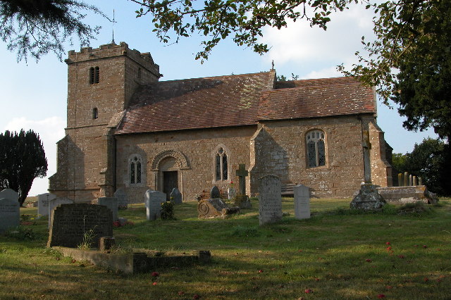
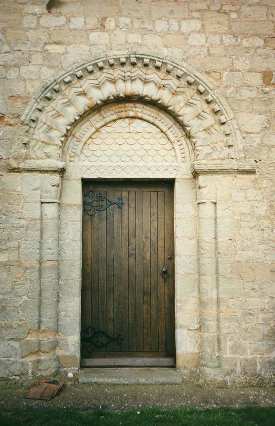
| Description | : | The Church of St John the Evangelist This lovely Norman church is set in a peaceful and elevated setting close to Pauntley Court. Pauntley Court was the home of the Whittington family from the 14th century and believed to be the birthplace of Dick Whittington, who was presumably baptised here in Pauntley Church. The church is well-known for its beautiful south doorway of the Dymock school of carving. |
frequently asked questions (FAQ):
-
Where is St. John the Evangelist Churchyard?
St. John the Evangelist Churchyard is located at Pauntley, Forest of Dean District ,Gloucestershire ,England.
-
St. John the Evangelist Churchyard cemetery's updated grave count on graveviews.com?
83 memorials
-
Where are the coordinates of the St. John the Evangelist Churchyard?
Latitude: 51.9588610
Longitude: -2.3670030
Nearby Cemetories:
1. St. Bartholomew's Churchyard
Redmarley, Forest of Dean District, England
Coordinate: 51.9795670, -2.3622700
2. St. Mary the Virgin Churchyard
Upleadon, Forest of Dean District, England
Coordinate: 51.9406240, -2.3378190
3. St Anne's Churchyard
Oxenhall, Forest of Dean District, England
Coordinate: 51.9383000, -2.4212000
4. St Mary the Virgin Churchyard
Bromsberrow, Forest of Dean District, England
Coordinate: 52.0008740, -2.3768560
5. Newent Cemetery
Newent, Forest of Dean District, England
Coordinate: 51.9272500, -2.4135730
6. St Mary's Churchyard
Dymock, Forest of Dean District, England
Coordinate: 51.9793264, -2.4376889
7. St. Mary the Virgin Churchyard
Hartpury, Forest of Dean District, England
Coordinate: 51.9110277, -2.3204027
8. St Faith Churchyard
Berrow, Malvern Hills District, England
Coordinate: 52.0065770, -2.3018720
9. Hartpury Methodist Churchyard
Hartpury, Forest of Dean District, England
Coordinate: 51.9196444, -2.2883000
10. Christ Church Churchyard
Gorsley, Forest of Dean District, England
Coordinate: 51.9291294, -2.4559924
11. St. Mary the Virgin Cemetery
Rudford, Forest of Dean District, England
Coordinate: 51.8936272, -2.3213976
12. All Saints Churchyard
Hollybush, Malvern Hills District, England
Coordinate: 52.0282510, -2.3384140
13. Pendock Old Church
Pendock, Malvern Hills District, England
Coordinate: 52.0014720, -2.2679110
14. Pendock Churchyard
Pendock, Malvern Hills District, England
Coordinate: 52.0015108, -2.2678653
15. St. Peter and St. Paul Churchyard
Birtsmorton, Malvern Hills District, England
Coordinate: 52.0176100, -2.2912600
16. St. John the Baptist
Eastnor, Herefordshire Unitary Authority, England
Coordinate: 52.0330980, -2.3932590
17. St. Michael and All Angels Churchyard
Tirley, Tewkesbury Borough, England
Coordinate: 51.9552600, -2.2341600
18. St. Oswald Churchyard
Lassington, Tewkesbury Borough, England
Coordinate: 51.8884700, -2.2978000
19. Ledbury Cemetery
Ledbury, Herefordshire Unitary Authority, England
Coordinate: 52.0308400, -2.4331830
20. St. Michael and All Angels Churchyard
Ledbury, Herefordshire Unitary Authority, England
Coordinate: 52.0369300, -2.4199360
21. St. Gregory Churchyard
Castlemorton, Malvern Hills District, England
Coordinate: 52.0332900, -2.3003800
22. St. Mary's Churchyard
Linton, Herefordshire Unitary Authority, England
Coordinate: 51.9254120, -2.4957470
23. St. Giles Churchyard
Maisemore, Tewkesbury Borough, England
Coordinate: 51.8931690, -2.2719540
24. St Lawrence Churchyard
Sandhurst, Tewkesbury Borough, England
Coordinate: 51.9083260, -2.2489570