
| Memorials | : | 0 |
| Location | : | Little Tew, West Oxfordshire District, England |
| Coordinate | : | 51.9540390, -1.4419230 |
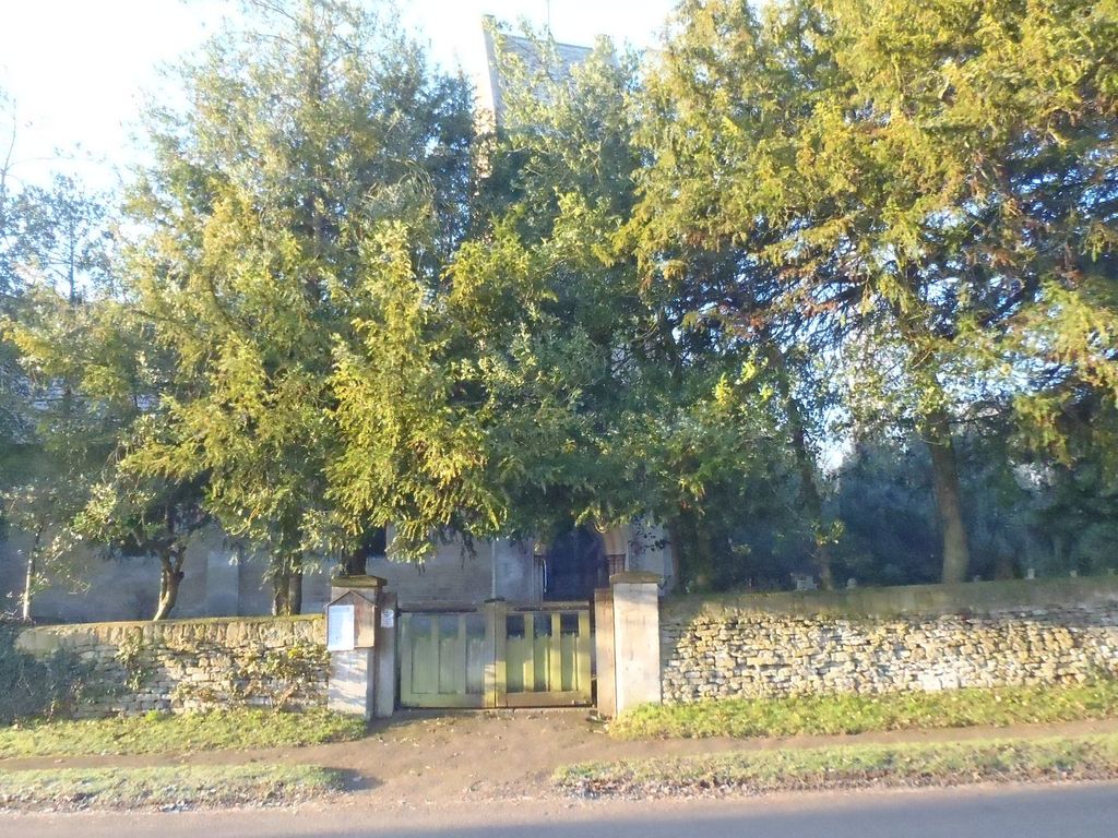
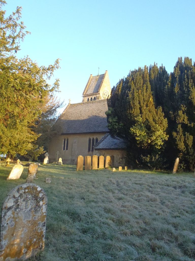
| Description | : | In 1845 the Baptists finally built a small chapel and in 1853 the Church of England completed the chapel of Saint John the Evangelist, designed by the Gothic Revival architect G.E. Street in an early 14th century style.It has a tower with a gabled roof and a chime of eight bells. St. John's was a chapel of ease of the parish of Great Tew until 1857, when Little Tew was made a separate ecclesiastical parish. Today St. John's is once again part of a single benefice with the parish of Great Tew. Text Added By Wertypop |
frequently asked questions (FAQ):
-
Where is St Johns Churchyard?
St Johns Churchyard is located at Water Lane Little Tew, West Oxfordshire District ,Oxfordshire , OX7 4JBEngland.
-
St Johns Churchyard cemetery's updated grave count on graveviews.com?
0 memorials
-
Where are the coordinates of the St Johns Churchyard?
Latitude: 51.9540390
Longitude: -1.4419230
Nearby Cemetories:
1. St Michael and All Angels Churchyard
Great Tew, West Oxfordshire District, England
Coordinate: 51.9569280, -1.4205150
2. St Mary Churchyard
Swerford, West Oxfordshire District, England
Coordinate: 51.9773470, -1.4593150
3. Old St. Nicholas Churchyard
Heythrop, West Oxfordshire District, England
Coordinate: 51.9468000, -1.4889600
4. St Kenelm's Churchyard Extension
Enstone, West Oxfordshire District, England
Coordinate: 51.9240960, -1.4484250
5. St. Kenelms Churchyard
Enstone, West Oxfordshire District, England
Coordinate: 51.9232490, -1.4494010
6. St Martins Churchyard
Sandford St Martin, West Oxfordshire District, England
Coordinate: 51.9371500, -1.3901400
7. St James Churchyard
Nether Worton, West Oxfordshire District, England
Coordinate: 51.9678100, -1.3807900
8. Holy Trinity Churchyard
Over Worton, West Oxfordshire District, England
Coordinate: 51.9598240, -1.3753620
9. Saint Giles
Wigginton, Cherwell District, England
Coordinate: 51.9966400, -1.4324000
10. South Newington St Peter ad Vincula
South Newington, Cherwell District, England
Coordinate: 51.9970000, -1.4082300
11. Hook Norton Cemetery
Hook Norton, Cherwell District, England
Coordinate: 51.9969440, -1.4787690
12. St Peters Churchyard
Hook Norton, Cherwell District, England
Coordinate: 51.9954200, -1.4842490
13. St. Edward the Confessor Churchyard
Westcot Barton, West Oxfordshire District, England
Coordinate: 51.9280100, -1.3747200
14. Hook Norton Baptist Burial Ground
Hook Norton, Cherwell District, England
Coordinate: 51.9953000, -1.4860900
15. St Nicholas Churchyard
Kiddington, West Oxfordshire District, England
Coordinate: 51.9032900, -1.4031790
16. Barford St. Michael Churchyard
Barford St Michael, Cherwell District, England
Coordinate: 51.9903200, -1.3711500
17. Great Rollright St Andrews Churchyard
Rollright, West Oxfordshire District, England
Coordinate: 51.9809290, -1.5255550
18. Saint Laurence Churchyard
Milcombe, Cherwell District, England
Coordinate: 52.0083060, -1.4033990
19. Holy Trinity Catholic Churchyard
Chipping Norton, West Oxfordshire District, England
Coordinate: 51.9439300, -1.5388200
20. St John's Churchyard
Barford St John, Cherwell District, England
Coordinate: 51.9955050, -1.3620350
21. St Mary Magdelene Churchyard
Duns Tew, Cherwell District, England
Coordinate: 51.9528350, -1.3363090
22. Steeple Barton Churchyard
Steeple Barton, West Oxfordshire District, England
Coordinate: 51.9207670, -1.3498060
23. St. Mary the Virgin Churchyard
Chipping Norton, West Oxfordshire District, England
Coordinate: 51.9434900, -1.5476200
24. Friends Burial Ground
Chipping Norton, West Oxfordshire District, England
Coordinate: 51.9415950, -1.5498310