
| Memorials | : | 1 |
| Location | : | Barford St John, Cherwell District, England |
| Coordinate | : | 51.9955050, -1.3620350 |
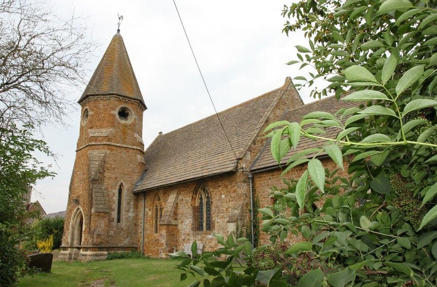
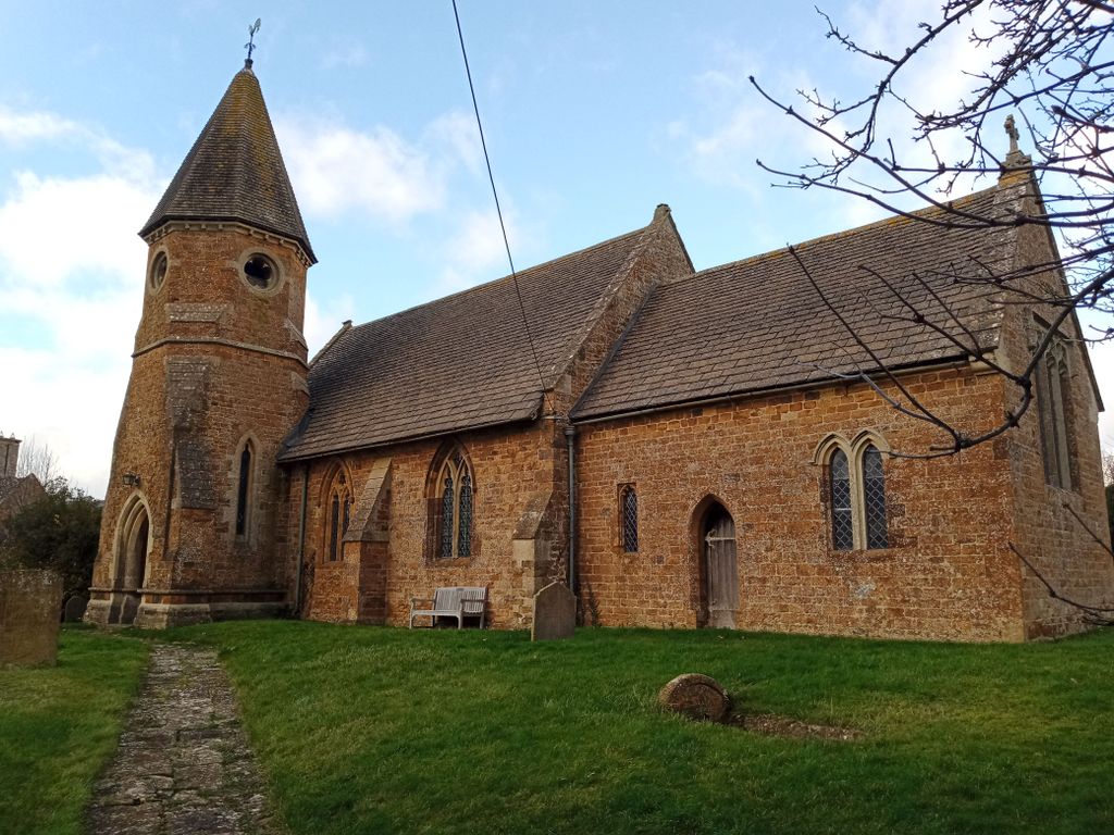
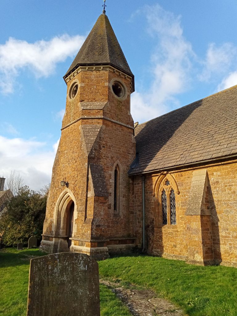
| Description | : | Barford St. John is a small village on the north bank of the River Swere in Oxfordshire, England, about 5 miles south of Banbury. It is part of the civil parish of Barford St. John and St. Michael. St. John's Chapel of the Church of England was built about 1150. In the 13th century, the chancel was restored and in the 14th century, the windows in the nave were added in the decorated style. The church was restored by the architect G E Street in the early 1860's. |
frequently asked questions (FAQ):
-
Where is St John's Churchyard?
St John's Churchyard is located at Church Lane Barford St John, Cherwell District ,Oxfordshire , OX15 0PREngland.
-
St John's Churchyard cemetery's updated grave count on graveviews.com?
1 memorials
-
Where are the coordinates of the St John's Churchyard?
Latitude: 51.9955050
Longitude: -1.3620350
Nearby Cemetories:
1. Barford St. Michael Churchyard
Barford St Michael, Cherwell District, England
Coordinate: 51.9903200, -1.3711500
2. St John the Evangelist
Milton, Cherwell District, England
Coordinate: 52.0117900, -1.3452510
3. Deddington Cemetery
Deddington, Cherwell District, England
Coordinate: 51.9824490, -1.3338930
4. St Mary's Churchyard
Bloxham, Cherwell District, England
Coordinate: 52.0181100, -1.3748900
5. South Newington St Peter ad Vincula
South Newington, Cherwell District, England
Coordinate: 51.9970000, -1.4082300
6. Saint Laurence Churchyard
Milcombe, Cherwell District, England
Coordinate: 52.0083060, -1.4033990
7. Ss Peter and Paul Churchyard
Deddington, Cherwell District, England
Coordinate: 51.9817680, -1.3207470
8. Adderbury Parish Cemetery
Adderbury, Cherwell District, England
Coordinate: 52.0139537, -1.3246874
9. St James Churchyard
Nether Worton, West Oxfordshire District, England
Coordinate: 51.9678100, -1.3807900
10. St Mary the Virgin Churchyard
Adderbury, Cherwell District, England
Coordinate: 52.0148420, -1.3152270
11. Holy Trinity Churchyard
Over Worton, West Oxfordshire District, England
Coordinate: 51.9598240, -1.3753620
12. Saint Giles
Wigginton, Cherwell District, England
Coordinate: 51.9966400, -1.4324000
13. Saint John the Baptist Churchyard
Bodicote, Cherwell District, England
Coordinate: 52.0356100, -1.3305700
14. St Mary Magdelene Churchyard
Duns Tew, Cherwell District, England
Coordinate: 51.9528350, -1.3363090
15. Bodicote Cemetery
Bodicote, Cherwell District, England
Coordinate: 52.0391710, -1.3397380
16. St Mary the Virgin Churchyard
Broughton, Cherwell District, England
Coordinate: 52.0417020, -1.3912030
17. St Michael and All Angels Churchyard
Great Tew, West Oxfordshire District, England
Coordinate: 51.9569280, -1.4205150
18. St Marys Churchyard
North Aston, Cherwell District, England
Coordinate: 51.9562960, -1.3020350
19. Ss Peter and Paul Churchyard
Kings Sutton, South Northamptonshire Borough, England
Coordinate: 52.0212000, -1.2763560
20. St Nicholas Churchyard
Tadmarton, Cherwell District, England
Coordinate: 52.0377060, -1.4295690
21. Kings Sutton Cemetery
Kings Sutton, South Northamptonshire Borough, England
Coordinate: 52.0151400, -1.2711000
22. St Martins Churchyard
Sandford St Martin, West Oxfordshire District, England
Coordinate: 51.9371500, -1.3901400
23. St Mary Churchyard
Swerford, West Oxfordshire District, England
Coordinate: 51.9773470, -1.4593150
24. St Johns Churchyard
Little Tew, West Oxfordshire District, England
Coordinate: 51.9540390, -1.4419230