
| Memorials | : | 1 |
| Location | : | Nether Worton, West Oxfordshire District, England |
| Coordinate | : | 51.9678100, -1.3807900 |
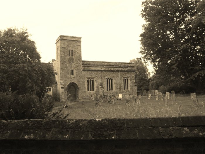
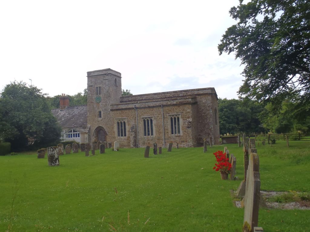
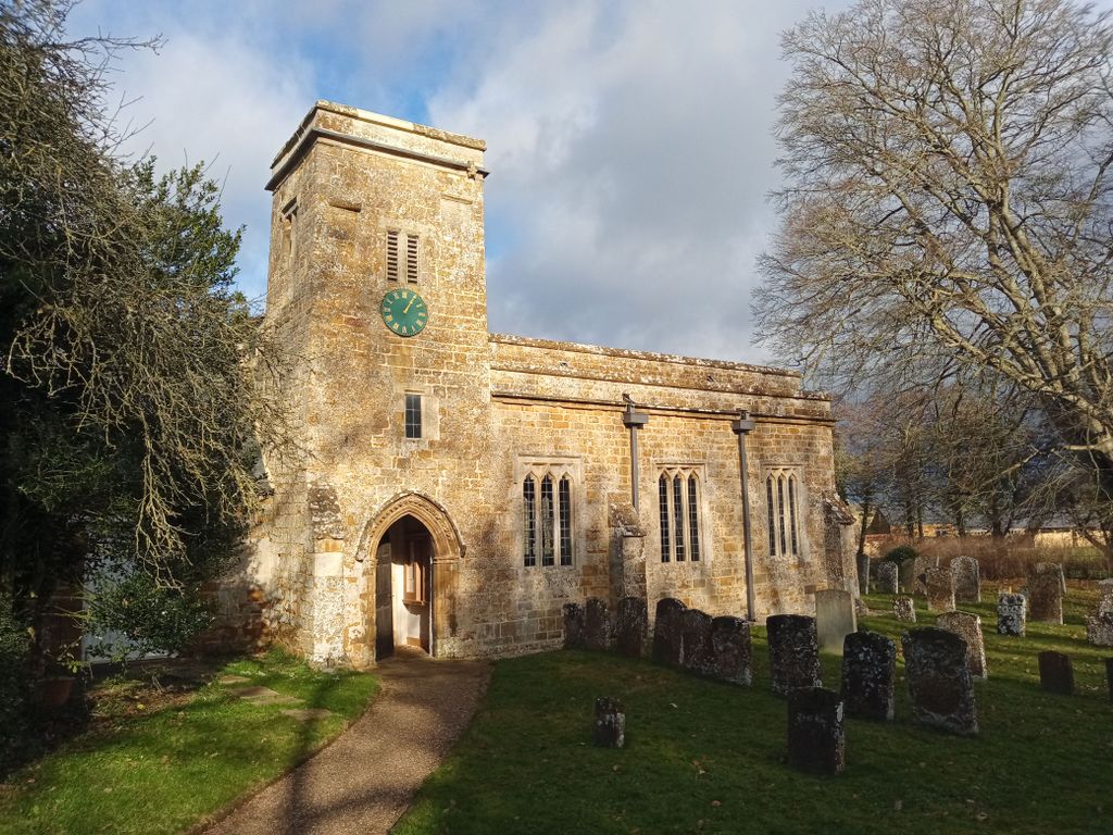
| Description | : | Nether Worton is an INCLUSIVE CHURCH which is united with Over Worton, and pastorally associated with Great Tew and Little Tew. Officially a chapel of ease, St James is a beautiful and lovingly cared for church in a small village tucked into a valley. The church is joined to the old schoolhouse, which in turn is joined to Church Cottage. There are memorials in the church to the Wilson (19th century)and Schuster (20th century) families. High on the tower is a stone bearing an inscription that seems to read "Robert E Parsons 1630". On the interior northwest wall is an... Read More |
frequently asked questions (FAQ):
-
Where is St James Churchyard?
St James Churchyard is located at Nether Worton, West Oxfordshire District ,Oxfordshire , OX7 7ASEngland.
-
St James Churchyard cemetery's updated grave count on graveviews.com?
1 memorials
-
Where are the coordinates of the St James Churchyard?
Latitude: 51.9678100
Longitude: -1.3807900
Nearby Cemetories:
1. Holy Trinity Churchyard
Over Worton, West Oxfordshire District, England
Coordinate: 51.9598240, -1.3753620
2. Barford St. Michael Churchyard
Barford St Michael, Cherwell District, England
Coordinate: 51.9903200, -1.3711500
3. St Michael and All Angels Churchyard
Great Tew, West Oxfordshire District, England
Coordinate: 51.9569280, -1.4205150
4. St John's Churchyard
Barford St John, Cherwell District, England
Coordinate: 51.9955050, -1.3620350
5. St Martins Churchyard
Sandford St Martin, West Oxfordshire District, England
Coordinate: 51.9371500, -1.3901400
6. St Mary Magdelene Churchyard
Duns Tew, Cherwell District, England
Coordinate: 51.9528350, -1.3363090
7. Deddington Cemetery
Deddington, Cherwell District, England
Coordinate: 51.9824490, -1.3338930
8. South Newington St Peter ad Vincula
South Newington, Cherwell District, England
Coordinate: 51.9970000, -1.4082300
9. Ss Peter and Paul Churchyard
Deddington, Cherwell District, England
Coordinate: 51.9817680, -1.3207470
10. St. Edward the Confessor Churchyard
Westcot Barton, West Oxfordshire District, England
Coordinate: 51.9280100, -1.3747200
11. St Johns Churchyard
Little Tew, West Oxfordshire District, England
Coordinate: 51.9540390, -1.4419230
12. Saint Laurence Churchyard
Milcombe, Cherwell District, England
Coordinate: 52.0083060, -1.4033990
13. Saint Giles
Wigginton, Cherwell District, England
Coordinate: 51.9966400, -1.4324000
14. St John the Evangelist
Milton, Cherwell District, England
Coordinate: 52.0117900, -1.3452510
15. St Mary Churchyard
Swerford, West Oxfordshire District, England
Coordinate: 51.9773470, -1.4593150
16. St Marys Churchyard
North Aston, Cherwell District, England
Coordinate: 51.9562960, -1.3020350
17. St Mary's Churchyard
Bloxham, Cherwell District, England
Coordinate: 52.0181100, -1.3748900
18. Steeple Barton Churchyard
Steeple Barton, West Oxfordshire District, England
Coordinate: 51.9207670, -1.3498060
19. SS Peter and Paul Churchyard
Steeple Aston, Cherwell District, England
Coordinate: 51.9311350, -1.3091000
20. Adderbury Parish Cemetery
Adderbury, Cherwell District, England
Coordinate: 52.0139537, -1.3246874
21. St Kenelm's Churchyard Extension
Enstone, West Oxfordshire District, England
Coordinate: 51.9240960, -1.4484250
22. St. Kenelms Churchyard
Enstone, West Oxfordshire District, England
Coordinate: 51.9232490, -1.4494010
23. St Mary the Virgin Churchyard
Adderbury, Cherwell District, England
Coordinate: 52.0148420, -1.3152270
24. St James Churchyard
Somerton, Cherwell District, England
Coordinate: 51.9539990, -1.2786200