
| Memorials | : | 0 |
| Location | : | Hawkhurst, Tunbridge Wells Borough, England |
| Coordinate | : | 51.0377240, 0.5031610 |
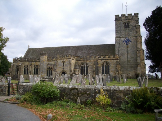
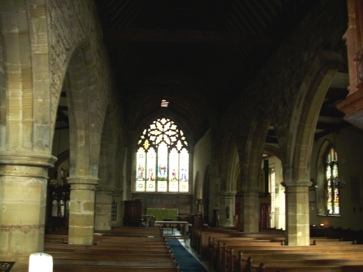
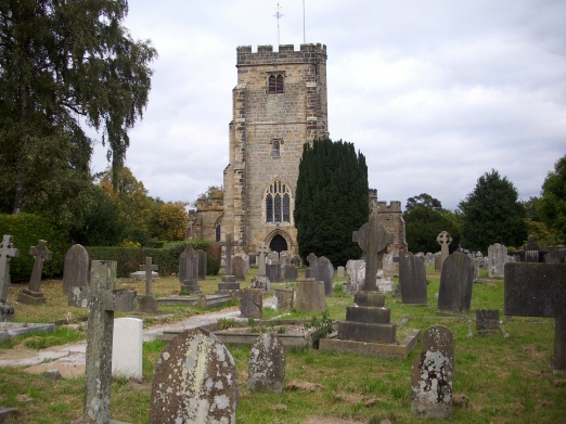
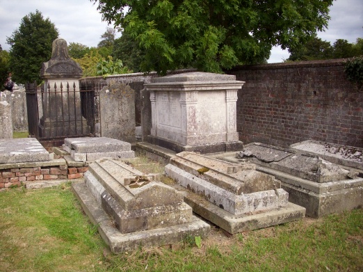
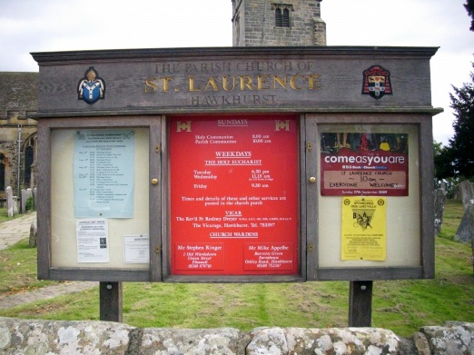
| Description | : | The parish church of St Laurence stands at the south end of the village known as The Moor, which is the older part of Hawkhurst, Kent. It is likely that a church has stood on this site since 1100, or even earlier. The first mention of the church is in the charter of 1285, and its first rector was Richard de Clyne in 1291. The present church dates from the 14th and mid-15th centuries. It was restored twice in the 19th century and again in the 20th century. In 1944, a German flying bomb landed in the churchyard, causing considerable... Read More |
frequently asked questions (FAQ):
-
Where is St. Laurence Churchyard?
St. Laurence Churchyard is located at Hawkhurst, Tunbridge Wells Borough ,Kent ,England.
-
St. Laurence Churchyard cemetery's updated grave count on graveviews.com?
0 memorials
-
Where are the coordinates of the St. Laurence Churchyard?
Latitude: 51.0377240
Longitude: 0.5031610
Nearby Cemetories:
1. Hawkhurst Cemetery
Hawkhurst, Tunbridge Wells Borough, England
Coordinate: 51.0302300, 0.5051300
2. Holy Trinity Churchyard
Hurst Green, Rother District, England
Coordinate: 51.0201400, 0.4691080
3. Saint Augustine's Churchyard
Flimwell, Rother District, England
Coordinate: 51.0514170, 0.4580350
4. Saint Giles' Churchyard
Bodiam, Rother District, England
Coordinate: 51.0074800, 0.5393000
5. St Mary the Virgin Churchyard
Salehurst, Rother District, England
Coordinate: 50.9910170, 0.4911260
6. Assumption of Blessed Mary & St. Nicholas Church
Etchingham, Rother District, England
Coordinate: 51.0095830, 0.4416420
7. St. George Parish Churchyard
Benenden, Tunbridge Wells Borough, England
Coordinate: 51.0648720, 0.5794570
8. Ewhurst Green Churchyard
Ewhurst, Rother District, England
Coordinate: 50.9924300, 0.5572900
9. St. Mary's Churchyard
Ticehurst, Rother District, England
Coordinate: 51.0454030, 0.4077110
10. St David's Bridge Strict Baptist Chapel
Cranbrook, Tunbridge Wells Borough, England
Coordinate: 51.0953430, 0.5378980
11. St Dunstan's Churchyard
Cranbrook, Tunbridge Wells Borough, England
Coordinate: 51.0973030, 0.5363690
12. Darvell Bruderhof Cemetery
Robertsbridge, Rother District, England
Coordinate: 50.9790497, 0.4561470
13. Cranbrook Cemetery
Cranbrook, Tunbridge Wells Borough, England
Coordinate: 51.0962250, 0.5541360
14. Christ Church Churchyard
Kilndown, Tunbridge Wells Borough, England
Coordinate: 51.0907820, 0.4269340
15. St Peter's Church
Newenden, Ashford Borough, England
Coordinate: 51.0157750, 0.6137190
16. Northiam Cemetery
Northiam, Rother District, England
Coordinate: 50.9926872, 0.5984631
17. St Mary's Churchyard
Northiam, Rother District, England
Coordinate: 50.9911250, 0.6061390
18. Goudhurst Cemetery
Goudhurst, Tunbridge Wells Borough, England
Coordinate: 51.1134210, 0.4624930
19. Goudhurst War Memorial
Goudhurst, Tunbridge Wells Borough, England
Coordinate: 51.1129960, 0.4586850
20. St. Mary the Virgin Churchyard
Goudhurst, Tunbridge Wells Borough, England
Coordinate: 51.1136160, 0.4609480
21. Sissinghurst Cemetery
Sissinghurst, Tunbridge Wells Borough, England
Coordinate: 51.1095310, 0.5629240
22. St. Peter's Churchyard
Stonegate, Rother District, England
Coordinate: 51.0303090, 0.3747690
23. St. Mary the Virgin Churchyard
Rolvenden, Ashford Borough, England
Coordinate: 51.0506590, 0.6310280
24. St. Bartholomew's Churchyard
Burwash, Rother District, England
Coordinate: 50.9976470, 0.3887490