
| Memorials | : | 0 |
| Location | : | Papworth St Agnes, South Cambridgeshire District, England |
| Coordinate | : | 52.2641300, -0.1414700 |
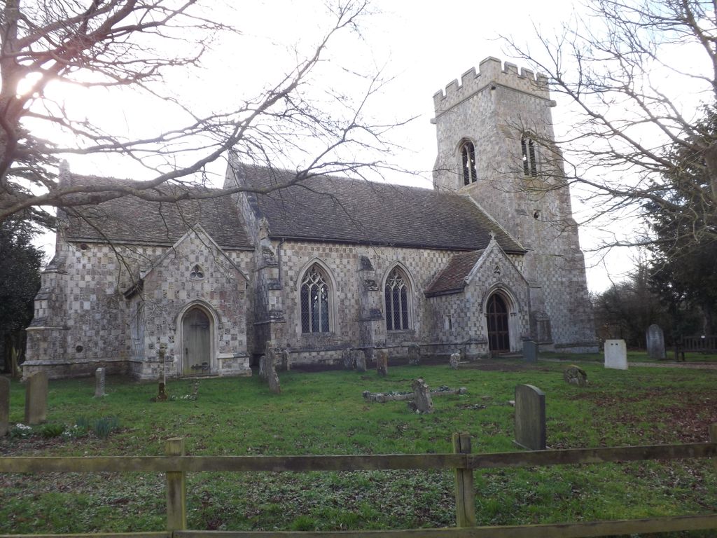
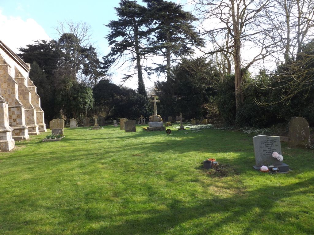
| Description | : | St John the Baptist Church, which was rebuilt in 1530 under the will of Anthony Mallory, and was again rebuilt in 1848, and 1854. In 1976 the Church commissioners declared the Church to be redundant, and in 1979 proposed to demolish the building. The villagers petitioned against this and proposed to take the upkeep of the building over. With the help of the Friends of Friendless Churches, and a great deal of fund raising the building has been restored and is used for a variety of village activities. |
frequently asked questions (FAQ):
-
Where is St John the Baptist Churchyard?
St John the Baptist Churchyard is located at Papworth St Agnes, South Cambridgeshire District ,Cambridgeshire ,England.
-
St John the Baptist Churchyard cemetery's updated grave count on graveviews.com?
0 memorials
-
Where are the coordinates of the St John the Baptist Churchyard?
Latitude: 52.2641300
Longitude: -0.1414700
Nearby Cemetories:
1. St Botolph Churchyard
Graveley, South Cambridgeshire District, England
Coordinate: 52.2605200, -0.1701700
2. St Pandionia and St John the Baptist Churchyard
Eltisley, South Cambridgeshire District, England
Coordinate: 52.2205960, -0.1445670
3. Elsworth Particular Baptist Chapelyard
Elsworth, South Cambridgeshire District, England
Coordinate: 52.2559800, -0.0686500
4. GODMANCHESTER LAWN CEMETERY
Godmanchester, Huntingdonshire District, England
Coordinate: 52.3091902, -0.1655030
5. St Mary Churchyard
Conington, South Cambridgeshire District, England
Coordinate: 52.2768320, -0.0665850
6. St. James Churchyard
Croxton, South Cambridgeshire District, England
Coordinate: 52.2174280, -0.1688510
7. St Peter's Churchyard
Offord d'Arcy, Huntingdonshire District, England
Coordinate: 52.2824000, -0.2178000
8. All Saints Churchyard
Offord Cluny, Huntingdonshire District, England
Coordinate: 52.2878400, -0.2144120
9. Holy Trinity Churchyard
Great Paxton, Huntingdonshire District, England
Coordinate: 52.2620300, -0.2291600
10. Hemingford Grey Cemetery
Hemingford Grey, Huntingdonshire District, England
Coordinate: 52.3162700, -0.1008800
11. St. Peter and St. Paul Churchyard
Fenstanton, Huntingdonshire District, England
Coordinate: 52.3009610, -0.0653900
12. St. Mary the Virgin Churchyard
Godmanchester, Huntingdonshire District, England
Coordinate: 52.3202190, -0.1744400
13. Fenstanton Cemetery
Fenstanton, Huntingdonshire District, England
Coordinate: 52.3013000, -0.0650700
14. Saint James Churchyard
Hemingford Grey, Huntingdonshire District, England
Coordinate: 52.3206701, -0.1051653
15. Church of All Saints
Knapwell, South Cambridgeshire District, England
Coordinate: 52.2491000, -0.0447000
16. St Margaret of Antioch Churchyard
Hemingford Abbots, Huntingdonshire District, England
Coordinate: 52.3237400, -0.1192820
17. Godmanchester War Memorial
Godmanchester, Huntingdonshire District, England
Coordinate: 52.3225780, -0.1759580
18. Cambourne Burial Ground
Cambourne, South Cambridgeshire District, England
Coordinate: 52.2179190, -0.0682910
19. Caxton Baptist Chapel
Caxton, South Cambridgeshire District, England
Coordinate: 52.2064820, -0.0926220
20. Church of St Andrew
Caxton, South Cambridgeshire District, England
Coordinate: 52.2031956, -0.0986441
21. St Marys Churchyard
Huntingdon, Huntingdonshire District, England
Coordinate: 52.3289548, -0.1799861
22. St Mary The Virgin
Houghton, Huntingdonshire District, England
Coordinate: 52.3320200, -0.1213200
23. Houghton Chapel
Houghton, Huntingdonshire District, England
Coordinate: 52.3322400, -0.1219200
24. St Margaret and All Saints Churchyard
Wyton, Huntingdonshire District, England
Coordinate: 52.3335810, -0.1257620