
| Memorials | : | 0 |
| Location | : | Luton, Luton Borough, England |
| Coordinate | : | 51.8788681, -0.4100020 |
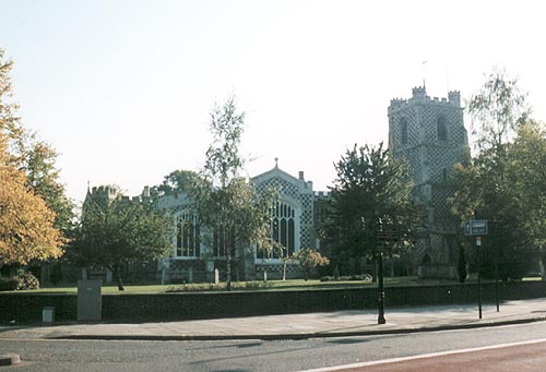
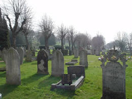
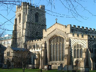
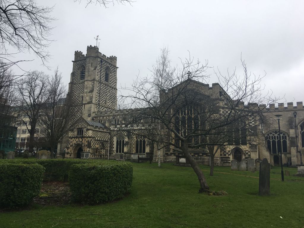
| Description | : | The church and surround graves is right in the centre of Luton, Bedfordshire. From the M1 motorway, junction 10, follow the signs to Luton Town Centre. Saint Mary Church is the oldest building in the town, dating back to 1137, and right in the centre, opposite the modern Arndale Shopping Centre and next door neighbours with Luton University. This graveyard surrounding the church is fairly ancient. The churchyard closed for burials in 1853, at which time a cemetery was opened a short distance away in Crawley Green Road, Luton. The churchyard is well maintained by the local council, and largely... Read More |
frequently asked questions (FAQ):
-
Where is St. Mary's Churchyard?
St. Mary's Churchyard is located at Church Street Luton, Luton Borough ,Bedfordshire , LU1 3JFEngland.
-
St. Mary's Churchyard cemetery's updated grave count on graveviews.com?
0 memorials
-
Where are the coordinates of the St. Mary's Churchyard?
Latitude: 51.8788681
Longitude: -0.4100020
Nearby Cemetories:
1. Church Burial Ground
Luton, Luton Borough, England
Coordinate: 51.8794640, -0.4027310
2. Quaker Burial Ground
Luton, Luton Borough, England
Coordinate: 51.8791910, -0.4023320
3. Friend's Burial Ground
Luton, Luton Borough, England
Coordinate: 51.8738060, -0.4170870
4. Luton General Cemetery
Luton, Luton Borough, England
Coordinate: 51.8773780, -0.4242060
5. Luton Vauxhall Motors War Memorial
Luton, Luton Borough, England
Coordinate: 51.8745100, -0.3967500
6. St Andrew Woodside Churchyard
Slip End, Central Bedfordshire Unitary Authority, England
Coordinate: 51.8577160, -0.4306600
7. Holy Trinity Churchyard
Biscot, Luton Borough, England
Coordinate: 51.9028700, -0.4375560
8. Vale Cemetery and Crematorium
Luton, Luton Borough, England
Coordinate: 51.9070900, -0.3924930
9. All Saints Churchyard
Caddington, Central Bedfordshire Unitary Authority, England
Coordinate: 51.8670460, -0.4561910
10. Aley Green Cemetery
Slip End, Central Bedfordshire Unitary Authority, England
Coordinate: 51.8522500, -0.4496420
11. Holy Trinity Churchyard
East Hyde, Central Bedfordshire Unitary Authority, England
Coordinate: 51.8433710, -0.3640760
12. Breachwood Green Baptist Church
Kings Walden, North Hertfordshire District, England
Coordinate: 51.8843200, -0.3293700
13. St. John the Baptist Churchyard
Markyate, Dacorum Borough, England
Coordinate: 51.8391900, -0.4658200
14. National Children's Home Cemetery
Harpenden, St Albans District, England
Coordinate: 51.8305000, -0.3563000
15. St. Leonard's Churchyard
Flamstead, Dacorum Borough, England
Coordinate: 51.8199400, -0.4326800
16. St Mary the Virgin, Kensworth
Kensworth, Central Bedfordshire Unitary Authority, England
Coordinate: 51.8602233, -0.5037911
17. Westfield Road Cemetery
Harpenden, St Albans District, England
Coordinate: 51.8270720, -0.3540300
18. St. Giles in the Woods Priory
Flamstead, Dacorum Borough, England
Coordinate: 51.8187400, -0.4374400
19. St. Mary the Virgin Churchyard
Sundon, Central Bedfordshire Unitary Authority, England
Coordinate: 51.9301970, -0.4769740
20. Dunstable Priory
Dunstable, Central Bedfordshire Unitary Authority, England
Coordinate: 51.8859940, -0.5177920
21. St Mary Magdalene Churchyard
Offley, North Hertfordshire District, England
Coordinate: 51.9277300, -0.3357400
22. St Nicholas Churchyard
Harpenden, St Albans District, England
Coordinate: 51.8169470, -0.3583300
23. Houghton Regis Cemetery
Houghton Regis, Central Bedfordshire Unitary Authority, England
Coordinate: 51.9019710, -0.5229130
24. All Saints Churchyard
Houghton Regis, Central Bedfordshire Unitary Authority, England
Coordinate: 51.9048640, -0.5212930