
| Memorials | : | 165 |
| Location | : | Orlestone, Ashford Borough, England |
| Coordinate | : | 51.0767000, 0.8539000 |
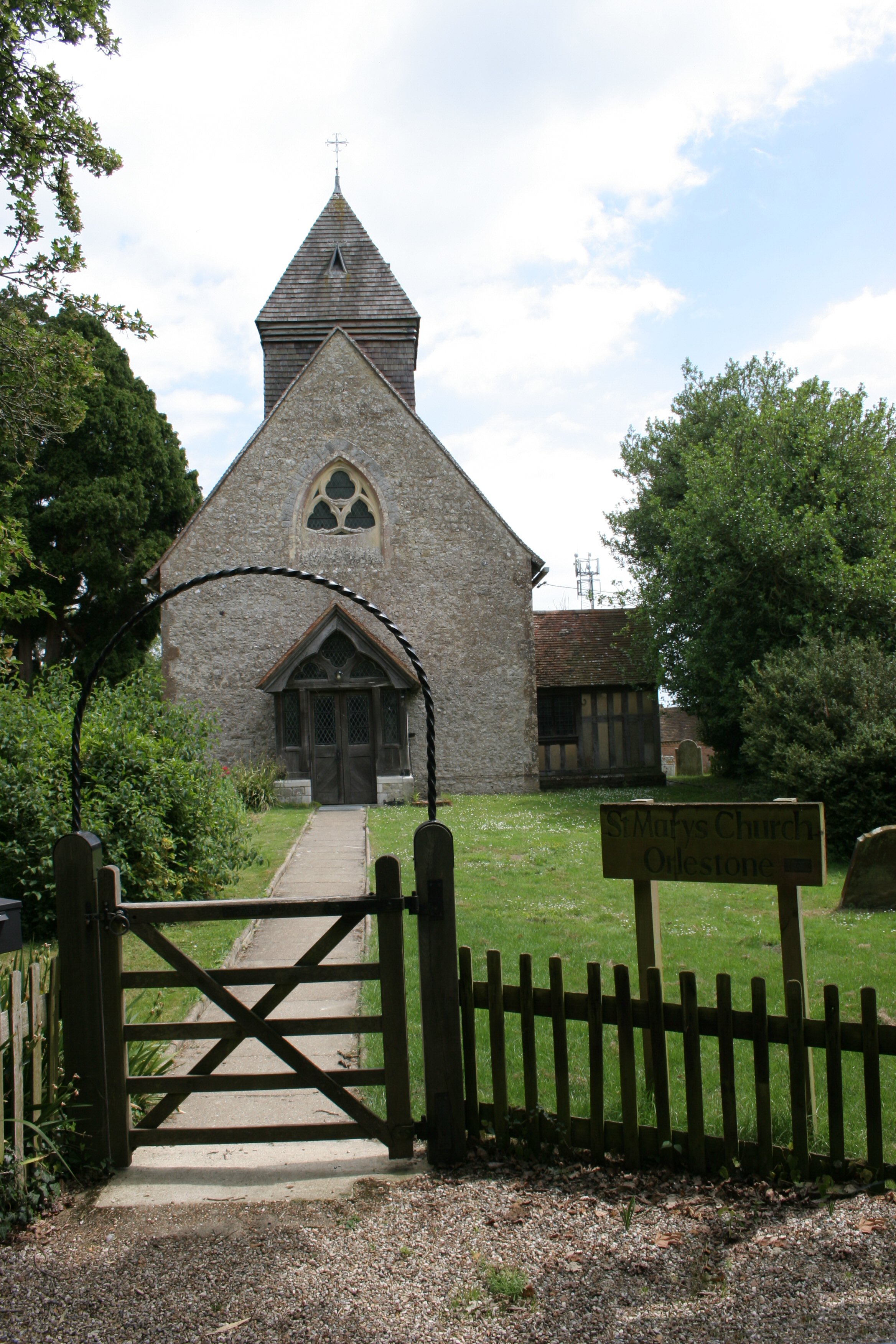
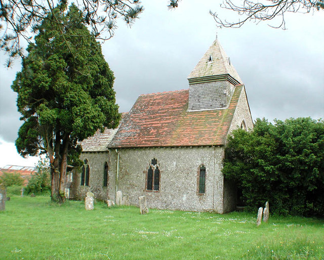
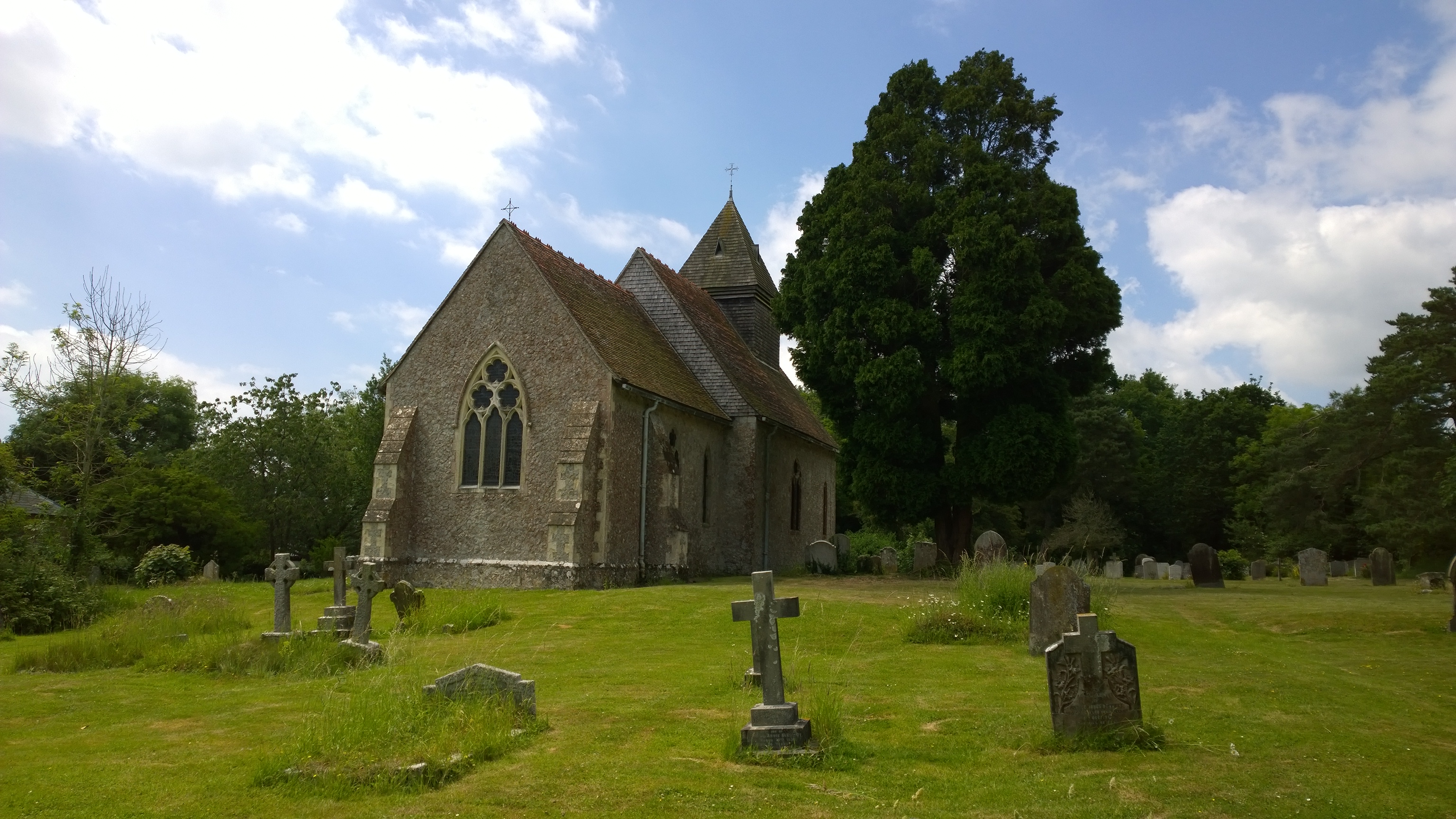
| Description | : | Located in the small hamlet of Orlestone, parts of the medieval parish church of St Mary the Virgin date back to the 11th century Edward Hasted, 'Parishes: Orlestone', in The History and Topographical Survey of the County of Kent: Volume 8 (Canterbury, 1799), pp. 360-365 described this church: "The church, which is dedicated to St. Mary, stands on the upper side of the hill, one field distant from the road, which may be said to be almost disused. The church-yard adjoins to the farm-yard and the courtlodge. It is a very small building, consisting of one isle and one chancel, having a... Read More |
frequently asked questions (FAQ):
-
Where is St Mary the Virgin Churchyard?
St Mary the Virgin Churchyard is located at Church Lane off Hamstreet Road Orlestone, Ashford Borough ,Kent , TN26 2EUEngland.
-
St Mary the Virgin Churchyard cemetery's updated grave count on graveviews.com?
1 memorials
-
Where are the coordinates of the St Mary the Virgin Churchyard?
Latitude: 51.0767000
Longitude: 0.8539000
Nearby Cemetories:
1. St. Matthew Churchyard
Warehorne, Ashford Borough, England
Coordinate: 51.0575460, 0.8375700
2. St. Mary Magdalene Churchyard
Ruckinge, Ashford Borough, England
Coordinate: 51.0654060, 0.8883300
3. St Mary's Churchyard
Kenardington, Ashford Borough, England
Coordinate: 51.0546000, 0.8164000
4. Ss Peter & Paul Churchyard
Shadoxhurst, Ashford Borough, England
Coordinate: 51.1044850, 0.8144740
5. St. Peter and St. Paul's Churchyard
Bilsington, Ashford Borough, England
Coordinate: 51.0713940, 0.9136430
6. St Augustine Church
Snave, Ashford Borough, England
Coordinate: 51.0334570, 0.8710390
7. St. Rumwold Churchyard
Bonnington, Ashford Borough, England
Coordinate: 51.0722680, 0.9350370
8. All Saints Churchyard
Woodchurch, Ashford Borough, England
Coordinate: 51.0807110, 0.7709980
9. St. Dunstan Churchyard
Snargate, Shepway District, England
Coordinate: 51.0227100, 0.8371750
10. Church of St. Peter & St. Paul
Newchurch, Shepway District, England
Coordinate: 51.0438640, 0.9272210
11. St Peter and St Paul Churchyard
Appledore, Ashford Borough, England
Coordinate: 51.0295660, 0.7903990
12. St Enswith's Church
Brenzett, Shepway District, England
Coordinate: 51.0138510, 0.8573170
13. St. John The Baptist Churchyard
Mersham, Ashford Borough, England
Coordinate: 51.1168720, 0.9312840
14. Brenzett Cemetery
Brenzett, Shepway District, England
Coordinate: 51.0130800, 0.8561300
15. St. Mary's Churchyard
Sevington, Ashford Borough, England
Coordinate: 51.1309040, 0.9100730
16. St. Mary the Virgin Churchyard
Willesborough, Ashford Borough, England
Coordinate: 51.1370700, 0.8992180
17. St. Mary the Virgin Churchyard
Great Chart, Ashford Borough, England
Coordinate: 51.1422350, 0.8285800
18. St George's Church
Ivychurch, Shepway District, England
Coordinate: 51.0124590, 0.8895980
19. Saint Martin's Churchyard
Aldington, Ashford Borough, England
Coordinate: 51.0874330, 0.9615520
20. Willesborough Cemetery
Willesborough, Ashford Borough, England
Coordinate: 51.1396490, 0.8984650
21. Ashford War Memorial
Ashford, Ashford Borough, England
Coordinate: 51.1469400, 0.8732390
22. St Mary the Virgin Church
Ashford, Ashford Borough, England
Coordinate: 51.1488270, 0.8728790
23. Ashford Cemetery
Ashford, Ashford Borough, England
Coordinate: 51.1534550, 0.8756450
24. St. Mary the Virgin Churchyard
Smeeth, Ashford Borough, England
Coordinate: 51.1183000, 0.9594580