
| Memorials | : | 0 |
| Location | : | Brenzett, Shepway District, England |
| Coordinate | : | 51.0130800, 0.8561300 |
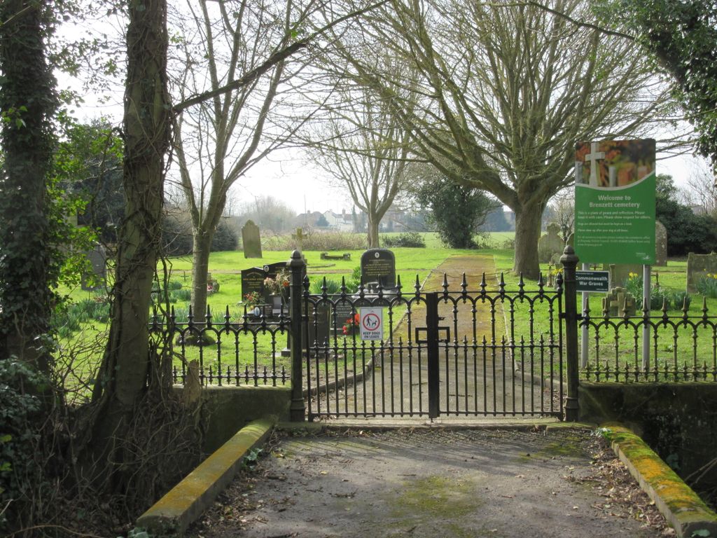
| Description | : | This is a small cemetery run by Shepway District Council near St Eanswith's Church, Brenzett. Ironically it is in Church Lane, which cannot be said for the church itself! The cemetery has beautiful views across the marshes. |
frequently asked questions (FAQ):
-
Where is Brenzett Cemetery?
Brenzett Cemetery is located at Brenzett, Shepway District ,Kent ,England.
-
Brenzett Cemetery cemetery's updated grave count on graveviews.com?
0 memorials
-
Where are the coordinates of the Brenzett Cemetery?
Latitude: 51.0130800
Longitude: 0.8561300
Nearby Cemetories:
1. St Enswith's Church
Brenzett, Shepway District, England
Coordinate: 51.0138510, 0.8573170
2. St. Dunstan Churchyard
Snargate, Shepway District, England
Coordinate: 51.0227100, 0.8371750
3. St George's Church
Ivychurch, Shepway District, England
Coordinate: 51.0124590, 0.8895980
4. St Augustine Church
Brookland, Shepway District, England
Coordinate: 50.9973880, 0.8337460
5. St Augustine Church
Snave, Ashford Borough, England
Coordinate: 51.0334570, 0.8710390
6. St Clement Churchyard
Old Romney, Shepway District, England
Coordinate: 50.9901390, 0.8981780
7. St. Thomas à Becket Cemetery
Fairfield, Shepway District, England
Coordinate: 51.0043210, 0.7993930
8. St Peter and St Paul Churchyard
Appledore, Ashford Borough, England
Coordinate: 51.0295660, 0.7903990
9. St. Matthew Churchyard
Warehorne, Ashford Borough, England
Coordinate: 51.0575460, 0.8375700
10. St Mary's Churchyard
Kenardington, Ashford Borough, England
Coordinate: 51.0546000, 0.8164000
11. St Mary the Virgin Churchyard
St Mary in the Marsh, Shepway District, England
Coordinate: 51.0141390, 0.9423380
12. Church of St. Peter & St. Paul
Newchurch, Shepway District, England
Coordinate: 51.0438640, 0.9272210
13. St. Mary Magdalene Churchyard
Ruckinge, Ashford Borough, England
Coordinate: 51.0654060, 0.8883300
14. St Mary the Virgin Churchyard
Stone-cum-Ebony, Ashford Borough, England
Coordinate: 51.0127980, 0.7645592
15. New Romney Cemetery
New Romney, Shepway District, England
Coordinate: 50.9843600, 0.9388800
16. Burma Campaign Memorial
New Romney, Shepway District, England
Coordinate: 50.9851600, 0.9404470
17. St Nicholas Churchyard
New Romney, Shepway District, England
Coordinate: 50.9850930, 0.9411740
18. St Mary the Virgin Churchyard
Orlestone, Ashford Borough, England
Coordinate: 51.0767000, 0.8539000
19. St. Peter and St. Paul's Churchyard
Bilsington, Ashford Borough, England
Coordinate: 51.0713940, 0.9136430
20. All Saints Churchyard
Lydd, Shepway District, England
Coordinate: 50.9518160, 0.9068730
21. Lydd Cemetery
Lydd, Shepway District, England
Coordinate: 50.9531810, 0.9127050
22. Ebony Old Cemetery
Stone-cum-Ebony, Ashford Borough, England
Coordinate: 51.0378926, 0.7422129
23. St. Rumwold Churchyard
Bonnington, Ashford Borough, England
Coordinate: 51.0722680, 0.9350370
24. St. Mary the Virgin Churchyard
Reading Street, Ashford Borough, England
Coordinate: 51.0431442, 0.7400970