
| Memorials | : | 0 |
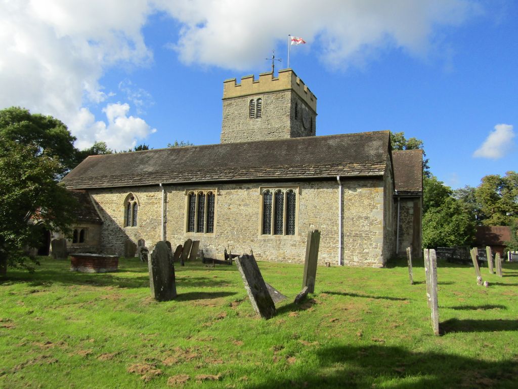
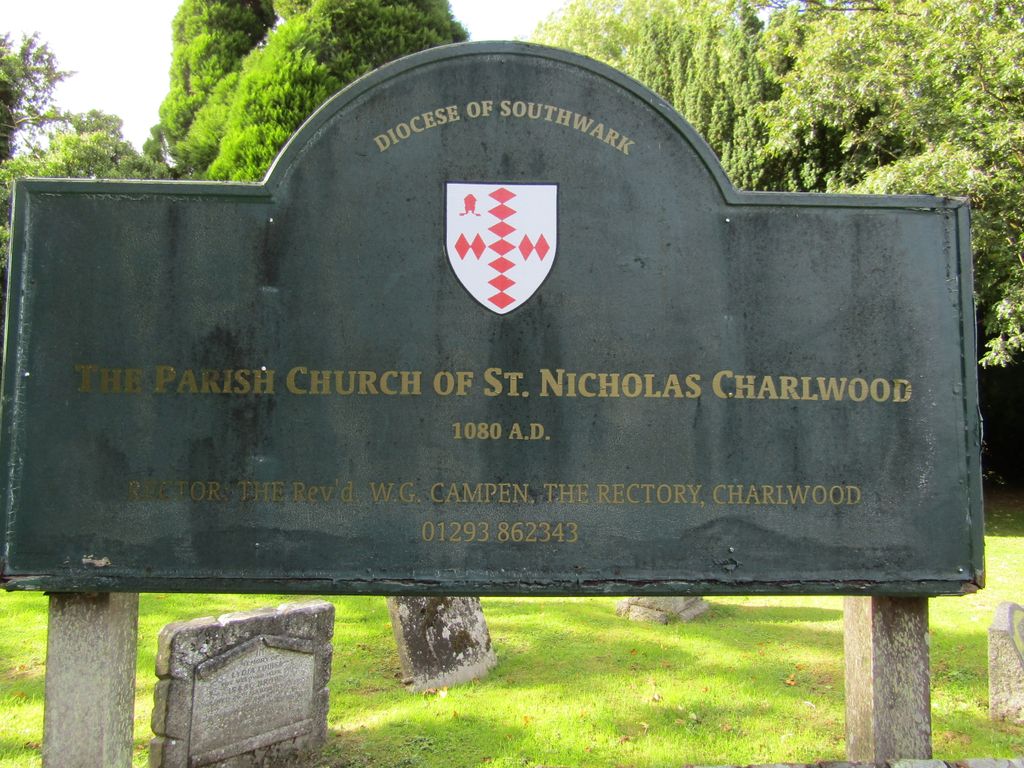
| Location | : | Charlwood, Mole Valley District, England |
frequently asked questions (FAQ):
-
Where is St. Nicholas?
St. Nicholas is located at Charlwood, Mole Valley District, England.
-
St. Nicholas cemetery's updated grave count on graveviews.com?
0 memorials
Nearby Cemetories:
1. St James Churchyard
Abinger, Mole Valley District, England
Coordinate: 51.2798220, -0.3739870
2. Christ Church Churchyard
Coldharbour, Mole Valley District, England
Coordinate: 51.2826900, -0.3864790
3. Randalls Park Cemetery and Crematorium
Leatherhead, Mole Valley District, England
Coordinate: 51.1904660, -0.3243540
4. St Andrew's Church
Leatherhead, Mole Valley District, England
Coordinate: 51.2307590, -0.3206630
5. St Mary and St Nicholas Churchyard
Leatherhead, Mole Valley District, England
Coordinate: 51.2365646, -0.3189580
6. Ockley Cemetery
Ockley, Mole Valley District, England
Coordinate: 51.2326360, -0.3320140
7. St Margaret Churchyard
Ockley, Mole Valley District, England
Coordinate: 51.2236075, -0.3694870
8. Capel Friends Burial Ground #2
Capel, Mole Valley District, England
Coordinate: 51.2085790, -0.2483520
9. Pleystowe in Capel Friends Grounds
Capel, Mole Valley District, England
Coordinate: 51.2198770, -0.3895890
10. St. John the Baptist Churchyard
Capel, Mole Valley District, England
Coordinate: 51.3086540, -0.2900093
11. Polesden Lacey Estate
Great Bookham, Mole Valley District, England
Coordinate: 51.1553700, -0.2305800
12. Polesden Lacey Estate Pet Cemetery
Great Bookham, Mole Valley District, England
Coordinate: 51.1900360, -0.4129370
13. St Nicolas Parish Churchyard
Great Bookham, Mole Valley District, England
Coordinate: 51.2798220, -0.3739870
14. All Saints Churchyard
Little Bookham, Mole Valley District, England
Coordinate: 51.2826900, -0.3864790
15. St Mary Magdalene Churchyard
South Holmwood, Mole Valley District, England
Coordinate: 51.1904660, -0.3243540
16. Deepdene Mausoleum
Dorking, Mole Valley District, England
Coordinate: 51.2307590, -0.3206630
17. Dorking Cemetery
Dorking, Mole Valley District, England
Coordinate: 51.2365646, -0.3189580
18. St Martin Churchyard
Dorking, Mole Valley District, England
Coordinate: 51.2326360, -0.3320140
19. Holy Trinity Churchyard, Westcott
Dorking, Mole Valley District, England
Coordinate: 51.2236075, -0.3694870
20. St. Bartholomew's Churchyard
Leigh, Mole Valley District, England
Coordinate: 51.2085790, -0.2483520
21. St John the Evangelist Churchyard
Wotton, Mole Valley District, England
Coordinate: 51.2198770, -0.3895890
22. St Giles Churchyard
Ashtead, Mole Valley District, England
Coordinate: 51.3086540, -0.2900093
23. Charlwood Friends Burial Ground
Charlwood, Mole Valley District, England
Coordinate: 51.1553700, -0.2305800
24. Felday Chapel
Holmbury St Mary, Mole Valley District, England
Coordinate: 51.1900360, -0.4129370