
| Memorials | : | 1 |
| Location | : | Zirconia, Henderson County, USA |
| Coordinate | : | 35.2299000, -82.4285000 |
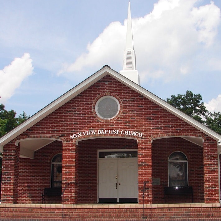
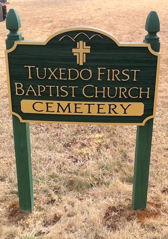
| Description | : | Tuxedo First Baptist Church Cemetery is on the grounds of the Mountain View Baptist Church. There is a paved road dividing the cemetery in half. The part to the south is the Tuxedo First Baptist Church Cemetery. The part to the north is the Mountain View Baptist Church Cemetery. There is also a large sign between the two cemeteries. Both cemeteries are well maintained. |
frequently asked questions (FAQ):
-
Where is Tuxedo First Baptist Church Cemetery?
Tuxedo First Baptist Church Cemetery is located at 458 Mountain View Church Road Zirconia, Henderson County ,North Carolina , 28790USA.
-
Tuxedo First Baptist Church Cemetery cemetery's updated grave count on graveviews.com?
1 memorials
-
Where are the coordinates of the Tuxedo First Baptist Church Cemetery?
Latitude: 35.2299000
Longitude: -82.4285000
Nearby Cemetories:
1. Mountain View Baptist Church Cemetery
Tuxedo, Henderson County, USA
Coordinate: 35.2325000, -82.4285000
2. Crossroads Baptist Church Cemetery
Zirconia, Henderson County, USA
Coordinate: 35.2287090, -82.4154320
3. Bell Family Cemetery
Tuxedo, Henderson County, USA
Coordinate: 35.2158970, -82.4247920
4. Freeman-Murray Cemetery
Tuxedo, Henderson County, USA
Coordinate: 35.2185860, -82.4416270
5. Ward Family Cemetery
Henderson County, USA
Coordinate: 35.2308780, -82.4049850
6. Fortune-Kuykendall Cemetery
Zirconia, Henderson County, USA
Coordinate: 35.2424000, -82.4032000
7. Andrews Cemetery
Henderson County, USA
Coordinate: 35.2089005, -82.4507980
8. Pace Cemetery
Henderson County, USA
Coordinate: 35.2131004, -82.4625015
9. Davis Family Cemetery
Henderson County, USA
Coordinate: 35.1979750, -82.4363250
10. Mount Olivet Baptist Church Cemetery
Zirconia, Henderson County, USA
Coordinate: 35.2366900, -82.4749000
11. Anders Cemetery
East Flat Rock, Henderson County, USA
Coordinate: 35.2654700, -82.4064300
12. Beddingfield Cemetery
Henderson County, USA
Coordinate: 35.1948690, -82.4523670
13. Hill Mausoleum
Flat Rock, Henderson County, USA
Coordinate: 35.2630638, -82.4577080
14. Bayne-Bane-Capps Cemetery
Henderson County, USA
Coordinate: 35.2057991, -82.4721985
15. Grace Missionary Baptist Church Cemetery
Mountain Page, Henderson County, USA
Coordinate: 35.2176960, -82.3746780
16. Double Springs Cemetery
Zirconia, Henderson County, USA
Coordinate: 35.1838989, -82.4289017
17. Oak Grove Baptist Church Cemetery
East Flat Rock, Henderson County, USA
Coordinate: 35.2729000, -82.4031580
18. Mountain Page Baptist Church Cemetery
Mountain Page, Henderson County, USA
Coordinate: 35.2097000, -82.3683400
19. Pinecrest Presbyterian Church Memorial Garden
Flat Rock, Henderson County, USA
Coordinate: 35.2822100, -82.4426360
20. Saint John In the Wilderness Cemetery
Flat Rock, Henderson County, USA
Coordinate: 35.2821170, -82.4435670
21. Oakland Cemetery
East Flat Rock, Henderson County, USA
Coordinate: 35.2835999, -82.4302979
22. Berea Baptist Church Cemetery
Flat Rock, Henderson County, USA
Coordinate: 35.2564011, -82.4875031
23. Mountain Valley Baptist Church Cemetery
Zirconia, Henderson County, USA
Coordinate: 35.2146988, -82.4938965
24. Old Mountain Page Baptist Cemetery
Mountain Page, Henderson County, USA
Coordinate: 35.2190300, -82.3607200