
| Memorials | : | 2 |
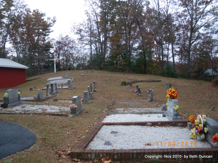
| Location | : | Zirconia, Henderson County, USA |
| Coordinate | : | 35.2287090, -82.4154320 |
| Description | : | directions: from Highway 25 North, take exit 5 and turn left onto NC Highway 225 North (Greenville Highway). Drive approx. 1/4 mile. Turn right onto Zirconia Road, and immediately turn right again onto Old Zirconia Road. At approx. 1/2 mile, cross a single railroad track. Paved road ends as soon as you cross the track. Follow dirt road another 1/2 mile and cross the railroad track again. Road changes to paved again and ends at Crossroads Baptist Church. |
frequently asked questions (FAQ):
-
Where is Crossroads Baptist Church Cemetery?
Crossroads Baptist Church Cemetery is located at Old Zirconia Road Zirconia, Henderson County ,North Carolina ,USA.
-
Crossroads Baptist Church Cemetery cemetery's updated grave count on graveviews.com?
2 memorials
-
Where are the coordinates of the Crossroads Baptist Church Cemetery?
Latitude: 35.2287090
Longitude: -82.4154320


Nearby Cemetories:
1. Ward Family Cemetery
Henderson County, USA
Coordinate: 35.2308780, -82.4049850
2. Tuxedo First Baptist Church Cemetery
Zirconia, Henderson County, USA
Coordinate: 35.2299000, -82.4285000
3. Mountain View Baptist Church Cemetery
Tuxedo, Henderson County, USA
Coordinate: 35.2325000, -82.4285000
4. Bell Family Cemetery
Tuxedo, Henderson County, USA
Coordinate: 35.2158970, -82.4247920
5. Fortune-Kuykendall Cemetery
Zirconia, Henderson County, USA
Coordinate: 35.2424000, -82.4032000
6. Freeman-Murray Cemetery
Tuxedo, Henderson County, USA
Coordinate: 35.2185860, -82.4416270
7. Andrews Cemetery
Henderson County, USA
Coordinate: 35.2089005, -82.4507980
8. Grace Missionary Baptist Church Cemetery
Mountain Page, Henderson County, USA
Coordinate: 35.2176960, -82.3746780
9. Davis Family Cemetery
Henderson County, USA
Coordinate: 35.1979750, -82.4363250
10. Anders Cemetery
East Flat Rock, Henderson County, USA
Coordinate: 35.2654700, -82.4064300
11. Pace Cemetery
Henderson County, USA
Coordinate: 35.2131004, -82.4625015
12. Mountain Page Baptist Church Cemetery
Mountain Page, Henderson County, USA
Coordinate: 35.2097000, -82.3683400
13. Oak Grove Baptist Church Cemetery
East Flat Rock, Henderson County, USA
Coordinate: 35.2729000, -82.4031580
14. Beddingfield Cemetery
Henderson County, USA
Coordinate: 35.1948690, -82.4523670
15. Old Mountain Page Baptist Cemetery
Mountain Page, Henderson County, USA
Coordinate: 35.2190300, -82.3607200
16. Double Springs Cemetery
Zirconia, Henderson County, USA
Coordinate: 35.1838989, -82.4289017
17. Hill Mausoleum
Flat Rock, Henderson County, USA
Coordinate: 35.2630638, -82.4577080
18. Mount Olivet Baptist Church Cemetery
Zirconia, Henderson County, USA
Coordinate: 35.2366900, -82.4749000
19. Bayne-Bane-Capps Cemetery
Henderson County, USA
Coordinate: 35.2057991, -82.4721985
20. Saluda City Cemetery
Saluda, Polk County, USA
Coordinate: 35.2438600, -82.3505400
21. Oakland Cemetery
East Flat Rock, Henderson County, USA
Coordinate: 35.2835999, -82.4302979
22. Pinecrest Presbyterian Church Memorial Garden
Flat Rock, Henderson County, USA
Coordinate: 35.2822100, -82.4426360
23. Saint John In the Wilderness Cemetery
Flat Rock, Henderson County, USA
Coordinate: 35.2821170, -82.4435670
24. Gilbert-Justus Family Cemetery
Upward, Henderson County, USA
Coordinate: 35.2861000, -82.3894380