
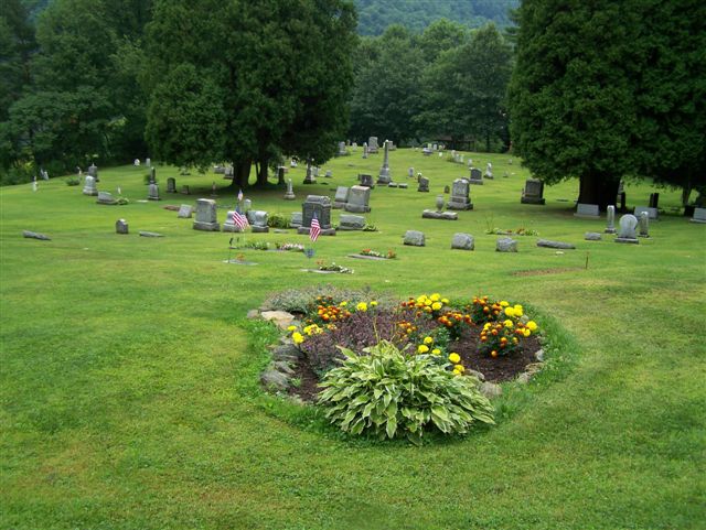
| Memorials | : | 0 |
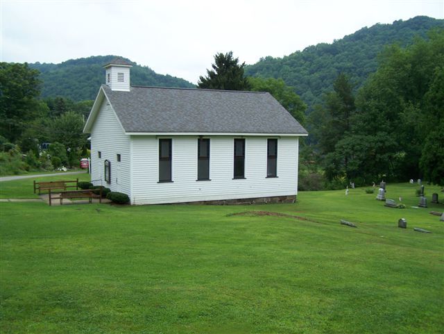
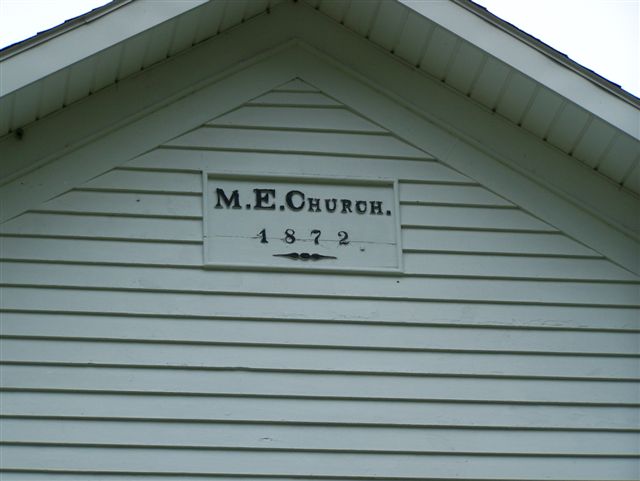
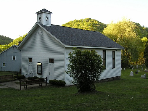
| Location | : | Wattersonville, Armstrong County, USA |
| Coordinate | : | 40.9801410, -79.5540080 |
| Description | : | Driving Directions: In West Kittanning, Armstrong County, PA, at the intersection of Business U.S. Route 422 and State Route 268, drive north and west on Route 268, toward Cowansville, for a total of 6.55 miles from this intersection, to the intersection at Wattersonville road. After driving thru Cowansville and begin to look for the sign, on the right, to Sherrett and Wattersonville, at the intersection of Wattersonville Road. (Also known as State Route 4017.) At Tatter's Tavern, on Route 268, turn right onto Wattersonville Road (State Route 4017) and drive for 2.95 miles, going thru the small... Read More |
frequently asked questions (FAQ):
-
Where is Wattersonville United Methodist Cemetery?
Wattersonville United Methodist Cemetery is located at Wattersonville, Armstrong County ,Pennsylvania ,USA.
-
Wattersonville United Methodist Cemetery cemetery's updated grave count on graveviews.com?
0 memorials
-
Where are the coordinates of the Wattersonville United Methodist Cemetery?
Latitude: 40.9801410
Longitude: -79.5540080
Nearby Cemetories:
1. Reynolds Cemetery
Armstrong County, USA
Coordinate: 40.9789170, -79.5457850
2. Saint Mary's Episcopal Cemetery
Armstrong County, USA
Coordinate: 40.9718630, -79.5398680
3. Phillipston Cemetery
Phillipston, Clarion County, USA
Coordinate: 40.9807000, -79.5889000
4. Truby-Rumbaugh Cemetery
Hillville, Armstrong County, USA
Coordinate: 40.9989471, -79.5863342
5. Saint Eusebius Cemetery
East Brady, Clarion County, USA
Coordinate: 40.9857620, -79.5991440
6. Tidal Cemetery
Tidal, Armstrong County, USA
Coordinate: 40.9582520, -79.4990020
7. Sherrett Cemetery
Sherrett, Armstrong County, USA
Coordinate: 40.9329185, -79.5553360
8. Old Earley Family Graveyard
Rimer, Armstrong County, USA
Coordinate: 40.9361115, -79.5255585
9. Mount Hope Cemetery
Madison Township, Clarion County, USA
Coordinate: 41.0298000, -79.5814000
10. Saint Mary's Cemetery
Bradys Bend, Armstrong County, USA
Coordinate: 40.9919010, -79.6246900
11. Lawsonham Cemetery
Rimersburg, Clarion County, USA
Coordinate: 41.0016000, -79.4872000
12. Rimer Hill Cemetery
Armstrong County, USA
Coordinate: 40.9398130, -79.4990980
13. Bradys Bend Cemetery
Bradys Bend Township, Armstrong County, USA
Coordinate: 40.9912530, -79.6320820
14. Duncan Cemetery
Armstrong County, USA
Coordinate: 40.9884750, -79.4727370
15. Bowser Cemetery
Morrows Corner, Armstrong County, USA
Coordinate: 40.9185070, -79.5341170
16. Robinson Cemetery
Bradys Bend, Armstrong County, USA
Coordinate: 41.0346985, -79.5999985
17. Bethesda Cemetery
Rimersburg, Clarion County, USA
Coordinate: 41.0385000, -79.5168000
18. Saints Peter and Paul Cemetery
Queenstown, Armstrong County, USA
Coordinate: 41.0105860, -79.6314890
19. Walthour Cemetery
Reesedale, Armstrong County, USA
Coordinate: 40.9379000, -79.4756000
20. Simpson Cemetery
Cowansville, Armstrong County, USA
Coordinate: 40.9092150, -79.5941450
21. Rimersburg Cemetery
Rimersburg, Clarion County, USA
Coordinate: 41.0475400, -79.4986800
22. Toy Cemetery
Reesedale, Armstrong County, USA
Coordinate: 40.9297750, -79.4706770
23. Brush Valley Cemetery
Adrian, Armstrong County, USA
Coordinate: 40.9044000, -79.5062000
24. Peters Cemetery
Bradys Bend, Armstrong County, USA
Coordinate: 41.0099680, -79.6580900