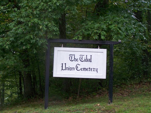
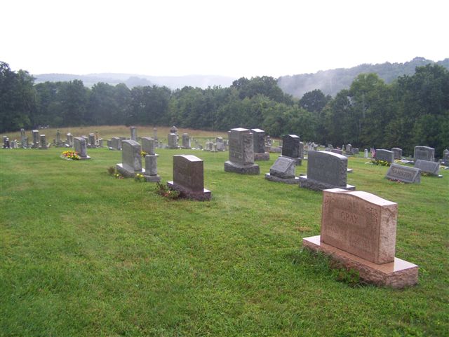
| Memorials | : | 1 |
| Location | : | Tidal, Armstrong County, USA |
| Coordinate | : | 40.9582520, -79.4990020 |
| Description | : | From Kittanning, Armstrong County, Pennsylvania, drive North on PA Route 28/66, a distance of 14.17 miles, into the village of Distant, PA., where there is a three-way intersection, of 28/66, with Kellersburg AND Kohlersburg Roads. As you drive up the hill and are just entering the village of Distant, this three road intersection will be on your left. Turn left into this intersection and make another immediate left onto Kellersburg Road, which is also called State Route 1004. (Top of the hill, in Distant, is too far...you missed this turn.) On Kellersburg Road, drive west, thru the village of... Read More |
frequently asked questions (FAQ):
-
Where is Tidal Cemetery?
Tidal Cemetery is located at Tidal, Armstrong County ,Pennsylvania ,USA.
-
Tidal Cemetery cemetery's updated grave count on graveviews.com?
1 memorials
-
Where are the coordinates of the Tidal Cemetery?
Latitude: 40.9582520
Longitude: -79.4990020
Nearby Cemetories:
1. Rimer Hill Cemetery
Armstrong County, USA
Coordinate: 40.9398130, -79.4990980
2. Walthour Cemetery
Reesedale, Armstrong County, USA
Coordinate: 40.9379000, -79.4756000
3. Old Earley Family Graveyard
Rimer, Armstrong County, USA
Coordinate: 40.9361115, -79.5255585
4. Saint Mary's Episcopal Cemetery
Armstrong County, USA
Coordinate: 40.9718630, -79.5398680
5. Toy Cemetery
Reesedale, Armstrong County, USA
Coordinate: 40.9297750, -79.4706770
6. Duncan Cemetery
Armstrong County, USA
Coordinate: 40.9884750, -79.4727370
7. Reynolds Cemetery
Armstrong County, USA
Coordinate: 40.9789170, -79.5457850
8. Bell Town Road Cemetery
Templeton, Armstrong County, USA
Coordinate: 40.9243110, -79.4624050
9. Lawsonham Cemetery
Rimersburg, Clarion County, USA
Coordinate: 41.0016000, -79.4872000
10. Wattersonville United Methodist Cemetery
Wattersonville, Armstrong County, USA
Coordinate: 40.9801410, -79.5540080
11. Bowser Cemetery
Morrows Corner, Armstrong County, USA
Coordinate: 40.9185070, -79.5341170
12. Sherrett Cemetery
Sherrett, Armstrong County, USA
Coordinate: 40.9329185, -79.5553360
13. Stewardson Furnace Cemetery
Armstrong County, USA
Coordinate: 40.9331510, -79.4421280
14. Brush Valley Cemetery
Adrian, Armstrong County, USA
Coordinate: 40.9044000, -79.5062000
15. Kellersburg Lutheran Cemetery
Kellersburg, Armstrong County, USA
Coordinate: 40.9704000, -79.4244000
16. John Cemetery
Frenchs Corners, Armstrong County, USA
Coordinate: 40.9003296, -79.4978409
17. Kellersburg Methodist Cemetery
Kellersburg, Armstrong County, USA
Coordinate: 40.9752000, -79.4240000
18. Toy Family Cemetery
Adrian, Armstrong County, USA
Coordinate: 40.8971130, -79.5082120
19. Limestone Church of God Cemetery
Adrian, Armstrong County, USA
Coordinate: 40.8968887, -79.5180740
20. Saint Mark's Lutheran Church Cemetery
Adrian, Armstrong County, USA
Coordinate: 40.8960152, -79.5370865
21. Cochran Cemetery
Templeton, Armstrong County, USA
Coordinate: 40.8941994, -79.4582977
22. Phillipston Cemetery
Phillipston, Clarion County, USA
Coordinate: 40.9807000, -79.5889000
23. Crissman Family Cemetery
Adrian, Armstrong County, USA
Coordinate: 40.8877490, -79.5402750
24. Montgomeryville Baptist Church Cemetery
Adrian, Armstrong County, USA
Coordinate: 40.8866615, -79.5376434


