
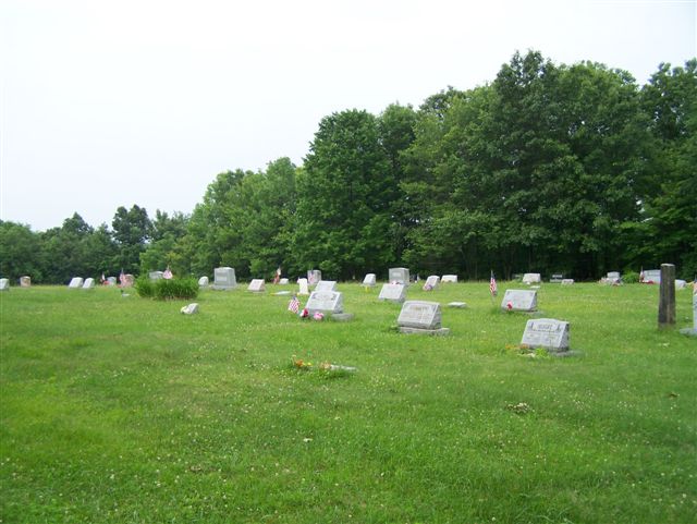
| Memorials | : | 1 |
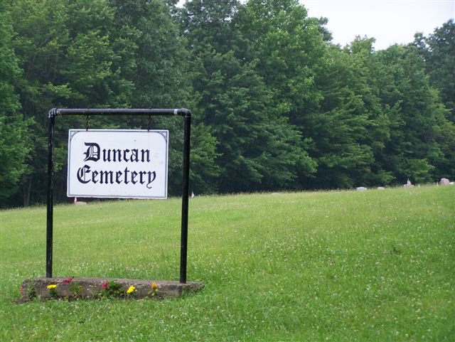
| Location | : | Armstrong County, USA |
| Coordinate | : | 40.9884750, -79.4727370 |
| Description | : | These directions are via the "Main roads"...If you are unfamiliar with Pennsylvania "back-roads," it is best to stay with the main thoroughfares: From Kittanning, Armstrong County, PA, drive North on PA Route 28/66, into the village of Distant, PA., where there is a three-way intersection of 28/66 with Kellersburg AND Kohlersburg Roads. As you drive up the hill and are just entering the village of Distant, this three road intersection will be on your left. Turn left into this intersection and make another immediate left onto Kellersburg Road, which is also called State Route 1004. (Top of... Read More |
frequently asked questions (FAQ):
-
Where is Duncan Cemetery?
Duncan Cemetery is located at Armstrong County ,Pennsylvania ,USA.
-
Duncan Cemetery cemetery's updated grave count on graveviews.com?
1 memorials
-
Where are the coordinates of the Duncan Cemetery?
Latitude: 40.9884750
Longitude: -79.4727370
Nearby Cemetories:
1. Lawsonham Cemetery
Rimersburg, Clarion County, USA
Coordinate: 41.0016000, -79.4872000
2. Tidal Cemetery
Tidal, Armstrong County, USA
Coordinate: 40.9582520, -79.4990020
3. Kellersburg Methodist Cemetery
Kellersburg, Armstrong County, USA
Coordinate: 40.9752000, -79.4240000
4. Kellersburg Lutheran Cemetery
Kellersburg, Armstrong County, USA
Coordinate: 40.9704000, -79.4244000
5. Oak Grove Cemetery
Porter Township, Clarion County, USA
Coordinate: 41.0270000, -79.4300000
6. Walthour Cemetery
Reesedale, Armstrong County, USA
Coordinate: 40.9379000, -79.4756000
7. Rimer Hill Cemetery
Armstrong County, USA
Coordinate: 40.9398130, -79.4990980
8. Saint Mary's Episcopal Cemetery
Armstrong County, USA
Coordinate: 40.9718630, -79.5398680
9. Reynolds Cemetery
Armstrong County, USA
Coordinate: 40.9789170, -79.5457850
10. Toy Cemetery
Reesedale, Armstrong County, USA
Coordinate: 40.9297750, -79.4706770
11. Stewardson Furnace Cemetery
Armstrong County, USA
Coordinate: 40.9331510, -79.4421280
12. Bethesda Cemetery
Rimersburg, Clarion County, USA
Coordinate: 41.0385000, -79.5168000
13. Wattersonville United Methodist Cemetery
Wattersonville, Armstrong County, USA
Coordinate: 40.9801410, -79.5540080
14. Rimersburg Cemetery
Rimersburg, Clarion County, USA
Coordinate: 41.0475400, -79.4986800
15. Herman Cemetery
Porter Township, Clarion County, USA
Coordinate: 41.0269000, -79.4059000
16. Bell Town Road Cemetery
Templeton, Armstrong County, USA
Coordinate: 40.9243110, -79.4624050
17. Old Earley Family Graveyard
Rimer, Armstrong County, USA
Coordinate: 40.9361115, -79.5255585
18. Squirrel Hill Cemetery
New Bethlehem, Clarion County, USA
Coordinate: 41.0401000, -79.4128000
19. Narrows Cemetery
Mahoning, Armstrong County, USA
Coordinate: 40.9699000, -79.3839000
20. Deanville Cemetery
Deanville, Armstrong County, USA
Coordinate: 40.9517700, -79.3919170
21. Associated United Presbyterian Church Cemetery
Toby, Clarion County, USA
Coordinate: 41.0709000, -79.4728000
22. Sherrett Cemetery
Sherrett, Armstrong County, USA
Coordinate: 40.9329185, -79.5553360
23. Bowser Cemetery
Morrows Corner, Armstrong County, USA
Coordinate: 40.9185070, -79.5341170
24. Truby-Rumbaugh Cemetery
Hillville, Armstrong County, USA
Coordinate: 40.9989471, -79.5863342