
| Memorials | : | 0 |
| Location | : | Morrows Corner, Armstrong County, USA |
| Coordinate | : | 40.9185070, -79.5341170 |
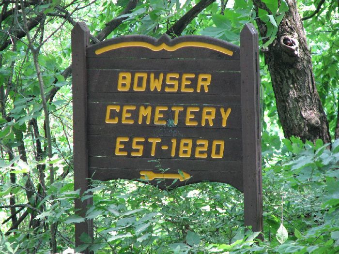
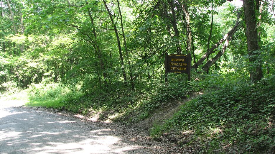
| Description | : | Bowser Cemetery is in Washington Township in Armstrong County, Pennsylvania. It is north of the village of Morrows Corner. Directions: From Adrian on Reesdale Road, drive east (actually you will be driving north) on Reesedale Road. You will immediately see the Montgomeryville Baptist Church on the left. Go another 0.5 miles on Reesedale Road and turn left on Sharrett Road. There is no sign for "Sharrett Road." but you will see a small sign pointing to the left, and indicating "SHERRETT 4 miles." Drive 1.7 miles on Sharrett Road, then turn right onto Center School Road. Drive 0.4 miles whereupon... Read More |
frequently asked questions (FAQ):
-
Where is Bowser Cemetery?
Bowser Cemetery is located at Morrows Corner, Armstrong County ,Pennsylvania ,USA.
-
Bowser Cemetery cemetery's updated grave count on graveviews.com?
0 memorials
-
Where are the coordinates of the Bowser Cemetery?
Latitude: 40.9185070
Longitude: -79.5341170
Nearby Cemetories:
1. Old Earley Family Graveyard
Rimer, Armstrong County, USA
Coordinate: 40.9361115, -79.5255585
2. Sherrett Cemetery
Sherrett, Armstrong County, USA
Coordinate: 40.9329185, -79.5553360
3. Saint Mark's Lutheran Church Cemetery
Adrian, Armstrong County, USA
Coordinate: 40.8960152, -79.5370865
4. Limestone Church of God Cemetery
Adrian, Armstrong County, USA
Coordinate: 40.8968887, -79.5180740
5. Brush Valley Cemetery
Adrian, Armstrong County, USA
Coordinate: 40.9044000, -79.5062000
6. Toy Family Cemetery
Adrian, Armstrong County, USA
Coordinate: 40.8971130, -79.5082120
7. Crissman Family Cemetery
Adrian, Armstrong County, USA
Coordinate: 40.8877490, -79.5402750
8. Montgomeryville Baptist Church Cemetery
Adrian, Armstrong County, USA
Coordinate: 40.8866615, -79.5376434
9. John Cemetery
Frenchs Corners, Armstrong County, USA
Coordinate: 40.9003296, -79.4978409
10. Fair Cemetery
Cowansville, Armstrong County, USA
Coordinate: 40.8961334, -79.5667419
11. Rimer Hill Cemetery
Armstrong County, USA
Coordinate: 40.9398130, -79.4990980
12. Croyle Cemetery
Adrian, Armstrong County, USA
Coordinate: 40.8782997, -79.5108032
13. Simpson Cemetery
Cowansville, Armstrong County, USA
Coordinate: 40.9092150, -79.5941450
14. Tidal Cemetery
Tidal, Armstrong County, USA
Coordinate: 40.9582520, -79.4990020
15. Walthour Cemetery
Reesedale, Armstrong County, USA
Coordinate: 40.9379000, -79.4756000
16. Toy Cemetery
Reesedale, Armstrong County, USA
Coordinate: 40.9297750, -79.4706770
17. Rich Hill United Presbyterian Church Cemetery
Cowansville, Armstrong County, USA
Coordinate: 40.8916750, -79.5890490
18. Cowansville Cemetery
Cowansville, Armstrong County, USA
Coordinate: 40.8878860, -79.5878143
19. Saint Mary's Episcopal Cemetery
Armstrong County, USA
Coordinate: 40.9718630, -79.5398680
20. Bell Town Road Cemetery
Templeton, Armstrong County, USA
Coordinate: 40.9243110, -79.4624050
21. Herron Family Cemetery
Cowansville, Armstrong County, USA
Coordinate: 40.8666170, -79.5751760
22. Reynolds Cemetery
Armstrong County, USA
Coordinate: 40.9789170, -79.5457850
23. Cochran Cemetery
Templeton, Armstrong County, USA
Coordinate: 40.8941994, -79.4582977
24. Myers-Patton Cemetery
Adrian, Armstrong County, USA
Coordinate: 40.8619270, -79.4972458