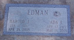
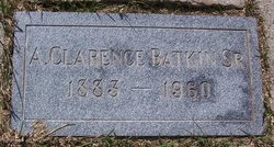
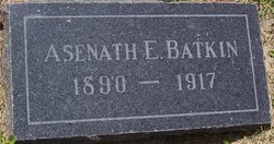
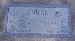
Ada Pearl Batkin Edman
| Birth | : | 16 Apr 1915 Lompoc, Santa Barbara County, California, USA |
| Death | : | 11 May 2005 Lompoc, Santa Barbara County, California, USA |
| Burial | : | Clifton United Jewish Cemetery, Cincinnati, Hamilton County, USA |
| Coordinate | : | 39.1470871, -84.5292816 |
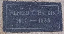
| Description | : | Memorial services remembering the life of Ada Edman, 90, of Lompoc, will be at 2 p.m. Monday, May 16, 2005, at the chapel of Starbuck-Lind Mortuary. Private burial is at Lompoc Cemetery. A native of Lompoc, Ada was born April 12, 1915, to Alfred Clarence and Asenath Houghton Batkin. She was the fifth of six children. In 1917, her mother died at the age of 25 and Ada and her siblings were then cared for by their grandmother, Harriet Houghton. Her father, Alfred, spent his early life clerking in one of Lompoc's first grocery stores. Later, he farmed and then worked... Read More |
frequently asked questions (FAQ):
-
Where is Ada Pearl Batkin Edman's memorial?
Ada Pearl Batkin Edman's memorial is located at: Clifton United Jewish Cemetery, Cincinnati, Hamilton County, USA.
-
When did Ada Pearl Batkin Edman death?
Ada Pearl Batkin Edman death on 11 May 2005 in Lompoc, Santa Barbara County, California, USA
-
Where are the coordinates of the Ada Pearl Batkin Edman's memorial?
Latitude: 39.1470871
Longitude: -84.5292816
Family Members:
Parent
Spouse
Siblings
Flowers:
Nearby Cemetories:
1. Hillside Chapel Crematory and Columbarium
Cincinnati, Hamilton County, USA
Coordinate: 39.1393509, -84.5247192
2. Vine Street Hill Cemetery
Cincinnati, Hamilton County, USA
Coordinate: 39.1516991, -84.5091019
3. Spring Grove Cemetery
Cincinnati, Hamilton County, USA
Coordinate: 39.1647900, -84.5231500
4. Wesleyan Cemetery
Cincinnati, Hamilton County, USA
Coordinate: 39.1599998, -84.5468979
5. Third Quaker Cemetery (Defunct)
Cincinnati, Hamilton County, USA
Coordinate: 39.1542400, -84.5523720
6. Saint John Cemetery
Saint Bernard, Hamilton County, USA
Coordinate: 39.1643982, -84.5053024
7. Methodist Protestant Cemetery (Defunct)
Cincinnati, Hamilton County, USA
Coordinate: 39.1324770, -84.4983160
8. Baltimore Pike Cemetery
Cincinnati, Hamilton County, USA
Coordinate: 39.1397018, -84.5681000
9. Second Quaker Cemetery (Defunct)
Cincinnati, Hamilton County, USA
Coordinate: 39.1153090, -84.5305240
10. First German Protestant Cemetery
Avondale, Hamilton County, USA
Coordinate: 39.1492004, -84.4863968
11. Martini United Church of Christ Cemetery
Fairmount, Hamilton County, USA
Coordinate: 39.1296272, -84.5664902
12. Christ Church Cemetery
Over-The-Rhine, Hamilton County, USA
Coordinate: 39.1126480, -84.5157623
13. Saint Mary Cemetery
Saint Bernard, Hamilton County, USA
Coordinate: 39.1664009, -84.4880981
14. Lincoln Park Potters Field (Defunct)
Cincinnati, Hamilton County, USA
Coordinate: 39.1097710, -84.5346450
15. Christ Episcopal Churchyard (Defunct)
Cincinnati, Hamilton County, USA
Coordinate: 39.1100520, -84.5177220
16. Potters Field
Cincinnati, Hamilton County, USA
Coordinate: 39.1094440, -84.5188890
17. Walnut Hills Cemetery
Cincinnati, Hamilton County, USA
Coordinate: 39.1355950, -84.4809040
18. Presbyterian Burying Ground
Cincinnati, Hamilton County, USA
Coordinate: 39.1082510, -84.5175720
19. Thomas Williams Cemetery (Defunct)
Cincinnati, Hamilton County, USA
Coordinate: 39.1085060, -84.5146050
20. Chestnut Street Cemetery
Over-The-Rhine, Hamilton County, USA
Coordinate: 39.1071610, -84.5212210
21. Catherine Street Burying Ground
Cincinnati, Hamilton County, USA
Coordinate: 39.1067490, -84.5252700
22. Enon Baptist Church Burying Ground (Defunct)
Cincinnati, Hamilton County, USA
Coordinate: 39.1065420, -84.5238110
23. Catherine Street Methodist Cemetery (Defunct)
Cincinnati, Hamilton County, USA
Coordinate: 39.1064840, -84.5243150
24. Walnut Hills Jewish Cemetery
Evanston, Hamilton County, USA
Coordinate: 39.1403700, -84.4731300

