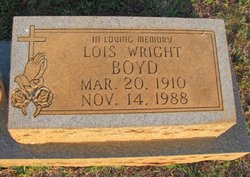
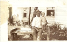
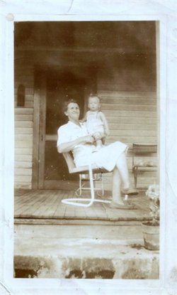
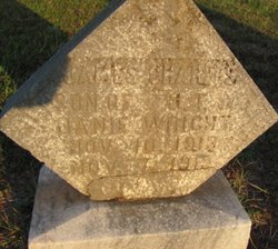
Alma Lois Wright Boyd
| Birth | : | 20 Mar 1910 York County, South Carolina, USA |
| Death | : | 14 Nov 1988 Rock Hill, York County, South Carolina, USA |
| Burial | : | St. Peter's Churchyard, Draycott, Mendip District, England |
| Coordinate | : | 51.2580900, -2.7523800 |
| Inscription | : | In Loving Memory |
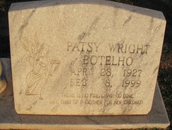
| Description | : | ..Obit::: The Charlotte Observer - November 16, 1988. *Lois Boyd, Bookkeeper --ROCK HILL - Mrs. Lois Wright Boyd, 78, of 220 Hutchinson St. died Nov. 14, 1988, at Piedmont Medical Center. Graveside services are 11 a.m. today at Unity Cemetery in Fort Mill, with the Rev. Jan Senneker officiating. Visitation is at the home of her sister, Mrs. Patsy Botelho, 220 Hutchinson St. Greene Funeral Home is in charge. Mrs. Boyd, a retired bookkeeper, was born in York County, daughter of the late James T. Wright and Janie Clawson Wright. She was the widow of Robert D. Boyd. Survivors are her... Read More |
frequently asked questions (FAQ):
-
Where is Alma Lois Wright Boyd's memorial?
Alma Lois Wright Boyd's memorial is located at: St. Peter's Churchyard, Draycott, Mendip District, England.
-
When did Alma Lois Wright Boyd death?
Alma Lois Wright Boyd death on 14 Nov 1988 in Rock Hill, York County, South Carolina, USA
-
Where are the coordinates of the Alma Lois Wright Boyd's memorial?
Latitude: 51.2580900
Longitude: -2.7523800
Family Members:
Parent
Siblings
Flowers:
Nearby Cemetories:
1. St. Peter's Churchyard
Draycott, Mendip District, England
Coordinate: 51.2580900, -2.7523800
2. St. Leonard's Churchyard
Rodney Stoke, Mendip District, England
Coordinate: 51.2455140, -2.7431800
3. St. Andrew's Churchyard
Cheddar, Sedgemoor District, England
Coordinate: 51.2736740, -2.7761330
4. Cheddar Baptist Burial Ground
Cheddar, Sedgemoor District, England
Coordinate: 51.2767330, -2.7792010
5. St Lawrence Churchyard
Westbury, Mendip District, England
Coordinate: 51.2354140, -2.7182630
6. St. Mary Magdalene Churchyard Extension
Wedmore, Sedgemoor District, England
Coordinate: 51.2327583, -2.8065246
7. St. Michael Sanatorium Cemetery
Axbridge, Sedgemoor District, England
Coordinate: 51.2904100, -2.8056900
8. St. Lawrence's Churchyard
Priddy, Mendip District, England
Coordinate: 51.2596770, -2.6777600
9. Christ Church Theale
Wedmore, Sedgemoor District, England
Coordinate: 51.2113720, -2.7631570
10. St. Mary Churchyard
Wedmore, Sedgemoor District, England
Coordinate: 51.2276790, -2.8110360
11. Baptist Churchyard
Wedmore, Sedgemoor District, England
Coordinate: 51.2260400, -2.8099800
12. St. John the Baptist Churchyard
Axbridge, Sedgemoor District, England
Coordinate: 51.2876300, -2.8162900
13. Christ Church Churchyard
Henton, Mendip District, England
Coordinate: 51.2056460, -2.7256380
14. St Gregory Churchyard
Weare, Sedgemoor District, England
Coordinate: 51.2699900, -2.8408600
15. Allerton Churchyard
Chapel Allerton, Sedgemoor District, England
Coordinate: 51.2479860, -2.8482400
16. St Leonard's Churchyard
Shipham, Sedgemoor District, England
Coordinate: 51.3130980, -2.8001830
17. St. Matthew Churchyard
Wookey, Mendip District, England
Coordinate: 51.2093000, -2.6893000
18. Holy Trinity Churchyard
Blackford, Sedgemoor District, England
Coordinate: 51.2257800, -2.8483000
19. Shipham Cemetery
Shipham, Sedgemoor District, England
Coordinate: 51.3201930, -2.7992390
20. St Michael and All Angels
Rowberrow, North Somerset Unitary Authority, England
Coordinate: 51.3240000, -2.7915000
21. Holy Trinity Churchyard
Burrington, North Somerset Unitary Authority, England
Coordinate: 51.3307830, -2.7496010
22. St Congar Churchyard
Badgworth, Sedgemoor District, England
Coordinate: 51.2699300, -2.8674000
23. St Andrew Churchyard
Blagdon, North Somerset Unitary Authority, England
Coordinate: 51.3275610, -2.7127710
24. Wells Cemetery
Wells, Mendip District, England
Coordinate: 51.2088240, -2.6640120

