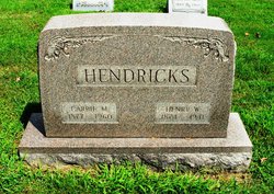
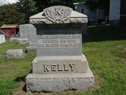
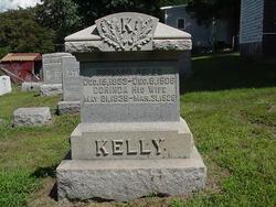
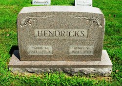
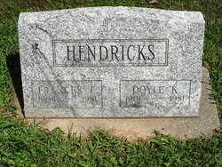
Carrie May Kelly Hendricks
| Birth | : | 18 Dec 1877 Perry Township, Carroll County, Ohio, USA |
| Death | : | 6 Sep 1960 Dennison, Tuscarawas County, Ohio, USA |
| Burial | : | St Andrew Churchyard, Langton, Ryedale District, England |
| Coordinate | : | 54.0934510, -0.7834680 |
| Description | : | Find A Grave contributor 46848597 provided the following: Her obituary in the Free Press Standard, Carrollton, Ohio, Thursday, September 15, 1960. Mrs. Carrie (Kelly) Hendricks, 83, a life resident of the Perrysville area, died September 6 in Twin City Hospital, Dennison, shortly after being admitted. She was a member of Perrysville Methodist Church. Her husband, Henry Hendricks, died in 1941. Surviving is one son, Doyle Hendricks, of the home. Services were Friday with burial in Perrysville EUB cemeter |
frequently asked questions (FAQ):
-
Where is Carrie May Kelly Hendricks's memorial?
Carrie May Kelly Hendricks's memorial is located at: St Andrew Churchyard, Langton, Ryedale District, England.
-
When did Carrie May Kelly Hendricks death?
Carrie May Kelly Hendricks death on 6 Sep 1960 in Dennison, Tuscarawas County, Ohio, USA
-
Where are the coordinates of the Carrie May Kelly Hendricks's memorial?
Latitude: 54.0934510
Longitude: -0.7834680
Family Members:
Parent
Spouse
Siblings
Children
Flowers:
Nearby Cemetories:
1. St Andrew Churchyard
Langton, Ryedale District, England
Coordinate: 54.0934510, -0.7834680
2. Burythorpe Churchyard
Burythorpe, Ryedale District, England
Coordinate: 54.0752951, -0.7955984
3. St Mary Churchyard
Birdsall, Ryedale District, England
Coordinate: 54.0780000, -0.7508000
4. St. Mary's Churchyard
Westow, Ryedale District, England
Coordinate: 54.0846190, -0.8406850
5. St Peter Churchyard
Norton, Ryedale District, England
Coordinate: 54.1289040, -0.7861910
6. Norton Cemetery
Norton, Ryedale District, England
Coordinate: 54.1306400, -0.7834200
7. St. Nicholas Churchyard
North Grimston, Ryedale District, England
Coordinate: 54.0989220, -0.7148680
8. St. Margaret's Churchyard
Huttons Ambo, Ryedale District, England
Coordinate: 54.1066490, -0.8490640
9. St. Leonard with St. Mary Churchyard
Malton, Ryedale District, England
Coordinate: 54.1348110, -0.7946110
10. Malton Cemetery
Malton, Ryedale District, England
Coordinate: 54.1392670, -0.7980300
11. All Saints Churchyard
Settrington, Ryedale District, England
Coordinate: 54.1212780, -0.7178830
12. Settrington Cemetery
Settrington, Ryedale District, England
Coordinate: 54.1254200, -0.7221700
13. St Mary the Virgin Priory Churchyard
Malton, Ryedale District, England
Coordinate: 54.1427520, -0.7786450
14. St John the Baptist
Acklam, Ryedale District, England
Coordinate: 54.0451010, -0.8006330
15. Old Malton Cemetery
Malton, Ryedale District, England
Coordinate: 54.1443200, -0.7808900
16. Kirkham Priory
Kirkham, Ryedale District, England
Coordinate: 54.0826180, -0.8768470
17. St Michael Churchyard
Crambe, Ryedale District, England
Coordinate: 54.0744550, -0.8809390
18. St. Martin Churchyard
Wharram Percy, Ryedale District, England
Coordinate: 54.0665700, -0.6901300
19. St. Mary's Churchyard
Wharram le Street, Ryedale District, England
Coordinate: 54.0820040, -0.6810779
20. Howsham Churchyard
Howsham, Ryedale District, England
Coordinate: 54.0565520, -0.8755670
21. Castle Howard Mausoleum
Castle Howard, Ryedale District, England
Coordinate: 54.1173870, -0.8886900
22. St. Mary's Churchyard
Thixendale, Ryedale District, England
Coordinate: 54.0387360, -0.7154888
23. St John the Evangelist Churchyard
Welburn (Malton), Ryedale District, England
Coordinate: 54.1008850, -0.8985440
24. St Helen Churchyard
Amotherby, Ryedale District, England
Coordinate: 54.1512000, -0.8521000

