

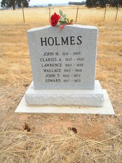
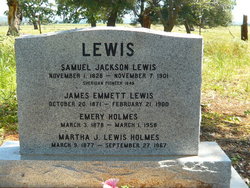
Clarissa Lain Holmes
| Birth | : | 1837 Illinois, USA |
| Death | : | 16 May 1920 Placer County, California, USA |
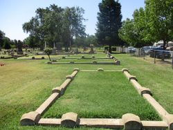
| Burial | : | Manzanita Cemetery, Lincoln, Placer County, USA |
| Coordinate | : | 38.9444008, -121.3032990 |
| Description | : | Mother of eleven children |
frequently asked questions (FAQ):
-
Where is Clarissa Lain Holmes's memorial?
Clarissa Lain Holmes's memorial is located at: Manzanita Cemetery, Lincoln, Placer County, USA.
-
When did Clarissa Lain Holmes death?
Clarissa Lain Holmes death on 16 May 1920 in Placer County, California, USA
-
Where are the coordinates of the Clarissa Lain Holmes's memorial?
Latitude: 38.9444008
Longitude: -121.3032990
Family Members:
Parent

Spouse

Siblings
Children


Nearby Cemetories:
1. Manzanita Cemetery
Lincoln, Placer County, USA
Coordinate: 38.9444008, -121.3032990
2. Morgan Oaks Eternal Preserve
Lincoln, Placer County, USA
Coordinate: 38.9629050, -121.2860530
3. Sheridan Cemetery
Sheridan, Placer County, USA
Coordinate: 38.9741000, -121.3585300
4. Santa Clara Memorial Park
Lincoln, Placer County, USA
Coordinate: 38.8894710, -121.3260560
5. Lincoln Cemetery
Lincoln, Placer County, USA
Coordinate: 38.8864310, -121.3020500
6. Camp Far West Cemetery
Wheatland, Yuba County, USA
Coordinate: 39.0395500, -121.3431400
7. Gold Hill Cemetery
Gold Hill, Placer County, USA
Coordinate: 38.9025000, -121.1802200
8. Wheatland Cemetery
Wheatland, Yuba County, USA
Coordinate: 39.0083008, -121.4360962
9. Whitney Family Mausoleum
Rocklin, Placer County, USA
Coordinate: 38.8256500, -121.2477000
10. Lone Star Cemetery
Placer County, USA
Coordinate: 38.9757996, -121.1380997
11. Lofton Cemetery
Yuba County, USA
Coordinate: 39.0783005, -121.3696976
12. Newcastle Cemetery
Newcastle, Placer County, USA
Coordinate: 38.8708880, -121.1444060
13. Ophir Cemetery
Placer County, USA
Coordinate: 38.8928870, -121.1273790
14. Stewarts Flat Cemetery
Penryn, Placer County, USA
Coordinate: 38.8447360, -121.1507950
15. Wells Cemetery
Auburn, Placer County, USA
Coordinate: 38.9667000, -121.1054900
16. School House Park Cemetery
Roseville, Placer County, USA
Coordinate: 38.7893180, -121.3578670
17. Cabbage Patch Cemetery
Waldo Junction, Yuba County, USA
Coordinate: 39.1117300, -121.3066200
18. Rocklin Cemetery
Rocklin, Placer County, USA
Coordinate: 38.7827670, -121.2337980
19. Fairview Cemetery
Rio Oso, Sutter County, USA
Coordinate: 38.9389000, -121.5250015
20. New Auburn Cemetery
Auburn, Placer County, USA
Coordinate: 38.9026900, -121.0870800
21. Chinese Cemetery
Auburn, Placer County, USA
Coordinate: 38.9183502, -121.0802383
22. Shepherd of the Sierra Memorial Garden
Loomis, Placer County, USA
Coordinate: 38.7890800, -121.1944200
23. Old Auburn Cemetery
Auburn, Placer County, USA
Coordinate: 38.9023720, -121.0812230
24. Clark Ashton Smith Gravesite
Auburn, Placer County, USA
Coordinate: 38.8952100, -121.0770500