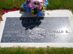
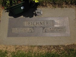
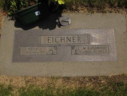
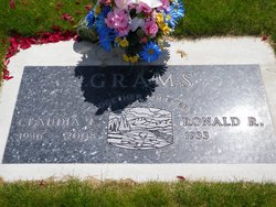
Claudia L Eichner Grams
| Birth | : | 15 May 1936 Idaho, USA |
| Death | : | 20 Feb 2008 Washington, USA |
| Burial | : | Doe Creek Cemetery, Scotts Hill, Henderson County, USA |
| Coordinate | : | 35.4692990, -88.2474350 |
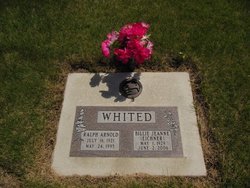
| Description | : | February 28, 2008 Claudia L. Grams Claudia L. Grams, 71, died peacefully at East Adams Rural Hospital on Wednesday, Feb. 20, 2008. She was born in Troy, Idaho, on May 15, 1936. She worked on the family wheat farm and also drove school bus for 15 years. Her greatest love was her family and friends. She was married to Ron for 56 years. She was preceded in death by her sister, Billie Jean Whited. She is survived by her husband, Ron; children, Rich Grams, Dale Grams and Holli Kembel; sister, Sherie Schafer; daughters-in-law, Jadine and Bonnie Grams; and son-in-law, Steve Kembel. She had... Read More |
frequently asked questions (FAQ):
-
Where is Claudia L Eichner Grams's memorial?
Claudia L Eichner Grams's memorial is located at: Doe Creek Cemetery, Scotts Hill, Henderson County, USA.
-
When did Claudia L Eichner Grams death?
Claudia L Eichner Grams death on 20 Feb 2008 in Washington, USA
-
Where are the coordinates of the Claudia L Eichner Grams's memorial?
Latitude: 35.4692990
Longitude: -88.2474350
Family Members:
Parent
Spouse
Siblings
Flowers:
Nearby Cemetories:
1. Doe Creek Cemetery
Scotts Hill, Henderson County, USA
Coordinate: 35.4692990, -88.2474350
2. Cedar Grove Cemetery
Henderson County, USA
Coordinate: 35.4799600, -88.2678900
3. Prospect Church Cemetery
Sardis, Henderson County, USA
Coordinate: 35.4584950, -88.2683120
4. Lowery-Doe Creek Cemetery
Decatur County, USA
Coordinate: 35.4483120, -88.2468900
5. Cedar Grove Pentecostal Cemetery
Sardis, Henderson County, USA
Coordinate: 35.4829530, -88.2698440
6. Fellowship Church Cemetery
Scotts Hill, Henderson County, USA
Coordinate: 35.4965940, -88.2602540
7. Bethel Cemetery
Scotts Hill, Decatur County, USA
Coordinate: 35.4963690, -88.2320790
8. Granny Austin Cemetery
Scotts Hill, Henderson County, USA
Coordinate: 35.4949850, -88.2734300
9. Liberty Church Cemetery
Scotts Hill, Decatur County, USA
Coordinate: 35.4466050, -88.2146570
10. Scotts Hill Pentecostal Church Cemetery
Scotts Hill, Decatur County, USA
Coordinate: 35.5065610, -88.2336080
11. Murphy Cemetery
Lick Skillet, Decatur County, USA
Coordinate: 35.4806930, -88.1983720
12. Sardis Cemetery
Sardis, Henderson County, USA
Coordinate: 35.4366020, -88.2833100
13. Pleasant View Cemetery
Sardis, Henderson County, USA
Coordinate: 35.4639730, -88.3019970
14. Grandsire Holmes Cemetery
Scotts Hill, Henderson County, USA
Coordinate: 35.5140820, -88.2483620
15. Scotts Hill Church Cemetery
Scotts Hill, Henderson County, USA
Coordinate: 35.5189480, -88.2463960
16. Patterson Cemetery
Lick Skillet, Decatur County, USA
Coordinate: 35.4383800, -88.1979020
17. Red Walnut Church Cemetery
Lick Skillet, Decatur County, USA
Coordinate: 35.4700840, -88.1787990
18. Peace Chapel Cemetery
Scotts Hill, Decatur County, USA
Coordinate: 35.5214060, -88.2206280
19. Pafford - Scotts Hill Cemetery
Scotts Hill, Henderson County, USA
Coordinate: 35.5265450, -88.2515290
20. Decatur County Farm Cemetery
Scotts Hill, Decatur County, USA
Coordinate: 35.5078697, -88.1940994
21. McBride Cemetery
Sardis, Henderson County, USA
Coordinate: 35.4406013, -88.3106003
22. Spring Hill Cemetery
Sardis, Henderson County, USA
Coordinate: 35.4277992, -88.3091965
23. Martin Family Cemetery
Decaturville, Decatur County, USA
Coordinate: 35.5139160, -88.1882440
24. Crawford Cemetery
Scotts Hill, Decatur County, USA
Coordinate: 35.5141550, -88.1882830

