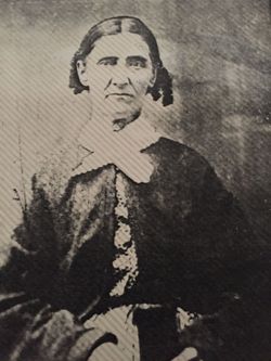
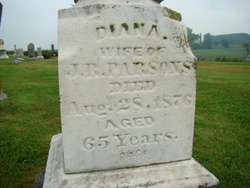
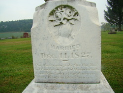
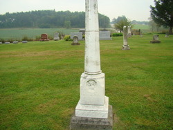
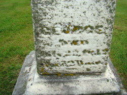
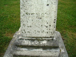
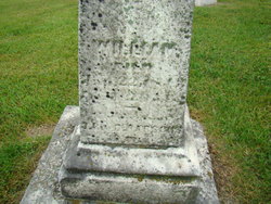
Diana Parsons Parsons
| Birth | : | 22 Jun 1811 Randolph County, West Virginia, USA |
| Death | : | 28 Aug 1876 Agency, Wapello County, Iowa, USA |
| Burial | : | Waiuku Cemetery, Waiuku, Auckland Council, New Zealand |
| Coordinate | : | -37.2612630, 174.7346520 |
| Description | : | Note: this memorial updated July 30, 2018 with parent relationship links per edit request. Am accepting those link requests in good faith, but it should be noted that those memorials are "burial unknowns", though given when and where the parents died it is quite possible that their exact burial locations were not marked or recorded. Any clarifications or changes would be appreciated. -------------------------- Birth date was originally estimated only based on headstone readings of age at death was "65 years". Subsequent research by others provides the date of June 21 or 22, 1811. Will use the... Read More |
frequently asked questions (FAQ):
-
Where is Diana Parsons Parsons's memorial?
Diana Parsons Parsons's memorial is located at: Waiuku Cemetery, Waiuku, Auckland Council, New Zealand.
-
When did Diana Parsons Parsons death?
Diana Parsons Parsons death on 28 Aug 1876 in Agency, Wapello County, Iowa, USA
-
Where are the coordinates of the Diana Parsons Parsons's memorial?
Latitude: -37.2612630
Longitude: 174.7346520
Family Members:
Parent
Spouse
Siblings
Children
Flowers:
Nearby Cemetories:
1. Waiuku Cemetery
Waiuku, Auckland Council, New Zealand
Coordinate: -37.2612630, 174.7346520
2. Tahuna Pa Road Urupā
Waiuku, Auckland Council, New Zealand
Coordinate: -37.2290900, 174.7080100
3. Waipipi Cemetery
Awhitu, Auckland Council, New Zealand
Coordinate: -37.2124964, 174.6845550
4. Mauku Cemetery
Mauku, Auckland Council, New Zealand
Coordinate: -37.2011420, 174.8109100
5. St Brides Church of England Cemetery
Mauku, Auckland Council, New Zealand
Coordinate: -37.2011260, 174.8120370
6. Tekohanga Urupā
Port Waikato, Waikato District, New Zealand
Coordinate: -37.3314940, 174.8085230
7. Mauku Historical Cemetery
Mauku, Auckland Council, New Zealand
Coordinate: -37.1743690, 174.7951870
8. Manutahi Urupā
Port Waikato, Waikato District, New Zealand
Coordinate: -37.3337939, 174.8210091
9. Kohekohe Cemetery
Pollok, Auckland Council, New Zealand
Coordinate: -37.1797380, 174.6508930
10. Waiau Pa Cemetery
Waiau Pa, Auckland Council, New Zealand
Coordinate: -37.1327190, 174.7573970
11. Oraeroa Urupā
Port Waikato, Waikato District, New Zealand
Coordinate: -37.3913670, 174.7257830
12. Pukekohe Public Cemetery
Pukekohe, Auckland Council, New Zealand
Coordinate: -37.2106400, 174.8974900
13. Pollok Cemetery
Pollok, Auckland Council, New Zealand
Coordinate: -37.1469760, 174.6257190
14. Pukekohe Catholic Cemetery
Pukekohe, Auckland Council, New Zealand
Coordinate: -37.1951510, 174.9014640
15. Onewhero Cemetery
Onewhero, Waikato District, New Zealand
Coordinate: -37.3158900, 174.9104900
16. Heights Park Cemetery
Paerata, Auckland Council, New Zealand
Coordinate: -37.1781928, 174.8938836
17. Alexandra Redoubt Cemetery
Tuakau, Waikato District, New Zealand
Coordinate: -37.2858200, 174.9419600
18. Tuakau Cemetery
Tuakau, Waikato District, New Zealand
Coordinate: -37.2844420, 174.9465660
19. Pukekohe East Cemetery
Pukekohe East, Auckland Council, New Zealand
Coordinate: -37.1883500, 174.9459000
20. Awhitu Central Cemetery
Awhitu Central, Auckland Council, New Zealand
Coordinate: -37.0956340, 174.5813100
21. Bombay Presbyterian Church Cemetery
Bombay, Auckland Council, New Zealand
Coordinate: -37.1790700, 174.9826900
22. St. Peter's in the Forest Anglican Cemetery
Bombay, Auckland Council, New Zealand
Coordinate: -37.1869100, 174.9914100
23. Pokeno Old Soldiers Cemetery
Pokeno, Waikato District, New Zealand
Coordinate: -37.2386120, 175.0094760
24. Pokeno Cemetery
Pokeno, Waikato District, New Zealand
Coordinate: -37.2364600, 175.0215400

