| Birth | : | 19 Sep 1908 Garfield County, Nebraska, USA |
| Death | : | 25 Jul 2000 Huron, Beadle County, South Dakota, USA |
| Burial | : | St. Andrew's Churchyard, Grinton, Richmondshire District, England |
| Coordinate | : | 54.3812610, -1.9305740 |
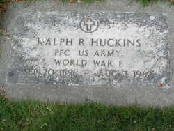
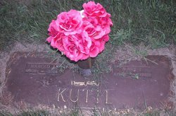
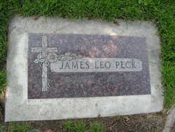
| Description | : | Researched and compiled by the Kartchner Brothers A Descendant of the Kartchner/Wilcox family of Philadelphia Dollie Curtis Dollie Curtis, 91, of 40 Aberdeen Ave, S.E. died Tuesday, July 25, 2000, at Huron Nursing Home. Graveside rites will be at 1 p.m. Thursday at Restlawn Memory Gardens Cemetery at Huron, with the Rev. Brandsrud officiating. Friends may call this afternoon and evening and Thursday morning at Welter Funeral Home in Huron. Dollie Peck was born Sept. 19, 1908 to T.W. and Lily Dale (Schamp) Peck at Rosevile, Neb. She married Ralph Huckins in 1926... Read More |
frequently asked questions (FAQ):
-
Where is Dollie Peck Curtis's memorial?
Dollie Peck Curtis's memorial is located at: St. Andrew's Churchyard, Grinton, Richmondshire District, England.
-
When did Dollie Peck Curtis death?
Dollie Peck Curtis death on 25 Jul 2000 in Huron, Beadle County, South Dakota, USA
-
Where are the coordinates of the Dollie Peck Curtis's memorial?
Latitude: 54.3812610
Longitude: -1.9305740
Family Members:
Parent
Spouse
Siblings
Children
Flowers:
Nearby Cemetories:
1. St. Andrew's Churchyard
Grinton, Richmondshire District, England
Coordinate: 54.3812610, -1.9305740
2. Reeth and Grinton Cemetery
Grinton, Richmondshire District, England
Coordinate: 54.3800400, -1.9246700
3. Reeth Congregational Chapelyard
Reeth, Richmondshire District, England
Coordinate: 54.3878600, -1.9422700
4. Marrick Priory Churchyard
Marrick, Richmondshire District, England
Coordinate: 54.3758830, -1.8977990
5. Langthwaite Wesleyan Methodist Chapelyard
Langthwaite, Richmondshire District, England
Coordinate: 54.4181000, -1.9958500
6. Holy Trinity Churchyard
Low Row, Richmondshire District, England
Coordinate: 54.3812800, -2.0223090
7. St. Mary the Virgin Churchyard
Langthwaite, Richmondshire District, England
Coordinate: 54.4195260, -1.9967580
8. Low Row Methodist Cemetery
Low Row, Richmondshire District, England
Coordinate: 54.3798050, -2.0259320
9. St Edmund the Martyr Churchyard
Marske, Richmondshire District, England
Coordinate: 54.3997500, -1.8403700
10. St Michael and All Angels Churchyard
Downholme, Richmondshire District, England
Coordinate: 54.3799700, -1.8313400
11. Church of Saint Mary the Virgin Graveyard
Arkengarthdale, Richmondshire District, England
Coordinate: 54.4225063, -2.0013365
12. Low Row United Reformed Chapelyard
Low Row, Richmondshire District, England
Coordinate: 54.3755880, -2.0317420
13. St Mary Churchyard
Redmire, Richmondshire District, England
Coordinate: 54.3126200, -1.9227400
14. Preston Under Scar Cemetery
Preston-under-Scar, Richmondshire District, England
Coordinate: 54.3133800, -1.8964000
15. St John the Evangelist Churchyard
Bellerby, Richmondshire District, England
Coordinate: 54.3303200, -1.8239000
16. Gunnerside Wesleyan Methodist Chapelyard
Gunnerside, Richmondshire District, England
Coordinate: 54.3783950, -2.0778320
17. Friends Meeting House Burial Ground
Carperby, Richmondshire District, England
Coordinate: 54.3031720, -1.9925670
18. St Michael and All Angels Churchyard
Hudswell, Richmondshire District, England
Coordinate: 54.3990300, -1.7846500
19. Holy Trinity Churchyard
Wensley, Richmondshire District, England
Coordinate: 54.3014000, -1.8600000
20. St Bartholomew Churchyard
West Witton, Richmondshire District, England
Coordinate: 54.2920100, -1.9073200
21. Wensley Cemetery
Wensley, Richmondshire District, England
Coordinate: 54.3013320, -1.8568169
22. Leyburn Cemetery
Leyburn, Richmondshire District, England
Coordinate: 54.3093030, -1.8348630
23. St. Andrew Churchyard
Aysgarth, Richmondshire District, England
Coordinate: 54.2922340, -1.9833760
24. Richmond Cemetery
Richmond, Richmondshire District, England
Coordinate: 54.4053750, -1.7572010


