
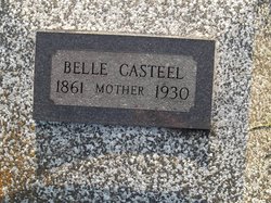
Harriet Belle Davis Casteel
| Birth | : | 1861 |
| Death | : | 1930 Bourbon County, Kansas, USA |
| Burial | : | Centralia Cemetery, Centralia, Boone County, USA |
| Coordinate | : | 39.2175400, -92.1340400 |
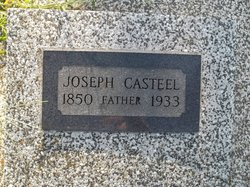
| Description | : | Belle Casteel 1920 Census Record Gender:Female Race:White Age at Time of Census:60 Est. Birth Year:1860 Birth Location:Ohio Residence:Bourbon, KS Father's Birthplace:Michigan Mother's Birthplace:Ohio Spouse:Joseph A Casteel Marital Status:Married Spouse Birthplace:Tennessee Head of Household:Joseph A Casteel Relationship to Head:Wife Line 10 1920 U.S. Federal Population Census National Archives, Courtesy of FamilySearch.org View full citation Members in Household Joseph Casteel 66 yrs, Spouse, Male Eula Casteel 24 yrs, Child, Female Grace Casteel 21 yrs, Child, Female Ruby Casteel 14 yrs, Child, Female |
frequently asked questions (FAQ):
-
Where is Harriet Belle Davis Casteel's memorial?
Harriet Belle Davis Casteel's memorial is located at: Centralia Cemetery, Centralia, Boone County, USA.
-
When did Harriet Belle Davis Casteel death?
Harriet Belle Davis Casteel death on 1930 in Bourbon County, Kansas, USA
-
Where are the coordinates of the Harriet Belle Davis Casteel's memorial?
Latitude: 39.2175400
Longitude: -92.1340400
Family Members:
Spouse
Children
Flowers:


Nearby Cemetories:
1. Centralia Cemetery
Centralia, Boone County, USA
Coordinate: 39.2175400, -92.1340400
2. Glendale Memorial Gardens
Centralia, Boone County, USA
Coordinate: 39.2200012, -92.1342010
3. Union Church Cemetery
Centralia, Boone County, USA
Coordinate: 39.1749992, -92.1635971
4. Pool Family Cemetery
Audrain County, USA
Coordinate: 39.2151900, -92.0544000
5. Skull Lick Cemetery
Audrain County, USA
Coordinate: 39.2186012, -92.0524979
6. Fountain Cemetery
Boone County, USA
Coordinate: 39.1963997, -92.2118988
7. Pleasant Grove Cemetery
Boone County, USA
Coordinate: 39.1514015, -92.1436005
8. Applemans Chapel Cemetery
Saling, Audrain County, USA
Coordinate: 39.2646600, -92.1972400
9. Bethlehem Cemetery
Audrain County, USA
Coordinate: 39.2680964, -92.0629515
10. German Cemetery
Boone County, USA
Coordinate: 39.1418991, -92.1121979
11. New Hope Cemetery
Mexico, Audrain County, USA
Coordinate: 39.1726420, -92.0498890
12. Far West Cemetery
Sturgeon, Boone County, USA
Coordinate: 39.1986008, -92.2388992
13. Liberty Christian Church Cemetery
Skinner, Audrain County, USA
Coordinate: 39.2193400, -92.0098700
14. Mount Horeb Cemetery
Sturgeon, Boone County, USA
Coordinate: 39.2158012, -92.2842026
15. Salt River Christian Church Cemetery
Mexico, Audrain County, USA
Coordinate: 39.1300200, -92.0340400
16. Palmer Family Cemetery
Sturgeon, Boone County, USA
Coordinate: 39.1666718, -92.2712555
17. Palmer Cemetery
Bourbon Township, Boone County, USA
Coordinate: 39.1880989, -92.2833023
18. Sturgeon Cemetery
Sturgeon, Boone County, USA
Coordinate: 39.2331009, -92.2936020
19. Maple Grove United Methodist Church Cemetery
Rowena, Audrain County, USA
Coordinate: 39.3252430, -92.0521150
20. Brink-Gibson Cemetery
Sturgeon, Boone County, USA
Coordinate: 39.2195540, -92.2956280
21. Pleasant Grove Cemetery
Audrain County, USA
Coordinate: 39.3022900, -92.2536200
22. Red Top Cemetery
Hallsville, Boone County, USA
Coordinate: 39.1201400, -92.2419000
23. Ruth Nowell Burial
Sturgeon, Boone County, USA
Coordinate: 39.1734026, -92.2921461
24. Church of Christ Cemetery
Boone County, USA
Coordinate: 39.1183160, -92.2430560