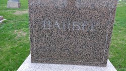
| Birth | : | 3 Jul 1845 Greene County, Ohio, USA |
| Death | : | 24 Oct 1919 Seward County, Nebraska, USA |
| Burial | : | Vine Street Hill Cemetery, Cincinnati, Hamilton County, USA |
| Coordinate | : | 39.1516991, -84.5091019 |
| Description | : | James Washington Pogue was born July 3, 1845 at Bellbrook, Ohio to Preston Patrick Pogue and Aner Sackett Pogue. He married Matilda Jane Berryhill on October 3, 1867. After marriage, James and Tillie moved westward to the Clarence and Stanwood area of Iowa, where they farmed and had the first two of ten children. In 1871, they moved to the Nebraska prairie and homesteaded in the Northwest corner of Seward County. The farm was right at the corner of Seward, York, Polk and Butler counties and was one of the first homesteads in the 4 counties. On... Read More |
frequently asked questions (FAQ):
-
Where is James Washington Pogue's memorial?
James Washington Pogue's memorial is located at: Vine Street Hill Cemetery, Cincinnati, Hamilton County, USA.
-
When did James Washington Pogue death?
James Washington Pogue death on 24 Oct 1919 in Seward County, Nebraska, USA
-
Where are the coordinates of the James Washington Pogue's memorial?
Latitude: 39.1516991
Longitude: -84.5091019
Family Members:
Parent
Spouse
Siblings
Children
Flowers:
Nearby Cemetories:
1. Vine Street Hill Cemetery
Cincinnati, Hamilton County, USA
Coordinate: 39.1516991, -84.5091019
2. Saint John Cemetery
Saint Bernard, Hamilton County, USA
Coordinate: 39.1643982, -84.5053024
3. Clifton United Jewish Cemetery
Cincinnati, Hamilton County, USA
Coordinate: 39.1470871, -84.5292816
4. Spring Grove Cemetery
Cincinnati, Hamilton County, USA
Coordinate: 39.1647900, -84.5231500
5. Hillside Chapel Crematory and Columbarium
Cincinnati, Hamilton County, USA
Coordinate: 39.1393509, -84.5247192
6. First German Protestant Cemetery
Avondale, Hamilton County, USA
Coordinate: 39.1492004, -84.4863968
7. Methodist Protestant Cemetery (Defunct)
Cincinnati, Hamilton County, USA
Coordinate: 39.1324770, -84.4983160
8. Saint Mary Cemetery
Saint Bernard, Hamilton County, USA
Coordinate: 39.1664009, -84.4880981
9. Walnut Hills Cemetery
Cincinnati, Hamilton County, USA
Coordinate: 39.1355950, -84.4809040
10. Walnut Hills Jewish Cemetery
Evanston, Hamilton County, USA
Coordinate: 39.1403700, -84.4731300
11. Wesleyan Cemetery
Cincinnati, Hamilton County, USA
Coordinate: 39.1599998, -84.5468979
12. Calvary Cemetery
Cincinnati, Hamilton County, USA
Coordinate: 39.1403008, -84.4697037
13. Third Quaker Cemetery (Defunct)
Cincinnati, Hamilton County, USA
Coordinate: 39.1542400, -84.5523720
14. Christ Church Cemetery
Over-The-Rhine, Hamilton County, USA
Coordinate: 39.1126480, -84.5157623
15. Second Quaker Cemetery (Defunct)
Cincinnati, Hamilton County, USA
Coordinate: 39.1153090, -84.5305240
16. Christ Episcopal Churchyard (Defunct)
Cincinnati, Hamilton County, USA
Coordinate: 39.1100520, -84.5177220
17. Potters Field
Cincinnati, Hamilton County, USA
Coordinate: 39.1094440, -84.5188890
18. Thomas Williams Cemetery (Defunct)
Cincinnati, Hamilton County, USA
Coordinate: 39.1085060, -84.5146050
19. Presbyterian Burying Ground
Cincinnati, Hamilton County, USA
Coordinate: 39.1082510, -84.5175720
20. Old Finneytown Cemetery
Finneytown, Hamilton County, USA
Coordinate: 39.1962220, -84.5206120
21. Chestnut Street Cemetery
Over-The-Rhine, Hamilton County, USA
Coordinate: 39.1071610, -84.5212210
22. Lincoln Park Potters Field (Defunct)
Cincinnati, Hamilton County, USA
Coordinate: 39.1097710, -84.5346450
23. Enon Baptist Church Burying Ground (Defunct)
Cincinnati, Hamilton County, USA
Coordinate: 39.1065420, -84.5238110
24. Catherine Street Burying Ground
Cincinnati, Hamilton County, USA
Coordinate: 39.1067490, -84.5252700


