
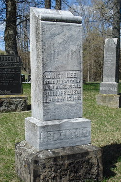
Janet Lee McDougald
| Birth | : | 9 Apr 1874 |
| Death | : | 16 May 1903 |
| Burial | : | St. Andrew's Churchyard, Cheddar, Sedgemoor District, England |
| Coordinate | : | 51.2736740, -2.7761330 |
| Plot | : | 235 |
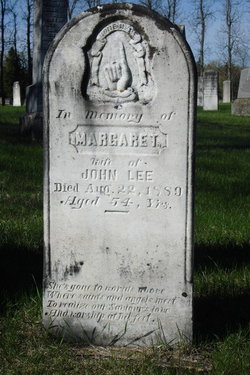
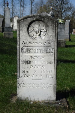
| Description | : | Janet was the daughter of John Lee & Margaret Turnbull. She was married at Lavant Station on June 13,1894, to John A. McDougald. They had a son, Herrick Allen Lee McDougall, born May 2,1903. Janet died 2 weeks later from complications of child birth. John re-married on June 22, 1904 to Mary Crawford, daughter of David Crawford & Patience Warren. --------------------------------- Plot 235 : - Janet Lee, beloved wife of John A. McDougald, born Apr.9,1874, died May 16,1903. --------------------------------- Death - The Perth Courier - May 29,1903- McDougald - Again death has claimed a loved one and devout Christian woman of thirty years - Mrs. John... Read More |
frequently asked questions (FAQ):
-
Where is Janet Lee McDougald's memorial?
Janet Lee McDougald's memorial is located at: St. Andrew's Churchyard, Cheddar, Sedgemoor District, England.
-
When did Janet Lee McDougald death?
Janet Lee McDougald death on 16 May 1903 in
-
Where are the coordinates of the Janet Lee McDougald's memorial?
Latitude: 51.2736740
Longitude: -2.7761330
Family Members:
Parent
Siblings

Flowers:


Nearby Cemetories:
1. St. Andrew's Churchyard
Cheddar, Sedgemoor District, England
Coordinate: 51.2736740, -2.7761330
2. Cheddar Baptist Burial Ground
Cheddar, Sedgemoor District, England
Coordinate: 51.2767330, -2.7792010
3. St. Peter's Churchyard
Draycott, Mendip District, England
Coordinate: 51.2580900, -2.7523800
4. St. Michael Sanatorium Cemetery
Axbridge, Sedgemoor District, England
Coordinate: 51.2904100, -2.8056900
5. St. John the Baptist Churchyard
Axbridge, Sedgemoor District, England
Coordinate: 51.2876300, -2.8162900
6. St. Leonard's Churchyard
Rodney Stoke, Mendip District, England
Coordinate: 51.2455140, -2.7431800
7. St Gregory Churchyard
Weare, Sedgemoor District, England
Coordinate: 51.2699900, -2.8408600
8. St Leonard's Churchyard
Shipham, Sedgemoor District, England
Coordinate: 51.3130980, -2.8001830
9. St. Mary Magdalene Churchyard Extension
Wedmore, Sedgemoor District, England
Coordinate: 51.2327583, -2.8065246
10. Shipham Cemetery
Shipham, Sedgemoor District, England
Coordinate: 51.3201930, -2.7992390
11. St. Mary Churchyard
Wedmore, Sedgemoor District, England
Coordinate: 51.2276790, -2.8110360
12. St Michael and All Angels
Rowberrow, North Somerset Unitary Authority, England
Coordinate: 51.3240000, -2.7915000
13. Allerton Churchyard
Chapel Allerton, Sedgemoor District, England
Coordinate: 51.2479860, -2.8482400
14. Baptist Churchyard
Wedmore, Sedgemoor District, England
Coordinate: 51.2260400, -2.8099800
15. St Lawrence Churchyard
Westbury, Mendip District, England
Coordinate: 51.2354140, -2.7182630
16. St. James the Great Churchyard
Winscombe, North Somerset Unitary Authority, England
Coordinate: 51.3059750, -2.8456900
17. St Congar Churchyard
Badgworth, Sedgemoor District, England
Coordinate: 51.2699300, -2.8674000
18. Holy Trinity Churchyard
Burrington, North Somerset Unitary Authority, England
Coordinate: 51.3307830, -2.7496010
19. Saint Andrew Churchyard
Compton Bishop, Sedgemoor District, England
Coordinate: 51.2943290, -2.8678900
20. Winscombe and Sandford Cemetery
Winscombe, North Somerset Unitary Authority, England
Coordinate: 51.3223861, -2.8386889
21. Methodist Church Burial Ground
Churchill, North Somerset Unitary Authority, England
Coordinate: 51.3344140, -2.8000610
22. Christ Church Theale
Wedmore, Sedgemoor District, England
Coordinate: 51.2113720, -2.7631570
23. St. Lawrence's Churchyard
Priddy, Mendip District, England
Coordinate: 51.2596770, -2.6777600
24. Holy Trinity Churchyard
Blackford, Sedgemoor District, England
Coordinate: 51.2257800, -2.8483000