
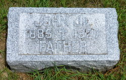
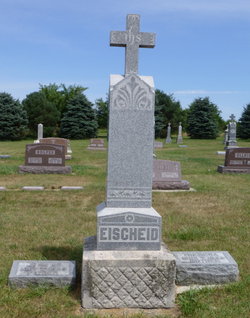
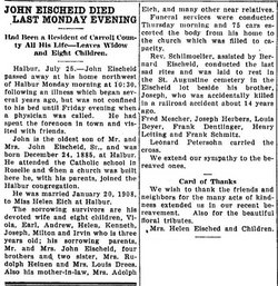
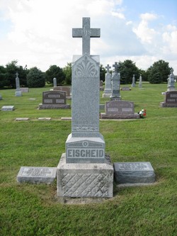
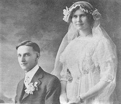
John Eischeid Jr.
| Birth | : | 24 Dec 1885 Halbur, Carroll County, Iowa, USA |
| Death | : | 25 Jul 1927 Halbur, Carroll County, Iowa, USA |
| Burial | : | Milborne Port Churchyard, Milborne Port, South Somerset District, England |
| Coordinate | : | 50.9653900, -2.4621550 |
frequently asked questions (FAQ):
-
Where is John Eischeid Jr.'s memorial?
John Eischeid Jr.'s memorial is located at: Milborne Port Churchyard, Milborne Port, South Somerset District, England.
-
When did John Eischeid Jr. death?
John Eischeid Jr. death on 25 Jul 1927 in Halbur, Carroll County, Iowa, USA
-
Where are the coordinates of the John Eischeid Jr.'s memorial?
Latitude: 50.9653900
Longitude: -2.4621550
Family Members:
Parent

Spouse
Siblings

Children
Flowers:


Nearby Cemetories:
1. Milborne Port Churchyard
Milborne Port, South Somerset District, England
Coordinate: 50.9653900, -2.4621550
2. Milborne Port Cemetery
Milborne Port, South Somerset District, England
Coordinate: 50.9662940, -2.4605880
3. St. Peter's Churchyard
Goathill, West Dorset District, England
Coordinate: 50.9534230, -2.4628960
4. St. Peter's Churchyard
Purse Caundle, West Dorset District, England
Coordinate: 50.9569440, -2.4342330
5. St Cuthbert Churchyard
Oborne, West Dorset District, England
Coordinate: 50.9649280, -2.4941270
6. Purse Caundle Civic Cemetery
Purse Caundle, West Dorset District, England
Coordinate: 50.9553680, -2.4327770
7. St. Cuthbert's Old Church
Oborne, West Dorset District, England
Coordinate: 50.9588620, -2.4947350
8. St. Catherine's Churchyard
Haydon, West Dorset District, England
Coordinate: 50.9404290, -2.4702910
9. All Saints Churchyard
Poyntington, West Dorset District, England
Coordinate: 50.9782070, -2.4997530
10. St Mary Magdalene Churchyard
Castleton, West Dorset District, England
Coordinate: 50.9496210, -2.5050130
11. Union Chapel
Sherborne, West Dorset District, England
Coordinate: 50.9475310, -2.5136220
12. Sherborne Abbey
Sherborne, West Dorset District, England
Coordinate: 50.9466680, -2.5166680
13. St. Mary Magdalene Churchyard
North Wootton, West Dorset District, England
Coordinate: 50.9281260, -2.4895320
14. Saint Peter & Saint Paul Churchyard
Charlton Horethorne, South Somerset District, England
Coordinate: 51.0060200, -2.4790100
15. St Nicholas Churchyard
Henstridge, South Somerset District, England
Coordinate: 50.9762610, -2.3957980
16. St. Peter's Churchyard
Stourton Caundle, North Dorset District, England
Coordinate: 50.9354210, -2.4080470
17. Stourton Caundle Civic Cemetery
Stourton Caundle, North Dorset District, England
Coordinate: 50.9349030, -2.4065510
18. Sherborne Cemetery
Sherborne, West Dorset District, England
Coordinate: 50.9420010, -2.5266500
19. St. Peter and St. Paul's Churchyard
Caundle Marsh, West Dorset District, England
Coordinate: 50.9176840, -2.4596680
20. St Lawrence Churchyard
Folke, West Dorset District, England
Coordinate: 50.9179430, -2.4854020
21. St Mary Churchyard
Stalbridge, North Dorset District, England
Coordinate: 50.9623690, -2.3808740
22. Corton Denham Cemetery
Corton Denham, South Somerset District, England
Coordinate: 51.0015810, -2.5202380
23. Saint Andrew Churchyard
Corton Denham, South Somerset District, England
Coordinate: 51.0015790, -2.5203100
24. Bishops Caundle
Bishops Caundle, West Dorset District, England
Coordinate: 50.9171310, -2.4336400