
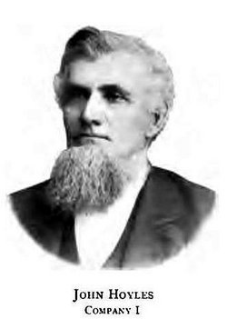


John Hoyles
| Birth | : | 10 Aug 1828 Ohio, USA |
| Death | : | 2 Mar 1913 Willard, Huron County, Ohio, USA |
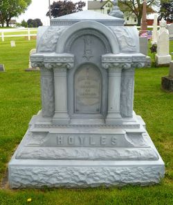
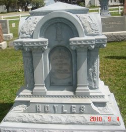
| Burial | : | Doe Creek Cemetery, Scotts Hill, Henderson County, USA |
| Coordinate | : | 35.4692990, -88.2474350 |
| Description | : | John Hoyles enlisted in Company J, Ohio 55th Volunteer Infantry Regiment on October 24, 1861. He went into camp for training at Norwalk, Ohio. The regiment departed for Grafton, West Virginia on January 25, 1862. Their first major battle was at Grafton, West Virginia after February 19, 1862, where the battle was with measles and other diseases. Over twenty men lost their lives and over four hundred were unfit for duty. The regiment engaged in many battles fighting under the command of many Union Generals. John mustered out on December 6, 1864, three long years and... Read More |
frequently asked questions (FAQ):
-
Where is John Hoyles's memorial?
John Hoyles's memorial is located at: Doe Creek Cemetery, Scotts Hill, Henderson County, USA.
-
When did John Hoyles death?
John Hoyles death on 2 Mar 1913 in Willard, Huron County, Ohio, USA
-
Where are the coordinates of the John Hoyles's memorial?
Latitude: 35.4692990
Longitude: -88.2474350
Family Members:
Parent
Spouse
Children
Flowers:


Nearby Cemetories:
1. Doe Creek Cemetery
Scotts Hill, Henderson County, USA
Coordinate: 35.4692990, -88.2474350
2. Cedar Grove Cemetery
Henderson County, USA
Coordinate: 35.4799600, -88.2678900
3. Prospect Church Cemetery
Sardis, Henderson County, USA
Coordinate: 35.4584950, -88.2683120
4. Lowery-Doe Creek Cemetery
Decatur County, USA
Coordinate: 35.4483120, -88.2468900
5. Cedar Grove Pentecostal Cemetery
Sardis, Henderson County, USA
Coordinate: 35.4829530, -88.2698440
6. Fellowship Church Cemetery
Scotts Hill, Henderson County, USA
Coordinate: 35.4965940, -88.2602540
7. Bethel Cemetery
Scotts Hill, Decatur County, USA
Coordinate: 35.4963690, -88.2320790
8. Granny Austin Cemetery
Scotts Hill, Henderson County, USA
Coordinate: 35.4949850, -88.2734300
9. Liberty Church Cemetery
Scotts Hill, Decatur County, USA
Coordinate: 35.4466050, -88.2146570
10. Scotts Hill Pentecostal Church Cemetery
Scotts Hill, Decatur County, USA
Coordinate: 35.5065610, -88.2336080
11. Murphy Cemetery
Lick Skillet, Decatur County, USA
Coordinate: 35.4806930, -88.1983720
12. Sardis Cemetery
Sardis, Henderson County, USA
Coordinate: 35.4366020, -88.2833100
13. Pleasant View Cemetery
Sardis, Henderson County, USA
Coordinate: 35.4639730, -88.3019970
14. Grandsire Holmes Cemetery
Scotts Hill, Henderson County, USA
Coordinate: 35.5140820, -88.2483620
15. Scotts Hill Church Cemetery
Scotts Hill, Henderson County, USA
Coordinate: 35.5189480, -88.2463960
16. Patterson Cemetery
Lick Skillet, Decatur County, USA
Coordinate: 35.4383800, -88.1979020
17. Red Walnut Church Cemetery
Lick Skillet, Decatur County, USA
Coordinate: 35.4700840, -88.1787990
18. Peace Chapel Cemetery
Scotts Hill, Decatur County, USA
Coordinate: 35.5214060, -88.2206280
19. Pafford - Scotts Hill Cemetery
Scotts Hill, Henderson County, USA
Coordinate: 35.5265450, -88.2515290
20. Decatur County Farm Cemetery
Scotts Hill, Decatur County, USA
Coordinate: 35.5078697, -88.1940994
21. McBride Cemetery
Sardis, Henderson County, USA
Coordinate: 35.4406013, -88.3106003
22. Spring Hill Cemetery
Sardis, Henderson County, USA
Coordinate: 35.4277992, -88.3091965
23. Martin Family Cemetery
Decaturville, Decatur County, USA
Coordinate: 35.5139160, -88.1882440
24. Crawford Cemetery
Scotts Hill, Decatur County, USA
Coordinate: 35.5141550, -88.1882830