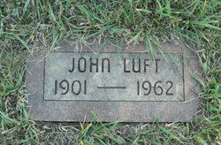
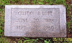
John Luft
| Birth | : | 1901 |
| Death | : | 15 Apr 1962 Omaha, Douglas County, Nebraska, USA |
| Burial | : | McDonald Cemetery, Baptist Ridge, Clay County, USA |
| Coordinate | : | 36.4855995, -85.5119019 |
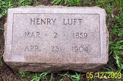
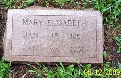
| Description | : | John was the son of Henry Luft and Mary Hoefling. He did not marry. The Odebolt Chronicle - Thursday , April 19th, 1962 - John Luft, 60, a native of Odebolt, was found dead in his residence in Omaha Sunday. The corner ruled the death by hanging a suicide. Funeral services were held at 2 o'clock Wednesday afternoon, April 18 at Mattes Funeral home in Odebolt. The Rev. Peter DeBeer of the Odebolt Presbyterian church officiated. Burial was in the Odebolt cemetery with Howard Mandernach, Floyd Mandernach, Earl Mandernach, Earl Hoefling, Hillman Reinhart and Faye McGonigle the... Read More |
frequently asked questions (FAQ):
-
Where is John Luft's memorial?
John Luft's memorial is located at: McDonald Cemetery, Baptist Ridge, Clay County, USA.
-
When did John Luft death?
John Luft death on 15 Apr 1962 in Omaha, Douglas County, Nebraska, USA
-
Where are the coordinates of the John Luft's memorial?
Latitude: 36.4855995
Longitude: -85.5119019
Family Members:
Parent
Siblings
Flowers:
Nearby Cemetories:
1. Emberton Cemetery
Celina, Clay County, USA
Coordinate: 36.4862150, -85.5237040
2. M R Cemetery
Baptist Ridge, Clay County, USA
Coordinate: 36.4769100, -85.5196770
3. Rich Cemetery
Baptist Ridge, Clay County, USA
Coordinate: 36.4757080, -85.4991700
4. Hall Cemetery
Clay County, USA
Coordinate: 36.4994011, -85.5366974
5. Doc Hall Cemetery
Clay County, USA
Coordinate: 36.4995390, -85.5369270
6. Turkeytown Cemetery
Clay County, USA
Coordinate: 36.4569016, -85.5177994
7. John Hamilton Cemetery
Butlers Landing, Clay County, USA
Coordinate: 36.4916010, -85.5489080
8. Goolsby Cemetery
Clay County, USA
Coordinate: 36.4603640, -85.5368040
9. Hamilton Cemetery
Clay County, USA
Coordinate: 36.5181007, -85.5338974
10. McClain Cemetery
Baptist Ridge, Clay County, USA
Coordinate: 36.4562840, -85.4838270
11. Mabry Cemetery
Clay County, USA
Coordinate: 36.5139008, -85.5464020
12. Butlers Landing Cemetery
Celina, Clay County, USA
Coordinate: 36.4941300, -85.5600410
13. Kirk Cemetery
Clay County, USA
Coordinate: 36.4960670, -85.5661650
14. Dale Davis Cemetery
Clay County, USA
Coordinate: 36.5143600, -85.4685300
15. McColgan Cemetery
Clay County, USA
Coordinate: 36.5163994, -85.5560989
16. Lester Brown Family Cemetery
Arcott, Clay County, USA
Coordinate: 36.5205700, -85.5547530
17. Roberts Cemetery
Celina, Clay County, USA
Coordinate: 36.5066986, -85.5727997
18. Peterman Bend Cemetery
Celina, Clay County, USA
Coordinate: 36.5370750, -85.4846300
19. Archibald Plumlee Cemetery
Pine Hill, Clay County, USA
Coordinate: 36.5203018, -85.5682983
20. Gates Cemetery
Celina, Clay County, USA
Coordinate: 36.5422640, -85.4891440
21. Walker Cemetery
Celina, Clay County, USA
Coordinate: 36.5372009, -85.4728012
22. Amos Kirkpatrick-Tinsley Cemetery
Jackson County, USA
Coordinate: 36.4715080, -85.5867230
23. Hix Cemetery
Jackson County, USA
Coordinate: 36.4580810, -85.5815000
24. Spicer Cemetery
Hilham, Overton County, USA
Coordinate: 36.4359130, -85.4615840

