Jonathan Stout
| Birth | : | 28 Jan 1805 Kentucky, USA |
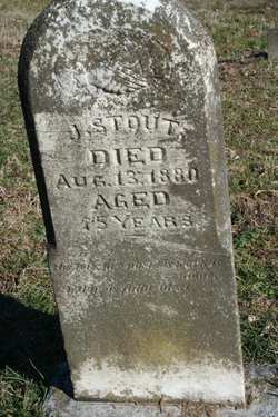
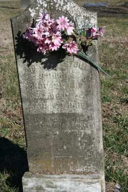
| Death | : | 13 Aug 1880 Arnett, Washington County, Arkansas, USA |
| Burial | : | St. Mary's and St. John RC Churchyard, Southworth, Samlesbury, South Ribble Borough, England |
| Coordinate | : | 53.7676690, -2.6183400 |
| Description | : | According to the Bible he purchased once his family was in Arkansas, Jonathan Stout was born 28 January 1805, and according to his census responses over the years, this birth took place in Kentucky. In the 1880 census, Jonathan said that his father was born in New Jersey and his mother was born in Pennsylvania. This adds to the likelihood that Jonathan is one of the many descendants of the well-known Richard and Penelope Stout of New Jersey. One popular theory is that Jonathan is the son of David Stout who died in Mason County, Kentucky, in 1806.... Read More |
frequently asked questions (FAQ):
-
Where is Jonathan Stout's memorial?
Jonathan Stout's memorial is located at: St. Mary's and St. John RC Churchyard, Southworth, Samlesbury, South Ribble Borough, England.
-
When did Jonathan Stout death?
Jonathan Stout death on 13 Aug 1880 in Arnett, Washington County, Arkansas, USA
-
Where are the coordinates of the Jonathan Stout's memorial?
Latitude: 53.7676690
Longitude: -2.6183400
Family Members:
Spouse
Children
Flowers:
Left by Anonymous on 28 May 2007
Rest in peace
Left by Anonymous on 24 Feb 2011
Left by Anonymous on 23 Apr 2012
This is my Great Great Great Grandfather. Father of Jeremiah "Jerry" Hannah Stout; Grandfather to John Harper Stout; Great Grandfather to Charles Brady Stout and Great Great Grandfather to Kenneth Wayne "Cotton" Stout.
Left by Anonymous on 20 Feb 2013
This is my Great Great Great Grandfather. Father to Samuel J Stout, Grandfather to Luke Stout and Great Grandfather to Earl Stout. Rest in peace.
Left by Anonymous on 06 Aug 2013
Nearby Cemetories:
1. St. Mary's and St. John RC Churchyard, Southworth
Samlesbury, South Ribble Borough, England
Coordinate: 53.7676690, -2.6183400
2. St. Leonard the Less Churchyard
Samlesbury, South Ribble Borough, England
Coordinate: 53.7680000, -2.6237000
3. Preston Crematorium
Preston, City of Preston, England
Coordinate: 53.7863750, -2.6340170
4. Preston Old Cemetery
Ribbleton, City of Preston, England
Coordinate: 53.7686352, -2.6623154
5. Preston New Cemetery
Ribbleton, City of Preston, England
Coordinate: 53.7717400, -2.6620900
6. All Saints Churchyard
Walton-le-Dale, South Ribble Borough, England
Coordinate: 53.7407250, -2.6408280
7. Our Lady and St Patrick's Church
Walton-le-Dale, South Ribble Borough, England
Coordinate: 53.7407250, -2.6408280
8. St. Michael's Churchyard
Grimsargh, City of Preston, England
Coordinate: 53.7990710, -2.6352530
9. St Leonard Churchyard
Walton-le-Dale, South Ribble Borough, England
Coordinate: 53.7476530, -2.6666950
10. St. Josephs Roman Catholic Churchyard
Brindle, Chorley Borough, England
Coordinate: 53.7350780, -2.5880640
11. St Leonard Churchyard
Balderstone, Ribble Valley Borough, England
Coordinate: 53.7860070, -2.5609380
12. Our Lady and St. Michael Roman Catholic Churchyard
Longridge, Ribble Valley Borough, England
Coordinate: 53.8088040, -2.6133470
13. Holy Trinity Churchyard
Hoghton, Chorley Borough, England
Coordinate: 53.7279300, -2.5848550
14. St Augustine of Canterbury
Preston, City of Preston, England
Coordinate: 53.7560420, -2.6912650
15. St. Paul Churchyard
Preston, City of Preston, England
Coordinate: 53.7625360, -2.6947080
16. St. James' Churchyard
Preston, City of Preston, England
Coordinate: 53.7566010, -2.6941110
17. St. Ignatius RC Churchyard
Preston, City of Preston, England
Coordinate: 53.7635270, -2.6965870
18. St John Churchyard
Preston, City of Preston, England
Coordinate: 53.7582080, -2.6959750
19. St Mary's Churchyard Brownedge
Bamber Bridge, South Ribble Borough, England
Coordinate: 53.7305472, -2.6669416
20. St. Mary's Churchyard
Preston, City of Preston, England
Coordinate: 53.8010830, -2.6779600
21. Holy Trinity
Preston, City of Preston, England
Coordinate: 53.7613030, -2.7030580
22. Friends Meeting House Burial Ground (Defunct)
Preston, City of Preston, England
Coordinate: 53.7610250, -2.7030380
23. St. George the Martyr
Preston, City of Preston, England
Coordinate: 53.7591220, -2.7025660
24. Christ Church Churchyard
Fulwood, City of Preston, England
Coordinate: 53.7771920, -2.7028700

