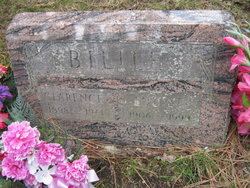
| Birth | : | 17 Nov 1908 Albany, Linn County, Oregon, USA |
| Death | : | 9 Aug 1969 Fort Benton, Chouteau County, Montana, USA |
| Burial | : | Low Gap Cemetery, Norborne, Carroll County, USA |
| Coordinate | : | 39.5244000, -93.7024000 |
| Description | : | Kenneth Frank Works was born on November 17, 1908 to William Wallace Works and Lulu Mae Furnish in Albany, Linn Co, Oregon. He had two brothers; Irvin and Dossie, and two sisters; Louise and Laurette. They were all born in Oregon, except Dossie who was born in Montana. On November 17, 1928 he married Helen Lucille Chandler, the daughter of Charles Bloomfield Chandler and Forest Lillian Gordon, at Havre, Montana. They had two daughters, and one son; Marlene(1932), Juanita(1935) and Merwin(1938). He was a farmer all his life. Kenneth died on August 9, 1969 at Fort Benton, Chouteau Co, Montana. He was... Read More |
frequently asked questions (FAQ):
-
Where is Kenneth Frank Works's memorial?
Kenneth Frank Works's memorial is located at: Low Gap Cemetery, Norborne, Carroll County, USA.
-
When did Kenneth Frank Works death?
Kenneth Frank Works death on 9 Aug 1969 in Fort Benton, Chouteau County, Montana, USA
-
Where are the coordinates of the Kenneth Frank Works's memorial?
Latitude: 39.5244000
Longitude: -93.7024000
Family Members:
Parent
Spouse
Siblings
Flowers:
Nearby Cemetories:
1. Low Gap Cemetery
Norborne, Carroll County, USA
Coordinate: 39.5244000, -93.7024000
2. McBee Chapel Cemetery
Carroll County, USA
Coordinate: 39.5239983, -93.7559967
3. Hawkins Cemetery
Carroll County, USA
Coordinate: 39.5014000, -93.6569977
4. Harris Cemetery
Mandeville, Carroll County, USA
Coordinate: 39.5083680, -93.6314570
5. Oster Cemetery
Caldwell County, USA
Coordinate: 39.5684400, -93.7622100
6. Tevalt-Northern Sympathizers Cemetery
Carroll County, USA
Coordinate: 39.4593010, -93.7379990
7. Enon Cemetery
Carroll County, USA
Coordinate: 39.5758000, -93.6366000
8. Brown Family Cemetery
Caldwell County, USA
Coordinate: 39.5978851, -93.7202454
9. Union Baptist Church Cemetery
Roads, Carroll County, USA
Coordinate: 39.4486008, -93.7021027
10. Plymouth Cemetery
Plymouth, Carroll County, USA
Coordinate: 39.6006012, -93.7014008
11. Smith Cemetery
Carroll County, USA
Coordinate: 39.4813995, -93.6205978
12. Gudgel Cemetery
Carroll County, USA
Coordinate: 39.5993996, -93.6660995
13. Tinney Grove Cemetery
Tinney Grove, Ray County, USA
Coordinate: 39.5066280, -93.8050000
14. Sykes Cemetery
Carroll County, USA
Coordinate: 39.5449000, -93.5993000
15. Elder Cemetery
Grape Grove Township, Ray County, USA
Coordinate: 39.5015259, -93.8108826
16. Unnamed Cemetery #26
Carroll County, USA
Coordinate: 39.4808006, -93.5985031
17. Mount Olivet Cemetery
Stet, Carroll County, USA
Coordinate: 39.4366000, -93.7403000
18. Graff Cemetery
Grape Grove Township, Ray County, USA
Coordinate: 39.4909286, -93.8144836
19. Unnamed Cemetery #5
Carroll County, USA
Coordinate: 39.5480995, -93.5820007
20. Street Cemetery
Bogard, Carroll County, USA
Coordinate: 39.4606018, -93.5969009
21. Marple Cemetery
Carroll County, USA
Coordinate: 39.5014992, -93.5702972
22. Evergreen Cemetery
Braymer, Caldwell County, USA
Coordinate: 39.5986290, -93.7981720
23. Kasriek Cemetery
Carroll County, USA
Coordinate: 39.4556999, -93.5977020
24. Glaze Cemetery
Carroll County, USA
Coordinate: 39.4908000, -93.5720000


