| Birth | : | 7 Oct 1856 Greentop, Schuyler County, Missouri, USA |
| Death | : | 15 Mar 1947 San Bernardino County, California, USA |
| Burial | : | St. Peter's Churchyard, Martons Both, Craven District, England |
| Coordinate | : | 53.9522064, -2.1413111 |
| Plot | : | Crypt 236, Cooidor 3, Building A |
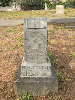
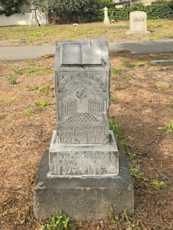
| Description | : | Laura Ann COUNTS married to William Henry Wiley in 1876. Together they had 8 children all born in Castana, Monora County in Iowa. They moved to Redlands, CA in 1903. In 1916 they moved to Long Beach. She was preceeded in death by her husband William. William Henry Wiley died in 1919 and is buried in the Sunnyside Cemetery in Long Beach. |
frequently asked questions (FAQ):
-
Where is Laura Ann Counts Guthrie's memorial?
Laura Ann Counts Guthrie's memorial is located at: St. Peter's Churchyard, Martons Both, Craven District, England.
-
When did Laura Ann Counts Guthrie death?
Laura Ann Counts Guthrie death on 15 Mar 1947 in San Bernardino County, California, USA
-
Where are the coordinates of the Laura Ann Counts Guthrie's memorial?
Latitude: 53.9522064
Longitude: -2.1413111
Family Members:
Parent
Spouse
Siblings
Children
Flowers:
Nearby Cemetories:
1. St. Peter's Churchyard
Martons Both, Craven District, England
Coordinate: 53.9522064, -2.1413111
2. St Peter Church
Martons Both, Craven District, England
Coordinate: 53.9522630, -2.1415720
3. St Mary the Virgin Churchyard
Thornton-in-Craven, Craven District, England
Coordinate: 53.9311350, -2.1513350
4. All Saints Churchyard
Broughton, Craven District, England
Coordinate: 53.9492880, -2.1019580
5. Saint Mary-le-Ghyll
Barnoldswick, Pendle Borough, England
Coordinate: 53.9279505, -2.1647004
6. Ghyll Cemetery
Barnoldswick, Pendle Borough, England
Coordinate: 53.9271100, -2.1646700
7. Earby Cemetery
Earby, Pendle Borough, England
Coordinate: 53.9189987, -2.1370001
8. St Andrew Churchyard
Gargrave, Craven District, England
Coordinate: 53.9811830, -2.1054420
9. Salterforth Cemetery
Salterforth, Pendle Borough, England
Coordinate: 53.9123170, -2.1654010
10. St. Peter's Churchyard
Coniston Cold, Craven District, England
Coordinate: 53.9944380, -2.1493870
11. Saint Michael's Church
Bracewell, Pendle Borough, England
Coordinate: 53.9322400, -2.2099730
12. St Mary's Churchyard
Kelbrook, Pendle Borough, England
Coordinate: 53.8991000, -2.1494100
13. Bethel Chapel Cemetery
Lothersdale, Craven District, England
Coordinate: 53.9102184, -2.0749640
14. St Mary the Virgin Churchyard
Carleton, Craven District, England
Coordinate: 53.9442300, -2.0417800
15. Christ Churchyard
Lothersdale, Craven District, England
Coordinate: 53.9097000, -2.0578600
16. Waltonwrays Cemetery and Skipton Crematorium
Skipton, Craven District, England
Coordinate: 53.9505500, -2.0272300
17. St. Aidan's Churchyard
Hellifield, Craven District, England
Coordinate: 54.0042070, -2.2201370
18. St Stephen Roman Catholic Churchyard
Skipton, Craven District, England
Coordinate: 53.9631760, -2.0210240
19. St. Mary the Virgin Churchyard
Gisburn, Ribble Valley Borough, England
Coordinate: 53.9356080, -2.2605210
20. Tarn Moor Memorial Woodland Burial Ground
Skipton, Craven District, England
Coordinate: 53.9759590, -2.0254260
21. Christ Churchyard
Skipton, Craven District, England
Coordinate: 53.9581200, -2.0188910
22. Raikes Road Burial Ground
Skipton, Craven District, England
Coordinate: 53.9643822, -2.0196819
23. Skipton War Memorial
Skipton, Craven District, England
Coordinate: 53.9627100, -2.0161680
24. Holy Trinity Churchyard
Skipton, Craven District, England
Coordinate: 53.9633250, -2.0161180


