
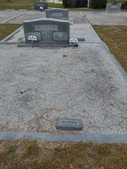
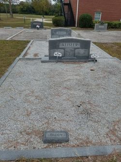
Lessie Gertrude Smith Keisler
| Birth | : | 6 Aug 1917 Gilbert, Lexington County, South Carolina, USA |
| Death | : | 13 Jul 2005 |
| Burial | : | St. Bartholomew's Churchyard, Horley, Reigate and Banstead Borough, England |
| Coordinate | : | 51.1698000, -0.1758000 |
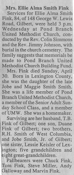
| Description | : | Obituary in The State, Columbia, SC, 15 Jul 2005: Lexington - Services for Lessie Smith Keisler, 87, will be held at 3 p.m. on Saturday, July 16, 2005, at Caughman-Harman Funeral Home, Lexington Chapel, with interment to follow in Pond Branch United Methodist Church, Gilbert, S.C. The Rev. Don Hebert and the Rev. Toni White will officiate. Pallbearers will be Glen Goodwin, Brock Adams, Robert Smith, Hoyt Smith, Duane Fink, and Ron Chitty. Honorary pallbearers will be the Love Class and the Archie O. Daniel Sunday School Class of Fellowship Baptist Church. The family will receive friends from 6-8 p.m.... Read More |
frequently asked questions (FAQ):
-
Where is Lessie Gertrude Smith Keisler's memorial?
Lessie Gertrude Smith Keisler's memorial is located at: St. Bartholomew's Churchyard, Horley, Reigate and Banstead Borough, England.
-
When did Lessie Gertrude Smith Keisler death?
Lessie Gertrude Smith Keisler death on 13 Jul 2005 in
-
Where are the coordinates of the Lessie Gertrude Smith Keisler's memorial?
Latitude: 51.1698000
Longitude: -0.1758000
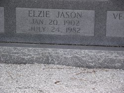
Family Members:
Parent
Spouse
Siblings
Flowers:


Nearby Cemetories:
1. St. Bartholomew's Churchyard
Horley, Reigate and Banstead Borough, England
Coordinate: 51.1698000, -0.1758000
2. Parish of Horley's New Churchyard
Horley, Reigate and Banstead Borough, England
Coordinate: 51.1711120, -0.1747610
3. St Bartholomew Churchyard
Burstow, Tandridge District, England
Coordinate: 51.1558610, -0.1247750
4. Charlwood Friends Burial Ground
Charlwood, Mole Valley District, England
Coordinate: 51.1553700, -0.2305800
5. Surrey and Sussex Crematorium
Crawley, Crawley Borough, England
Coordinate: 51.1357000, -0.1469230
6. Smallfield Ebenezer Chapel Cemetery
Smallfield, Tandridge District, England
Coordinate: 51.1770230, -0.1151960
7. Sidlow Bridge Emmanuel Churchyard
Sidlow, Reigate and Banstead Borough, England
Coordinate: 51.2077270, -0.1989510
8. St John the Evangelist Churchyard
Copthorne, Crawley Borough, England
Coordinate: 51.1394100, -0.1175700
9. St John the Baptist Churchyard
Outwood, Tandridge District, England
Coordinate: 51.1981770, -0.1127510
10. Friends Meeting House
Ifield, Crawley Borough, England
Coordinate: 51.1263400, -0.2120200
11. St Margaret of Antioch Churchyard
Ifield, Crawley Borough, England
Coordinate: 51.1238700, -0.2194760
12. St. Mary the Virgin Churchyard
Horne, Tandridge District, England
Coordinate: 51.1827330, -0.0886630
13. St John the Baptist Church
Crawley, Crawley Borough, England
Coordinate: 51.1140840, -0.1892240
14. Snell Hatch Cemetery
Crawley, Crawley Borough, England
Coordinate: 51.1164130, -0.2053970
15. Friary Churchyard of St. Francis and St. Anthony
Crawley, Crawley Borough, England
Coordinate: 51.1133670, -0.1875970
16. St. Bartholomew's Churchyard
Leigh, Mole Valley District, England
Coordinate: 51.2085790, -0.2483520
17. Redstone Cemetery
Redhill, Reigate and Banstead Borough, England
Coordinate: 51.2310910, -0.1601330
18. St Nicholas Churchyard
Worth, Mid Sussex District, England
Coordinate: 51.1102870, -0.1415280
19. Reigate Cemetery
Reigate, Reigate and Banstead Borough, England
Coordinate: 51.2353550, -0.1977820
20. Quakers Burial Ground
Reigate, Reigate and Banstead Borough, England
Coordinate: 51.2372600, -0.1936700
21. St Mary Magdalene Churchyard
Reigate, Reigate and Banstead Borough, England
Coordinate: 51.2368540, -0.1972560
22. St Peter Churchyard
Newdigate, Mole Valley District, England
Coordinate: 51.1652200, -0.2884860
23. All Saints Churchyard
Crawley Down, Mid Sussex District, England
Coordinate: 51.1211200, -0.0830650
24. St Peter and St Paul Churchyard
Nutfield, Tandridge District, England
Coordinate: 51.2419780, -0.1258540