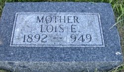
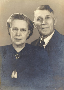
Lois Estella McCombs Thomazin
| Birth | : | 5 Jun 1892 Westerville, Custer County, Nebraska, USA |
| Death | : | 9 Jan 1949 Loup City, Sherman County, Nebraska, USA |
| Burial | : | Walnut Hill Cemetery, Brightwater, Benton County, USA |
| Coordinate | : | 36.4082985, -93.9907990 |
| Plot | : | Section 16 |
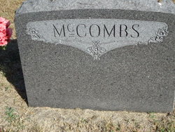
| Description | : | "Sherman County Times" January 1949 -- Mrs. James Thomazin Buried on Wednesday: Mrs. James Thomazin, 56, was buried at Evergreen cemetery Wednesday, Jan. 12, after her death the previous Sunday. Funeral services were held at the Steele Funeral Home with the Rev. Edgar Barton of Platte Center in charge. "Rock of Ages" and "Beautiful Isle of Somewhere" were rendered by Robert Bell, accompanied by Mrs. John Parks. Pallbearers were William Couton, Otto Peterson, Elmer Youngquist, Albert Siebler, Frank Daddow, and Elba Smalley. Lois Estella McCombs was born June 5, 1892, to R. Wesley and Jennie McCombs at Westerville, and died... Read More |
frequently asked questions (FAQ):
-
Where is Lois Estella McCombs Thomazin's memorial?
Lois Estella McCombs Thomazin's memorial is located at: Walnut Hill Cemetery, Brightwater, Benton County, USA.
-
When did Lois Estella McCombs Thomazin death?
Lois Estella McCombs Thomazin death on 9 Jan 1949 in Loup City, Sherman County, Nebraska, USA
-
Where are the coordinates of the Lois Estella McCombs Thomazin's memorial?
Latitude: 36.4082985
Longitude: -93.9907990
Family Members:
Parent
Spouse
Siblings
Children
Flowers:
Nearby Cemetories:
1. Walnut Hill Cemetery
Brightwater, Benton County, USA
Coordinate: 36.4082985, -93.9907990
2. Williams Cemetery
Benton County, USA
Coordinate: 36.4164009, -94.0002975
3. Snoderly Cemetery
Brightwater, Benton County, USA
Coordinate: 36.4171982, -94.0010986
4. Blaylock Cemetery
Avoca, Benton County, USA
Coordinate: 36.3938700, -93.9799100
5. Dean Cemetery
Benton County, USA
Coordinate: 36.4188995, -94.0211029
6. Liberty Cemetery
Garfield, Benton County, USA
Coordinate: 36.4389000, -94.0105972
7. Union Chapel Cemetery
Garfield, Benton County, USA
Coordinate: 36.4304180, -93.9525340
8. Ruddick Cemetery
Garfield, Benton County, USA
Coordinate: 36.4295000, -93.9512400
9. Pratt Cemetery
Garfield, Benton County, USA
Coordinate: 36.4375000, -94.0335999
10. Henson Jennings Cemetery
Garfield, Benton County, USA
Coordinate: 36.4373300, -94.0347000
11. Paces Chapel Cemetery
Benton County, USA
Coordinate: 36.4372940, -94.0350770
12. Alpine Cemetery (Defunct)
Benton County, USA
Coordinate: 36.3558006, -93.9944000
13. Ford Cemetery
Benton County, USA
Coordinate: 36.4557991, -94.0261002
14. Webb Cemetery (Defunct)
Benton County, USA
Coordinate: 36.3544006, -93.9356003
15. Wardlaw Cemetery
Pea Ridge, Benton County, USA
Coordinate: 36.4193400, -94.0768120
16. Martin Cemetery
Larue, Benton County, USA
Coordinate: 36.3465500, -93.9484700
17. Williams Cemetery (Defunct)
Prairie Creek, Benton County, USA
Coordinate: 36.3507996, -94.0436020
18. Saint Vincents Cemetery
Avoca, Benton County, USA
Coordinate: 36.3894005, -94.0877991
19. Bayless Cemetery
Gateway, Benton County, USA
Coordinate: 36.4831009, -93.9539032
20. Scott Cemetery
Garfield, Benton County, USA
Coordinate: 36.4822006, -94.0314026
21. Miser Family Homestead Cemetery
Pea Ridge, Benton County, USA
Coordinate: 36.4307133, -94.0875982
22. Ingersoll Cemetery (Defunct)
Benton County, USA
Coordinate: 36.3278008, -94.0119019
23. Potts Cemetery
Garfield, Benton County, USA
Coordinate: 36.4873620, -94.0228990
24. Twelve Corners Cemetery
Pea Ridge, Benton County, USA
Coordinate: 36.4700012, -94.0622025

