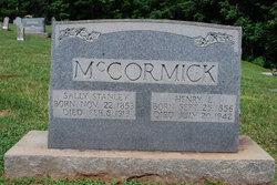
| Birth | : | Feb 1864 Surry County, North Carolina, USA |
| Death | : | 7 May 1918 Surry County, North Carolina, USA |
| Burial | : | Clay Cemetery, Parsons, Decatur County, USA |
| Coordinate | : | 35.6375510, -88.1126050 |
| Description | : | Her husband George, was her 1st cousin. (Recorded by: K. Ned Beasley, h/o Teresa Sizemore Beasley, 1st cousin 3 times removed). |
frequently asked questions (FAQ):
-
Where is Martha Emmaline “Monk” Stanley Stanley's memorial?
Martha Emmaline “Monk” Stanley Stanley's memorial is located at: Clay Cemetery, Parsons, Decatur County, USA.
-
When did Martha Emmaline “Monk” Stanley Stanley death?
Martha Emmaline “Monk” Stanley Stanley death on 7 May 1918 in Surry County, North Carolina, USA
-
Where are the coordinates of the Martha Emmaline “Monk” Stanley Stanley's memorial?
Latitude: 35.6375510
Longitude: -88.1126050
Family Members:
Parent
Spouse
Siblings
Children
Flowers:
Nearby Cemetories:
1. Clay Cemetery
Parsons, Decatur County, USA
Coordinate: 35.6375510, -88.1126050
2. Southside Church Cemetery
Parsons, Decatur County, USA
Coordinate: 35.6282030, -88.1103900
3. Parsons Cemetery
Parsons, Decatur County, USA
Coordinate: 35.6472200, -88.1205000
4. Mount Tabor Church Cemetery
Parsons, Decatur County, USA
Coordinate: 35.6242020, -88.1169180
5. Houston Cemetery
Parsons, Decatur County, USA
Coordinate: 35.6171810, -88.1125870
6. Houston Cemetery
Decatur County, USA
Coordinate: 35.6268997, -88.0888977
7. Herndon Cemetery
Parsons, Decatur County, USA
Coordinate: 35.6181970, -88.1255280
8. Rosson Cemetery
Parsons, Decatur County, USA
Coordinate: 35.6243920, -88.1377210
9. Graves Cemetery
Parsons, Decatur County, USA
Coordinate: 35.6274740, -88.1421470
10. White Cemetery
Decatur County, USA
Coordinate: 35.6068993, -88.1110992
11. Iron Hill Church Cemetery
Parsons, Decatur County, USA
Coordinate: 35.6638920, -88.0932450
12. Bear Creek Church Cemetery
Parsons, Decatur County, USA
Coordinate: 35.6491130, -88.1481300
13. Barnett Cemetery
Parsons, Decatur County, USA
Coordinate: 35.6377790, -88.1581500
14. Sardis Ridge Cemetery
Parsons, Decatur County, USA
Coordinate: 35.6274370, -88.0665750
15. Lunsford Cemetery
Parsons, Decatur County, USA
Coordinate: 35.6684530, -88.0829530
16. Tolley Cemetery
Parsons, Decatur County, USA
Coordinate: 35.6090410, -88.0782990
17. Hopewell Cemetery
Parsons, Decatur County, USA
Coordinate: 35.6538890, -88.0653850
18. Cross Roads Church Cemetery
Parsons, Decatur County, USA
Coordinate: 35.6814030, -88.1150360
19. Decatur County Memorial Gardens
Parsons, Decatur County, USA
Coordinate: 35.6838580, -88.1127480
20. Keen Cemetery
Parsons, Decatur County, USA
Coordinate: 35.6459090, -88.1715020
21. Stills Cemetery
Parsons, Decatur County, USA
Coordinate: 35.6848660, -88.1269820
22. Apostolic Church of Jesus Christ Cemetery
Parsons, Decatur County, USA
Coordinate: 35.6871480, -88.1106520
23. Decaturville City Cemetery
Decaturville, Decatur County, USA
Coordinate: 35.5875240, -88.1200490
24. McMurry Cemetery
Parsons, Decatur County, USA
Coordinate: 35.6864650, -88.1294860


